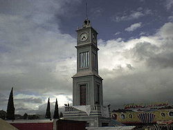
The city is formally known as Heroica Ciudad de Tlaxiaco ("heroic city of Tlaxiaco") in honour of a battle waged there during the 1862–67 French invasion. Tlaxiaco [t͡ɬa.ˈʃia.ko] is a Nahuatl name containing the elements tlachtli[t͡ɬˈat͡ʃt͡ɬi] (ball game), quiahuitl[kiˈawit͡ɬ] (rain), and -co[ko] (place marker). It thus approximates to "Place where it rains on the ball court". Its name in the Mixtec language is Ndijiinu, which means "good view".[1]
On January 1, 2019, Tlaxiaco found itself in the international news, when newly elected mayor, Alejandro Aparicio (MORENA), was assassinated in the street shortly after taking his oath of office.[2]
Tlaxiaco is located in temperate valley, surrounded by two mountains belonging to the Sierra Mixteca: Cerro Negro and Cerro Yucuninu, the latter of which is the highest point in the municipality at 2875 metres above sea level. Like most of the Mixteca region, the Tlaxiaco valley is drained by the Río Balsas system, which is fed by numerous small streams that rise in the hills near the municipal seat.
The climate is subhumid temperate, with a rainy reason in the summer. The average annual temperature is 18°C, although in winter temperatures can drop to zero or below. Unlike other areas in the Mixteca region, the Tlaxiaco valley and its surrounding mountains still possess some conifer forests, inhabited by species including deers, armadillos, rabbits, and other small mammals.
As municipal seat, Tlaxiaco has governing jurisdiction over the following communities:
Agua Zarca, Arboleda, Atayiki, Barranca Obscura, Barrio San Miguel, Barrio San Nicolás, Benito Juárez Cuquila, Cañada Alejandro, Cañada Candelaria, Cañada del Curtidor, Cañada María (Primera Sección), Cañada María (Segunda Sección), Cabayoco, Campo de Aviación, Capilla del Carrizal, Cerrito de la Virgen, Cerro Negro, Colonia Adolfo López Mateos, Cruz Llorada, Ejido Cañada Santa María, Ejido Ojo de Agua (El Vergelito), El Apartadero, El Boquerón, El Capulín 1, El Capulín 2, El Crucero, El Mogote, El Ojite, El Sabino, El Terrero (Venustiano Carranza), El Vergel, Guadalupe Hidalgo, Ignacio Manuel Altamirano, Joya Grande, Juan Escutia Cuquila, Kilómetro Doce, La Angostura, La Barranca del Tabaco, La Corona, La Cruz Verde, La Desviación (Tierra Colorada), La Lobera 1, La Lobera 2, La Peña Negra, La Providencia, La Purísima Concepción, La Séptima Poniente, La Unión, Las Huertas, Linda Vista 1, Linda Vista 2, Llano Castro, Llano de Guadalupe, Llano de Plaza, Llano del Guajolote (Los Sánchez), Loma Aplastado, Loma del Venado, Loma Saayii, Loma Snuviji, Los Ángeles, Los Blancos, Los Cortés, Mexicalcingo de los Granados, Mogote de San Cristóbal, Nuñuma, Nueva Reforma, Ojo de Agua 1, Ojo de Agua 2, Palo de Letra, Plan de Guadalupe, Ranchería Santos, Rancho Viejo, Rancho Viejo (Eskandaba), Rancho Yosondua, Río de Arena, Río de los Pinos, Río de Ocotepec (Yutecuiñi), Río Delgado, San Agustín Tlacotepec, San Bartolo, San Diego, San Felipe Tindaco, San Isidro, San Isidro Mirasol, San Juan de las Flores, San Miguel Progreso, San Pedro, San Pedro Llano Grande, −SAN PEDRO YOSOTATU—, San Sebastián, Santa Lucrecia, Santa María Cuquila, Santo Domingo Huendío, Snite, Tierra Azul, Tierra Blanca (San Nicolás), Tierra Colorada, Yosobee, Yosocahanu, Yososana, Yosostato, Yosostuvi, Yosotica, Yosotium, Yucahua, Yucuhillo, Yucutu, Yutendoo, and Yutenino Segunda Sección.
The municipality reported a population of 34,587 in the 2005 Census, of whom 9,399 spoke an indigenous language (predominantly Mixtecan and Triqui).
The land is essentially used for habitation and small-scale agriculture, which represents the main economic activity of the municipality's inhabitants.
Related Research Articles
Isthmus Nahuatl is a Nahuatl dialect cluster spoken by about 30,000 people in Veracruz, Mexico. According to Ethnologue 16, the Cosoleacaque dialect is 84% intelligible with Pajapan, and 83% intelligible with Mecayapan.
Chocho is a language of the Popolocan branch of the Oto-Manguean language family spoken in Mexico in the following communities of Oaxaca: San Miguel Chicahua, Teotongo, San Miguel Huautla, Santa Magdalena Jicotlán, San Pedro Nopala, San Miguel Tequixtepec, San Francisco Teopan, Ocotlán, Santa María Nativitas, San Juan Bautista Coixtlahuaca, and San Miguel Tulancingo. Chocho is spoken by 770 speakers.
Almoloya de Juárez is a town in the State of Mexico and the seat of the municipality of Almoloya de Juárez. The name Almoloya comes from the Nahuatl, that is properly Almoloyan, composed of: atl, "water"; molo "impersonal voice of moloni, to flow the source" and yan, "place"; that it means "place where flows the water source".
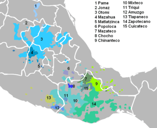
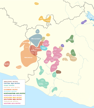
The Triqui or Trique are an Indigenous people of the western part of the Mexican state of Oaxaca, centered in the municipalities of Juxtlahuaca, Putla, and Tlaxiaco. They number around 23,000 according to Ethnologue surveys. The Triqui language is a Mixtecan language of Oto-Manguean genetic affiliation. Trique peoples are known for their distinctive woven huipiles, baskets, and morrales (handbags).
Huixquilucan Municipality is one of the municipalities in State of Mexico, Mexico. It lies adjacent to the west side of the Federal District and is part of Greater Mexico City but independent of Mexico City itself. The name "Huixquilucan" comes from Nahuatl meaning, "place full of edible thistles".
San Juan Bautista Tuxtepec, or simply referred to as Tuxtepec, is the head of the municipality by the same name and is the second most populous city of the Mexican state of Oaxaca. It is part of the Tuxtepec District of the Papaloapan Region. As of the 2020 census, the city is home to a population of 103,609 and 159,452 in the municipality, though census data are often under reported for various reasons.
Jerécuaro is a Mexican city located in the lowlands of the state of Guanajuato. The municipality has an area of 828.3 square kilometres and is bordered to the north by Apaseo el Alto, to the east by Coroneo and the state of Querétaro, to the south by Tarandacuao, to the southwest with Acámbaro, and to the northwest with Tarimoro. The municipality had 55,311 inhabitants according to the 2005 census. The municipal president of Jerécuaro and its many smaller outlying communities is C.Jaime García Cardona.
Tlatlaya is one of 125 municipalities of the State of Mexico in Mexico. The municipal seat is the town of Tlatlaya which is the eleventh largest town in the municipality. The word “Tlatlaya” means when the hearth is black and red.
Jiquipilco Municipality is one of the municipalities of the State of Mexico in Mexico. It is north of the Toluca Valley, part of the region consisting of the southern and western slopes of Cerro La Catedral, which has a concentration of speakers of the Otomi language. It is about 40 km from Toluca, the state capital. The name is a corruption of Nahuatl “Xiquipilco”, meaning “in the saddlebags”. Jiquipilco is situated on the transversal volcanic axis that crosses Mexico in an area surrounded by lakes and volcanoes. This portion is called "Anahuac”.
Huautla de Jimenez is a town and municipality in the Mexican state of Oaxaca. It is part of the Teotitlán District in the north of the Cañada Region.
San Jose Villa de Allende is a town and municipal seat of the municipality of Villa de Allende. It is the fifth largest town in the municipality. It is located 70 kilometers to the west of the city of Toluca. Villa de Allende was named in honor of Ignacio Allende, a hero of the Mexican War of Independence.
Tejupilco is a municipality in the State of Mexico, Mexico, located approximately 100 kilometres (62 mi) southwest of the state capital Toluca, along Federal Highway 134. Its municipal seat is Tejupilco de Hidalgo. The municipality has a total area of about 1,327 km2 (512 sq mi), with a contrasting topography ranging from deep ravines and canyons to high ridges; the highest elevation within the municipality reaches some 1,117 metres (3,660 ft) asl. The 2005 census recorded a population of 62,547 inhabitants.
Pinotepa Nacional is a city and seat of the municipality of the same name, in the Mexican state of Oaxaca. It is located in the Jamiltepec District in the west of the Costa Region. The name Pinotepa means "toward the crumbling hill" in Náhuatl.
San Juan Bautista Coixtlahuaca is a small town and municipality located in the Mixteca Region of the State of Oaxaca, Mexico, and the center of the Coixtlahuaca district. The name, "Coixtlahuaca" means 'plain of snakes' in the Nahuatl language.
Putla Villa de Guerrero or simply Putla, is a town and municipality in the State of Oaxaca, Mexico. It is part of Putla District in the west of the Sierra Sur Region.
San Felipe Jalapa de Díaz is a town, and the surrounding municipality of the same name, in the Mexican state of Oaxaca. It is some 50 km west of Tuxtepec, and is part of the Tuxtepec District of the Papaloapan Region.
Luvianos is a small town and municipality located in the southwest of the State of Mexico. It gained municipal status in 2000. People can access Luvianos by driving Federal Road 134 south from Toluca, and then take a detour about 25 minutes north of Tejupilco. The name is derived from a hacienda what was established during colonial times.
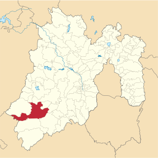
Tlaxiaco District is located in the south of the Mixteca Region of the State of Oaxaca, Mexico. The main city is the Heroic City of Tlaxiaco
The internal classification of Mixtec is controversial. Many varieties are mutually unintelligible and by that criterion separate languages. In the 16th century, Spanish authorities recognized half a dozen lenguas comprising the Mixtec lengua. It is not clear to what extent these were distinct languages at the time. Regardless, the colonial disintegration of the Mixtec nation and resulting isolation of local communities led to the rapid diversification of local dialects into distinct languages. Below are some attempts at Mixtec classification by various scholars.
References
1 2 Tlaxiaco(Enciclopedia de los municipios de México)]
This page is based on this Wikipedia article Text is available under the CC BY-SA 4.0 license; additional terms may apply. Images, videos and audio are available under their respective licenses.