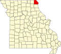
Chambersburg is an unincorporated community in Clark County, in the U.S. state of Missouri. [1]
Clark County is a county located in the U.S. state of Missouri. As of the 2010 census, the county's population was 7,139. Its county seat is Kahoka. The county was organized December 16, 1836 and named for William Clark, leader of the Lewis and Clark Expedition and later Governor of Missouri Territory.
In the United States, a state is a constituent political entity, of which there are currently 50. Bound together in a political union, each state holds governmental jurisdiction over a separate and defined geographic territory and shares its sovereignty with the federal government. Due to this shared sovereignty, Americans are citizens both of the federal republic and of the state in which they reside. State citizenship and residency are flexible, and no government approval is required to move between states, except for persons restricted by certain types of court orders. Four states use the term commonwealth rather than state in their full official names.
Missouri is a state in the Midwestern United States. With over six million residents, it is the 18th-most populous state of the Union. The largest urban areas are St. Louis, Kansas City, Springfield, and Columbia; the capital is Jefferson City. The state is the 21st-most extensive in area. In the South are the Ozarks, a forested highland, providing timber, minerals, and recreation. The Missouri River, after which the state is named, flows through the center of the state into the Mississippi River, which makes up Missouri's eastern border.
A post office called Chambersburg was established in 1849, and remained in operation until 1904. [2] The community most likely was named after Chambersburg, Pennsylvania, the native home of a share of the first settlers. [3]
Chambersburg is a borough in and the county seat of Franklin County, in the South Central region of Pennsylvania, United States. It is in the Cumberland Valley, which is part of the Great Appalachian Valley, and 13 miles (21 km) north of Maryland and the Mason-Dixon line and 52 miles (84 km) southwest of Harrisburg, the state capital. According to the United States Census Bureau, Chambersburg's 2010 population was 20,268. When combined with the surrounding Greene, Hamilton, and Guilford Townships, the population of Greater Chambersburg is 52,273 people. The Chambersburg, PA Micropolitan Statistical Area includes surrounding Franklin County, and in 2010 included 149,618 people.
Heatonville is a small unincorporated community in Lawrence County, Missouri, United States. It lies along former U.S. Route 66, approximately six miles (10 km) north-east of Mount Vernon.
Taylor is an unincorporated community in northeastern Marion County, Missouri, United States. Taylor is located at the northern junction of U.S. Routes 24 and 61, approximately five miles west of Quincy, Illinois and eight miles north of Palmyra. The community is part of the Hannibal Micropolitan Statistical Area.
Millersville is an unincorporated community in western Cape Girardeau County, Missouri, United States. It is located six miles (10 km) west of Jackson on Route 72.
Acasto is an unincorporated community in Clark County, in the U.S. state of Missouri.
Anson is an unincorporated community in Clark County, in the U.S. state of Missouri.
Antioch is an unincorporated community in Clark County, in the U.S. state of Missouri.
Ashton is an unincorporated community in Clark County, in the U.S. state of Missouri.
Clark City is an unincorporated community in Clark County, in the U.S. state of Missouri.
Dumas is an unincorporated community in Clark County, in the U.S. state of Missouri. The community was located along the banks of Dumas Creek just west (upstream) of the confluence with the Des Moines River. The Atchison, Topeka and Santa Fe Railroad line was adjacent to the community site. Revere lies to the southwest of the location and Argyle, Iowa lies to the northeast along the rail line.
Fairmont is an unincorporated community in Clark County, in the U.S. state of Missouri.
Gregory Landing is an unincorporated community in Clark County, in the U.S. state of Missouri.
Medill is an unincorporated community in Clark County, in the U.S. state of Missouri.
Neeper is an unincorporated community in Clark County, in the U.S. state of Missouri.
Peaksville is an unincorporated community in Clark County, in the U.S. state of Missouri.
Union is an unincorporated community in Clark County, in the U.S. state of Missouri.
Winchester is an unincorporated community in Clark County, in the U.S. state of Missouri.
Folker Township is an inactive township in Clark County, in the U.S. state of Missouri.
Myatt Creek is a stream in northeastern Fulton County, Arkansas and southeastern Howell County, Missouri.
New Market is an unincorporated community in northern Platte County, in the U.S. state of Missouri. The community is located on Missouri Route 371 about 1.5 miles south of the Platte-Buchanan county line. Dearborn is two miles to the northeast across U.S. Route 71 and Bee Creek flows past the west side of the community.
Stinking Pond Hollow is a stream valley in eastern Oregon County in the U.S. state of Missouri. The stream is a tributary to the Eleven Point River.
Coordinates: 40°31′26″N91°47′58″W / 40.52389°N 91.79944°W
A geographic coordinate system is a coordinate system that enables every location on Earth to be specified by a set of numbers, letters or symbols. The coordinates are often chosen such that one of the numbers represents a vertical position and two or three of the numbers represent a horizontal position; alternatively, a geographic position may be expressed in a combined three-dimensional Cartesian vector. A common choice of coordinates is latitude, longitude and elevation. To specify a location on a plane requires a map projection.
This Clark County, Missouri state location article is a stub. You can help Wikipedia by expanding it. |