Related Research Articles
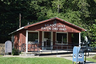
Elkton is an unincorporated community located in central Elkrun Township, Columbiana County, Ohio, United States. It lies along State Route 154 at the confluence of Elk Run and the Little Beaver Creek and has the ZIP code 44415. It is home to the Federal Correctional Institution, Elkton, a male low-security federal prison. Additionally, Elkton is home to one of the shortest covered bridges in the United States, the Church Hill Road Covered Bridge.
Colony is an unincorporated community in Knox County, in the U.S. state of Missouri. It is situated on in Colony Township, at the K&V junction.
Maples is an unincorporated community in northeastern Texas County, Missouri, United States. It is located approximately seven miles northeast of Licking on Missouri Route C.
Treloar is an unincorporated community in southern Warren County, Missouri, United States. It is located on the north edge of the Missouri River floodplain and Kochs Creek enters the floodplain just west of the community. Route 94 passes just south of the community and Warrenton is twelve miles to the north.
Etna is an unincorporated community in Scotland County, Missouri, United States. It lies at an elevation of 755 feet.
Hutton Valley is an unincorporated community in the township of the same name in northern Howell County, in the U.S. state of Missouri. The community is located approximately five miles east of Willow Springs on Missouri Route U, just south of U.S. Route 60.
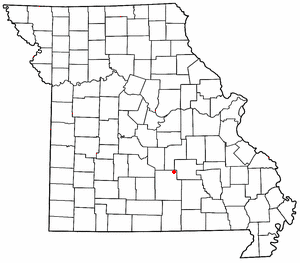
Lakenan is an unincorporated community in Shelby County, in the U.S. state of Missouri.
Oneida is an unincorporated community in Carroll County, in the U.S. state of Ohio.
Winchester is an unincorporated community in eastern Clark County, in the U.S. state of Missouri.
Ark is a ghost town in Dent County, in the U.S. state of Missouri.
Bucklick Creek is a stream in northwest Franklin County in the U.S. state of Missouri. It is a tributary of Boeuf Creek.
Dissen is an unincorporated community in western Franklin County, in the U.S. state of Missouri. The community is located on the north side of Boeuf Creek along Missouri Route Y and four miles southwest of New Haven.
Bunker Hill is a former town in Lewis County, in the U.S. state of Missouri.
Feuersville is an extinct town in Osage County, in the U.S. state of Missouri.
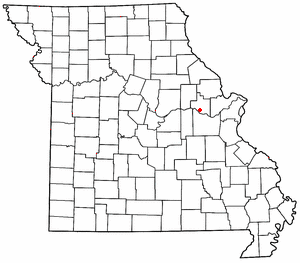
Darksville is an unincorporated community in northern Randolph County, in the U.S. state of Missouri. Darksville is on Missouri Route C, approximately three miles east of the Thomas Hill Reservoir dam.
Hubbard is an unincorporated community in northwest Randolph County, Missouri.
Prospect Grove is an unincorporated community in Scotland County, in the U.S. state of Missouri.
Round Spring is an unincorporated community in Shannon County, in the U.S. state of Missouri. The site is located on Missouri Route 19, adjacent to the confluence of Spring Valley Creek with the Current River.
Clear Springs is an unincorporated community in southern Texas County, in the U.S. state of Missouri. The community is located on Missouri Route Y, one mile east of Missouri Route 137. The spring is on the South Prong Jacks Fork, 1.5 miles south of the community site.
Venable is an unincorporated community in northwest Texas County, in the U.S. state of Missouri.
References
- ↑ U.S. Geological Survey Geographic Names Information System: Athens, Missouri
- ↑ Earngey, Bill (1995). Missouri Roadsides: The Traveler's Companion. University of Missouri Press. p. 9. ISBN 9780826210210.
- ↑ Eaton, David Wolfe (1916). How Missouri Counties, Towns and Streams Were Named. The State Historical Society of Missouri. pp. 276.
- ↑ Merkner, Sue A. (Jul 27, 1977). "Odd places give Missouri towns foreign names". The Nevada Daily Mail. p. 5. Retrieved 7 June 2015.
- ↑ "Post Offices". Jim Forte Postal History. Archived from the original on 6 March 2016. Retrieved 18 September 2016.
Municipalities and communities of Clark County, Missouri, United States | ||
|---|---|---|
| Cities |  | |
| Villages | ||
| Townships | ||
| CDPs | ||
| Other communities | ||
Coordinates: 40°34′57″N91°41′55″W / 40.58250°N 91.69861°W
| | This Clark County, Missouri state location article is a stub. You can help Wikipedia by expanding it. |