Chapai Nawabganj

Last updated
Chapai Nawabganj
Shah Neamotullah Degree College 5.jpg
Shah Niamatullah Degree College
Bangladesh Rajshahi location map.svg
Red pog.svg
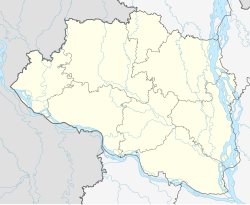
Chapai Nawabganj
Location in Bangladesh
Bangladesh adm location map.svg
Red pog.svg
Chapai Nawabganj
Chapai Nawabganj (Bangladesh)
Coordinates: 24°35′28″N88°16′08″E / 24.591°N 88.269°E / 24.591; 88.269
Country Flag of Bangladesh.svg  Bangladesh
Division Rajshahi
District Chapai Nawabganj
Upazila Chapai Nawabganj Sadar
Government
  TypeMayor-Council
  BodyChapai Nawabganj Municipality
  MayorMd. Mokhlesur Rahman
Area
  Total32.90 km2 (12.70 sq mi)
Population
 (2022)
  Total201,000
  Density6,100/km2 (16,000/sq mi)
Time zone UTC+6 (Bangladesh Time)
Postal code
6300
National Dialing Code +880
Local Dialing Code 781

Chapai Nawabganj is a town in north-western Bangladesh. It is the headquarters of Chapai Nawabganj District. It is located on the banks of the Mahananda River.

Contents

Etymology

It is believed the name 'Nawabganj' derives from its status as a favourite hunting ground of the Nawabs of Bengal. There are several theories about how the name 'Chapai' was attached to it. [1]

One claims that in a nearby village, a beautiful girl named Champarani or Champabai lived who was a favourite of the Nawabs. Another claims that the region was Champak, the capital of King Lakhindra, who was loved by Behula in the Manasamangal Kāvya. [1]

Demographics

Religions in Chapai Nawabganj city (2011) [2]
ReligionPercent
Islam
96.48%
Hinduism
3.50%
Other or not stated
0.02%

According to the 2022 Bangladesh census, Chapai Nawabganj city had a population of 201,000. [3] :388–394

According to the 2011 Bangladesh census, Chapai Nawabganj city had 39,422 households and a population of 180,731. 35,936 (19.88%) were under 10 years of age. Chapai Nawabganj had a literacy rate (age 7 and over) of 60.84%, compared to the national average of 51.8%, and a sex ratio of 1101 females per 1000 males. [2]

Related Research Articles

<span class="mw-page-title-main">Kushtia</span> City and District headquarter of Kushtia District

Kushtia is a city in the Khulna Division of southwestern Bangladesh. Kushtia is the second largest municipality in Bangladesh and the eleventh largest city in the country. The second largest city in Khulna division, Kushtia is one of the commercial cities. It serves as the headquarters of Kushtia Sadar Upazila and Kushtia District.

<span class="mw-page-title-main">Chapai Nawabganj District</span> District of Bangladesh in Rajshahi Division

Chapainawabganj is located in the north-western part of Bangladesh. It is a part of the Rajshahi Division, and was formerly a sub-division of Malda district of Bengal Province. The north and west part of Chapai Nawabganj is bounded by Malda and Murshidabad districts of India, the east by Naogaon District, and south-east by Rajshahi District.

<span class="mw-page-title-main">Dohar Upazila</span> Upazila in Dhaka, Bangladesh

Dohar is an upazila of Dhaka District in the division of Dhaka, Bangladesh. The upazila is situated in the southernmost part of Dhaka District. The Padma River borders the southern part of the upazila.

<span class="mw-page-title-main">Keraniganj Upazila</span> Upazila in Dhaka, Bangladesh

Keraniganj is an upazila of Dhaka District in the division of Dhaka, Bangladesh.

<span class="mw-page-title-main">Nawabganj Upazila, Dhaka</span> Upazila in Dhaka, Bangladesh

Nawabganj is an upazila of Dhaka District in the Dhaka Division, Bangladesh.

<span class="mw-page-title-main">Nawabganj Upazila, Dinajpur</span> Upazila in Rangpur, Bangladesh

Nawabganj is an upazila of Dinajpur District in the Division of Rangpur, Bangladesh.

<span class="mw-page-title-main">Bholahat Upazila</span> Upazila in Rajshahi, Bangladesh

Bholahat is an upazila of Chapainawabganj District in the Division of Rajshahi, Bangladesh.

<span class="mw-page-title-main">Gomostapur Upazila</span> Upazila in Rajshahi, Bangladesh

Gomostapur is an upazila of Nawabganj District in the Division of Rajshahi, Bangladesh.

<span class="mw-page-title-main">Nachol Upazila</span> Upazila in Rajshahi, Bangladesh

Nachole is an upazila of Chapai Nawabganj District in the Division of Rajshahi, Bangladesh.

<span class="mw-page-title-main">Chapai Nawabganj Sadar Upazila</span> Upazila in Rajshahi, Bangladesh

Nawabganj Sadar is an upazila of Nawabganj District in the Division of Rajshahi, Bangladesh.

<span class="mw-page-title-main">Shibganj Upazila, Chapai Nawabganj</span> Upazila in Rajshahi Division, Bangladesh

Shibganj is an upazila of Nawabganj District in the Division of Rajshahi, Bangladesh.

<span class="mw-page-title-main">Godagari Upazila</span> Upazila in Rajshahi, Bangladesh

Godagari is an Upazila of Rajshahi District in the Division of Rajshahi, Bangladesh. This is the place where Mahananda river fall to Padma or Ganges.

<span class="mw-page-title-main">Tanore Upazila</span> Upazila in Rajshahi, Bangladesh

Tanore is an Upazila of Rajshahi District in the Division of Rajshahi, Bangladesh. Tanore police station was established in February 1869 and it was declared sub-district or upazila in 1983.

Gomostapur or Gomastapur is a village in Bangladesh located in Gomostapur Upazila in the northwestern district of Chapai Nawabganj.

<span class="mw-page-title-main">Dhanbari Upazila</span> Upazila in Dhaka, Bangladesh

Dhanbari is an upazila under Tangail District in the Dhaka Division, Bangladesh. It was formed from Madhupur Upazila in 2006 by the efforts of Fakir Mahbub Anam Swapan, Central BNP leader who contest in the constituency Tangail-1 (Madhupur-Dhanbari). Its headquarters are in Dhanbari, the former seat of the Nawabs of Dhanbari.

<span class="mw-page-title-main">Maijdee</span> City in Chattogram Division, Bangladesh

Maijdee is a city and district headquarter of Noakhali District, located in south eastern Bangladesh. It is the administrative center and the main city of Noakhali District in Chattogram Division, Bangladesh. It is also known as Maijdee City. It consists of 9 wards and 36 mahallas. It has an area of 23.79 km2.

Kansat is a union parishad under Shibganj Upazila, Chapai Nawabganj District in the Rajshahi Division of north-western Bangladesh.

Dogachhi is a village in Nezampur Union Parishad of Nachol Upazila in Chapai Nawabganj District, Bangladesh.

<span class="mw-page-title-main">Harunur Rashid (Chapai Nawabganj politician)</span> Bangladesh Nationalist Party politician

Harunur Rashid is a Bangladesh Nationalist Party politician and the incumbent Jatiya Sangsad member from the Chapai Nawabganj-3 constituency since January 2019.

<span class="mw-page-title-main">Chandpur, Bangladesh</span> City of Bangladesh in Chattogram Division

Chandpur is a city and district headquarter of Chandpur District in Chattogram Division, Bangladesh. It stands near the confluence of the Padma River and the Meghna River. Chandpur city was made a municipality in 1892.

References

  1. 1 2 "Background of Chapainawabganj district". chapainawabganj.gov.bd. Government of Bangladesh.
  2. 1 2 "Population & Housing Census 2011 (Zila Series & Community Series)". bbs.gov.bd. Bangladesh Bureau of Statistics.
  3. Population and Housing Census 2022 National Report (PDF). Vol. 1. Bangladesh Bureau of Statistics. November 2023.