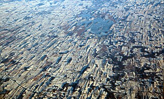
Charity Shoal Crater

Last updated
Charity Shoal crater
Canada Ontario location map 2.svg
Map pointer.svg
Charity Shoal crater
Impact crater/structure
Confidence possible [1] [2]
Diameter 1.2–1.4 kilometers (0.75–0.87 mi) [1]
Age Middle Ordovician [2]
Exposed Yes, on lake bottom, but covered with thin veneer of Ordovician limestone at water depths from 1–19.5 meters (3.3–64.0 ft) [2]
Drilled No
Location
Coordinates 44°2′15″N76°29′37″W / 44.03750°N 76.49361°W / 44.03750; -76.49361 Coordinates: 44°2′15″N76°29′37″W / 44.03750°N 76.49361°W / 44.03750; -76.49361
Country Canada

The Charity Shoal Crater is a 1.2–1.4 kilometers (0.75–0.87 mi) in diameter circular feature that lies submerged beneath the northeast end of Lake Ontario about 12 kilometers (7.5 mi) southwest of Wolfe Island, and 25 kilometers (16 mi) south of Kingston, Ontario at about latitude 44° 02′ N and longitude 76° 29′ W. It is hypothesized to be a Middle Ordovician impact crater. [2] [3]

Diameter straight line segment that passes through the center of a circle

In geometry, a diameter of a circle is any straight line segment that passes through the center of the circle and whose endpoints lie on the circle. It can also be defined as the longest chord of the circle. Both definitions are also valid for the diameter of a sphere.

Lake Ontario one of the Great Lakes in North America

Lake Ontario is one of the five Great Lakes of North America. It is surrounded on the north, west, and southwest by the Canadian province of Ontario, and on the south and east by the American state of New York, whose water boundaries meet in the middle of the lake. Ontario, Canada's most populous province, was named for the lake. Many of Ontario's most populous cities, including Toronto, Canada's most populous city, and Hamilton, are on the lake's northern or western shores. In the Huron language, the name Ontarí'io means "Lake of Shining Waters". Its primary inlet is the Niagara River from Lake Erie. The last in the Great Lakes chain, Lake Ontario serves as the outlet to the Atlantic Ocean via the Saint Lawrence River. It is the only Great Lake not to border the state of Michigan.

Wolfe Island (Ontario) island

Wolfe Island is an island at the entrance to the Saint Lawrence River in Lake Ontario near Kingston, Ontario. Wolfe Island is part of Frontenac County, Ontario and the Township of Frontenac Islands. It is the largest of the Thousand Islands. The largest community on the island is Marysville. The island was part of the traditional hunting lands of the Tyendinaga Mohawk people and the original name of the island is Ganounkouesnot. It was called Grand Island. In a proclamation by the Lieutenant Governor of Upper Canada John Graves Simcoe on 16 July 1792, the island was renamed from Grand island to Wolfe island, after British General James Wolfe.

Contents

History

On December 5, 1897, the (Steamship) Rosedale grounded upon the rocks of East Charity Shoal in the eastern end of Lake Ontario during a northwest gale. [4] During the summer of 1900, John C. Churchill, Jr. visited Charity Shoal to survey and chart the outlying spur known as East Charity Shoal. [5]

It was first mapped in detail as part of a bathymetric map of Lake Ontario that was compiled from historic data sets by the National Oceanic and Atmospheric Administration’s (NOAA) National Geophysical Data Center, the NOAA Great Lakes Environmental Research Laboratory, and the Canadian Hydrographic Service. [6] Based on this bathymetric map and field investigations, it was first proposed that Charity Creek Crater is an impact crater in 2001. [1] In November 2010 and May 2011, high-resolution bathymetric and acoustic backscatter data were collected from the area of Charity Shoal and a 1 by 1 m grid model of its bathymetry was assembled by the Canadian Hydrographic Service. [2] In July 2012, detailed magnetic and bathymetric surveys were conducted across a 9 km2 (3.5 sq mi) area over Charity Shoal. [3]

National Oceanic and Atmospheric Administration An American scientific agency within the US Department of Commerce that focuses on the oceans and the atmosphere

The National Oceanic and Atmospheric Administration is an American scientific agency within the United States Department of Commerce that focuses on the conditions of the oceans, major waterways, and the atmosphere.

The United States National Geophysical Data Center (NGDC) provided scientific stewardship, products and services for geophysical data describing the solid earth, marine, and solar-terrestrial environment, as well as earth observations from space. In 2015, NGDC was merged with the National Climatic Data Center and the National Oceanographic Data Center into the National Centers for Environmental Information (NCEI).

Great Lakes Environmental Research Laboratory

The Great Lakes Environmental Research Laboratory (GLERL) is a laboratory in the National Oceanic and Atmospheric Administration (NOAA) Office of Oceanic and Atmospheric Research (OAR). It is headquartered in Ann Arbor, Michigan, with a subsidiary field station in Muskegon, Michigan.

Morphology

The Charity Shoal Crater is a small oval basin with a circular rim that is approximately 1.2–1.5 kilometers (0.75–0.93 mi) in diameter. A continuous rim encircles the crater floor, ranging in water depth from less than 1 m at the Charity Shoal Lighthouse on the eastern rim, to just over 10 meters (33 ft) at the southernmost juncture of the rim. The exterior slopes of its rim are less steep than its interior slopes. Northeast-southwest trending erosional valleys cut across the southwestern sector of the crater rim. The crater floor is slightly ovoid, with a northwest–southeast-oriented long axis diameter of about 1 kilometer (0.62 mi) and a short axis diameter of about 0.8 kilometers (0.50 mi). At its deepest point, this basin is 18–19.5 meters (59–64 ft). A low, 2–3 meters (6.6–9.8 ft) high, central rise high, ridge divides the interior basin into two separate, small depressions. [2] [3]

From the Charity Shoal Crater, a prominent, elongated, and tapering ridge extends about 3–4 kilometers (1.9–2.5 mi) southwestward away from its rim and gives it the appearance of a frying pan. At its shallowest, ridges lies less than 6 meters (20 ft) below the surface of Lake Ontario. Northwest and southeast of and parallel to this ridge, smaller northwest-southeast-trending ridges lie at depths of 18–19.5 meters (59–64 ft). In addition, numerous smaller northeast-southwest trending linear features cut Charity Shoal Crater and cover the entire northeastern end of Lake Ontario. [1]

The Charity Shoal Crater and associated ridge both lie upon a broader and larger flat-topped ridge. This larger ridge is one of a series of several N23E-trending ridge segments that lie between Main Duck and Wolfe Islands and just northwest of the 30–50 meters (98–164 ft) Saint Lawrence Channel. The Simcoe Island Channel lies on the opposite side of this ridge. This ridge, the Charity Shoal Crater, and the entire northeast end of Lake Ontario are all crosscut N53E-trending lineations. These lineations, which were likely created by subglacial erosion, form a well-defined en echelon topography that characterize the bottom of Lake Ontario. [1]

Main Duck Island

Main Duck Island is a Canadian island in the eastern part of Lake Ontario situated next to the smaller Yorkshire Island. It was purchased by Parks Canada in 1977 and has been administered as part of the Thousand Islands National Park since 1998, even though it is not part of the Thousand Islands region.

Surficial geology

The surface of the Charity Shoal Crater consists of a mixture of bedrock, broken bedrock, and lacustrine sediments. The rim of this feature consists of eroded bedrock and patches of broken bedrock. Broken bedrock covers the interior and exterior slopes of the feature. Loose rocks recovered from the inner slope of the west–central portion of the crater rim consisted mainly of sandstone, quartzite, and gneiss that are glacial erratics derived from exposures of Precambrian, Cambrian, and Ordovician strata to the northeast. Of these rocks, two specimens consist of fossiliferous limestone and are thought to be representative of local bedrock. Neither shatter cones nor breccia were reported as having been observed among these rocks. [2] [3]

The interior basin of this feature is stiff, varved clay covered with a layer of coarse brown sand about 1–2 cm (0.39–0.79 in) [7] Sub-bottom seismic profiles found that at most a maximum of 10–12 meters (33–39 ft) of crudely stratified unconsolidated sediments overlie Ordovician limestones of the Trenton Group. Planar parallel reflections, which are interpreted as laminated (post-glacial-Holocene?) muds and silt, comprise the upper 2–3 meters (6.6–9.8 ft) of the crater fill. These sediments overlie an acoustically transparent unit that is largely devoid of reflections. This units represents poorly-stratified unconsolidated sediment that likely consist of sand and gravel. The base of the crater fill is a low relief, symmetric, parabolic-shaped bedrock surface that lies only 20 meters (66 ft) below the crest of the crater’s rim. [3]

The ridge that extends southwestward form the crater consists of bedrock that is capped by unstratified gravelly and sandy sediment that resembles a medial moraine. The orientations of this ridge parallels other northwest-southeast-trending ridges, lineations, and features that cut through the rim of the Charity Shoal Crater and the bedrock bottom of Lake Ontario. [2]

Bedrock geology

The bottom of Lake Ontario within the area of the Charity Shoal Crater consists of Middle Ordovician limestone belonging to the Trenton Group. They are hard erosion resistant strata that dip very gently to the southwest. As a result, the Trenton Group forms the lake bottom over a wide area although it is only 100s of meters thick. These Middle Ordovician strata overlie thin Cambrian sandstones which in turn rest unconformably on Late Proterozoic basement rocks. The basement rocks are part of the Frontenac Terrane of the Grenville Province. Thus, they most likely consists of high-grade gneisses, marble and quartzite. [2] [3]

High-resolution multibeam sonar data collected in November 2010 and May 2011 revealed that the rim of the crater consists of undisturbed and unbrecciated bedrock that has been al most completely stripped of sediments and debris by erosion. The sonar data demonstrates that the rim consists of severely eroded bedrock exhibits micro-ridges that are generally less than 1 meter (3.3 ft) in relief and spaced generally less than 15 meters (49 ft) apart, depending on the thicknesses, attitudes, and erosional resistances of the strata. Furthermore, these micro-ridges both parallel the rim itself, and dip away from the rim axis in both directions, revealing a continuous ring anticline with a diameter of 2.1–2.5 kilometers (1.3–1.6 mi). This ring anticline coincides with the crater rim, with rock strata dipping gently in both directions away from the rim axis. The ring anticline is more nearly circular, in contrast to the ovoid shape of the Charity Shoal topographic crater floor. The dips of exposed rock strata are generally gentle and lack any evidence of beds being overturned or even vertical. [2]

Evidence of shock metamorphism

No evidence of shock metamorphism has been reported from the Charity Shoal Crater. This is likely because, in situ samples from the sedimentary strata underlying the layers Middle Ordovician limestone that still cover the rim of this feature have not been collected from it. Drilling and coring of this feature will be required to recover any evidence of shock metamorphism and verify the impact origin of the Charity Shoal Crater. [2] [3]

Origin

The ring anticline that forms the bulk of the rim of the Charity Shoal Crater is interpreted to consist of layers of Middle Ordovician limestone that are draped over the still buried rim of an underlying crater. The microridges are argued to be edges of these limestone beds that have been truncated by erosion, which are presumed to be glacial in nature. Based upon its circular nature, lack of local and regional volcanism, and geophysical anomalies, the Charity Shoal Crater is hypothesized to be an extraterrestrial impact crater. [2] As a result of modelling of data collected during a magnetic survey of this feature, Philip Suttak concluded that Charity Shoal Crater is neither a shallow glacial erosional, nor karst sinkhole. As modelled, the data proved to be most consistent with an impact crater that is in the range of 450–600 meters (1,480–1,970 ft) deep and possibly consistent with a diatreme. [3]

The ridge that extends southwestward from the crater is judged to represent a till ridge or bedrock fluting (Crag-and-tail feature). Crag-and-tail features are a common occurrence in some drumlin fields. It likely formed below the southwestward flowing Laurentide Ice Sheet during the last glaciation. Other streamlined erosional features, e.g. oriented bedrock ridges and troughs, Flat-topped ridges, and bedrock lineations indicate that the bottom of this part of Lake Ontario, including Charity Shoal, have been significantly modified by glacial erosion. [1] [2] [3]

Age

Currently, the age of the Charity Shoal Crater is argued to Middle Ordovician. The presence of continuous and well-defined northeast-trending lineations that cut across both the Charity Shoal Crater and adjacent bedrock indicates that this landform has been significantly eroded by glacial processes and predates the last glacial advance of the Laurentide ice sheet. As the existing research indicates that the rim of this crater is draped by layers of Middle Ordovician limestone, the Charity Shoal Crater must be at least as old as the Middle Ordovician. That its rim height is 80 to 90 percent lower than predicted by cratering models indicates that the relief has been diminished by the filling of the central basin with sediments after its formation. [2] [3]

See also

Related Research Articles

Drumlin Elongated hill formed by the action of glacial ice on the substrate

A drumlin, from the Irish word droimnín, first recorded in 1833, and in the classical sense is an elongated hill in the shape of an inverted spoon or half-buried egg formed by glacial ice acting on underlying unconsolidated till or ground moraine.

Niagara Escarpment

The Niagara Escarpment is a long escarpment, or cuesta, in the United States and Canada that runs predominantly east/west from New York, through Ontario, Michigan, Wisconsin, and Illinois. The escarpment is most famous as the cliff over which the Niagara River plunges at Niagara Falls, for which it is named.

Llano Uplift

The Llano uplift is a low geologic dome that is about 90 miles (140 km) in diameter. It consists of an island-like exposure of Precambrian igneous and metamorphic rocks surrounded by outcrops of Paleozoic and Cretaceous sedimentary strata. At their widest, the exposed Precambrian rocks extend about 65 miles (105 km) westward from the valley of the Colorado River and beneath a broad, gentle topographic basin drained by the Llano River. The subdued topographic basin is underlain by Precambrian rocks and bordered by a discontinuous rim of flat-topped hills. These hills are the dissected edge of the Edwards Plateau, which consist of overlying Cretaceous sedimentary strata. Within this basin and along its margin are down-faulted blocks and erosional remnants of Paleozoic strata which form prominent hills.

Flynn Creek crater, is an impact crater situated in Jackson County, approximately 8 km south of Gainesboro, Tennessee, USA. It was formed approximately 360 million years ago as a shallow, saucer-shaped crater, 3.8 km (2.4 mi) in diameter and about 150 m deep. A large central hill, highly deformed rim strata, and a breccia lens 40 m (130 ft) in thickness were produced during formation. Over 2 km2 of flat lying Middle and Upper Paleozoic limestone and dolomite were brecciated and mixed to a depth of 200 m (660 ft), and at least half of the breccia was ejected from the crater. The remaining breccia contains fragments ranging in size from small grains to megabreccia blocks 100 m (330 ft) in length. Undisturbed strata lie 100 m below the original crater floor.

The Oak Ridges Moraine is a geological landform that runs east-west across south central Ontario, Canada. It developed about 12,000 years ago, during the Wisconsin glaciation in North America. A complex ridge of sedimentary material, the moraine is known to have partially developed under water. The Niagara Escarpment played a key role in forming the moraine in that it acted as a dam for glacial meltwater trapped between it and two ice lobes.

Tunnel valley A U-shaped valley originally cut by water under the glacial ice near the margin of continental ice sheets

A tunnel valley is a large, long, U-shaped valley originally cut under the glacial ice near the margin of continental ice sheets such as that now covering Antarctica and formerly covering portions of all continents during past glacial ages.

Geology of Pennsylvania

The Geology of Pennsylvania consists of six distinct physiographic provinces, three of which are subdivided into different sections. Each province has its own economic advantages and geologic hazards and plays an important role in shaping everyday life in the state. They are: the Atlantic Coastal Plain Province, the Piedmont Province, the New England Province, the Ridge and Valley Province, the Appalachian Plateau Province, and the Central Lowlands Province.

Weald–Artois Anticline

The Weald–Artois anticline is a large anticline, a geological structure running between the regions of the Weald in southern England and Artois in northern France. The fold formed during the Alpine orogeny, from the late Oligocene to middle Miocene as an uplifted form of the Weald basin through inversion of the basin. The folding resulted in uplift of about 180 metres (590 ft), though concurrent erosion may have substantially reduced the actual height of the resulting chalk ridges.

Siljan Ring

The Siljan Ring is a prehistoric impact crater in Dalarna, central Sweden. It is one of the 15 largest known impact craters on Earth and the largest in Europe, with a diameter of about 52 kilometres (32 mi). The impact that created the Siljan Ring occurred when a meteorite collided with the Earth's surface during the Devonian period, about 376.8 ± 1.7 Ma. This coincides around the first Devonian extinction, the Kellwasser Event or Late Frasnian extinction at 376.1 Ma ± 1.6 Ma. The effects of the impact can clearly be seen in the bedrock in the area. The Cambrian, Ordovician and Silurian sedimentary rocks deformed by the impact are rich in fossils.

Endeavour (crater) impact crater on Mars

Endeavour is an impact crater located in the Meridiani Planum extraterrestrial plain within the Margaritifer Sinus quadrangle (MC-19) region of the planet Mars. Endeavour is about 22 kilometers (14 mi) in diameter. Using Mars Reconnaissance Orbiter data, phyllosilicate-bearing outcrops have been detected along its rim. These minerals may have formed under wet conditions in a low-acidic environment during the early history of Mars. There are raised rim segments to the north, east, and southwest. The rim has become worn, rounded and degraded, with infilling of plains material in a manner similar to the Victoria crater.

Caribou Island island in Canada

Caribou Island is an uninhabited island in the eastern end of Lake Superior, 40 kilometres (25 mi) south of Michipicoten Island. It lies entirely within the territorial waters of Canada although only about five kilometres from the international border between Canada and the United States. It is approximately 5.6 kilometres (3.5 mi) long and 2.4 kilometres (1.5 mi) wide, and 1,600 acres (647 ha) in area. The interior is low scrub and bog with small lakes, Little Italy, Hambone, and Deer Lake among many unnamed ones. Several of the lakes are maintained by beavers and all are several feet above Lake Superior.

Overdeepening

Overdeepening is a characteristic of basins and valleys eroded by glaciers. An overdeepened valley profile is often eroded to depths which are hundreds of metres below the deepest continuous line along a valley or watercourse. This phenomenon is observed under modern day glaciers, in salt-water fjords and fresh-water lakes remaining after glaciers melt, as well as in tunnel valleys which are partially or totally filled with sediment. When the channel produced by a glacier is filled with debris, the subsurface geomorphic structure is found to be erosionally cut into bedrock and subsequently filled by sediments. These overdeepened cuts into bedrock structures can reach a depth of several hundred metres below the valley floor.

The Shadow Lake formation is a geological unit that crops out in Southern Ontario, Canada and northern Pennsylvania, United States. The shaly sections act as a caprock to petroleum reservoirs.
Corossol crater

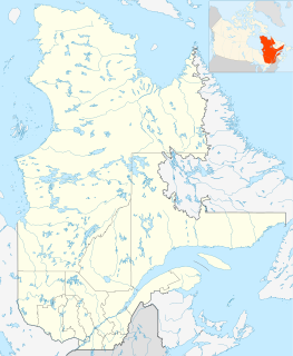
The Corossol structure, which is also known as the Corossol crater, is a circular, 4.3-by-3.9-kilometer in diameter, underwater bedrock feature that is exposed on the gulf floor of the northwestern Gulf of Saint Lawrence 20-kilometer (12 mi) offshore of the city of Sept-Îles, Quebec in eastern Canada. It is hypothesized to be a possible pre-Pleistocene, extraterrestrial impact structure. It lies underwater at a depth of 40–208-meter (131–682 ft). This underwater feature was found during the study of high-resolution bathymetric and sub-bottom profiler data collected south of the city of Sept-Iles in the northwestern Gulf of Saint Lawrence.

Bloody Creek crater

Bloody Creek crater, which is also known as the Bloody Creek structure, is a 420-by-350-meter in diameter elliptical feature that is located in southwestern Nova Scotia, Canada. It is argued to be either a possible extraterrestrial impact crater or an impact structure. It lies between Bridgetown and West Dalhousie, Annapolis County, Nova Scotia, where the Bloody Creek structure straddles what was once a stretch of Bloody Creek. It also is informally known as the Astrid crater.

The Wallaby Plateau, which is also known as the Cuvier Plateau, is a large bathymetric high about 450 kilometres (280 mi) west of Carnarvon, Western Australia. The Wallaby Plateau covers approximately 100,000 km2 (39,000 sq mi) and is in water depths of 2,200 meters (7,200 ft) to greater than 5,000 meters (16,000 ft). In the west, the Wallaby Plateau is separated from the Zenith Plateau by a 100–150-kilometre (62–93 mi) wide, north to northeast-trending bathymetric trough. Wallaby Plateau is the name used by the Australian geologists and government for this undersea plateau. This name was first used in a Hartog AGSO bathymetric map and formally recognized in a peer-reviewed paper by Symonds and Cameron in 1977. In contrast, the internationally recognized name for it is Cuvier Plateau. Cuvier is a historical name that is presumably derived from the adjacent Cape Cuvier. Cape Cuvier was named for Georges Cuvier, zoologist and statesman, by a French expedition led by Baudin in 1800 – 1803. The Wallaby Plateau lies inside the Australian Exclusive Economic Zone.

Castle Lake (Washington)

Castle Lake is a barrier lake formed by the May 18, 1980 eruption of Mount St. Helens, when an avalanche dammed the South Fork of Castle Creek. The lake covers just slightly more than 1 square kilometer (0.39 sq mi). In 1981 a spillway was constructed to alleviate concerns about sudden erosion. The lake is difficult to access, but trails have been built to it and recreational fishing is allowed.

The geology of Estonia is the study of rocks, minerals, water, landforms and geologic history in Estonia. The crust is part of the East European Craton and formed beginning in the Paleoproterozoic nearly two billion years ago. Shallow marine environments predominated in Estonia, producing extensive natural resources from organic matter such as oil shale and phosphorite. The Mesozoic and much of the Cenozoic are not well-preserved in the rock record, although the glaciations during the Pleistocene buried deep valleys in sediment, rechanneled streams and left a landscape of extensive lakes and peat bogs.

The geology of Thailand includes deep crystalline metamorphic basement rocks, overlain by extensive sandstone, limestone, turbidites and some volcanic rocks. The region experienced complicated tectonics during the Paleozoic, long-running shallow water conditions and then renewed uplift and erosion in the past several million years ago.

References

  1. 1 2 3 4 5 6 Holcombe, T.L., J. S. Warren, D. F. Reid, W. T. Virden, and D. L. Divins, 2001, Small Rimmed Depression in Lake Ontario: An Impact Crater? Journal of Great Lakes Research. vol. 27, no. 4, pp. 510-517.
  2. 1 2 3 4 5 6 7 8 9 10 11 12 13 14 Holcombe, T.L., S. Youngblut, and N. Slowey, 2013, Geological structure of Charity Shoal crater, Lake Ontario, revealed by multi beam bathymetry. Geo-Marine Letters. vol. 33, no. 4, pp 245-252.
  3. 1 2 3 4 5 6 7 8 9 10 Suttak, P.A., 2013, High-resolution lake-based magnetic mapping and modeling of basement structures, with examples from Küçükçekmece Lagoon, Turkey and Charity Shoal, Lake Ontario. unpublished MS thesis, School of Geography and Earth Sciences, McMaster University, Hamilton, Ontario. 113 pp.
  4. http://www.lighthousefriends.com/light.asp?ID=316
  5. http://www.lighthousefriends.com/light.asp?ID=316
  6. Virden, WT., J.S. Warren, T.L. Holcombe, D.F. Reid, and T.L. Berggren (1999) Bathymetry of Lake Ontario. National Geophysical Data Center, World Data Center A for Marine Geology & Geophysics, Boulder CO. Rept. MGG–14.
  7. Edsall, T.A. (1990) Surficial substrates and bathymetry of five historical lake trout spawning reefs in nearshore waters of the Great Lakes. Great Lakes Fishery Commission. Ann Arbor, Michigan. 21 pp.