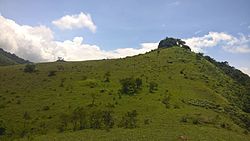
Peermade, also spelt Peerumedu is a village, Grama Panchayat and hill station in the state of Kerala, in southwestern India. It lies 915 metres (3,002 ft) above sea level in the Western Ghats (Sahyadri) about 85 kilometres (53 mi) east of Kottayam on the way to Thekkady through the nearby city of Kanjirappally.

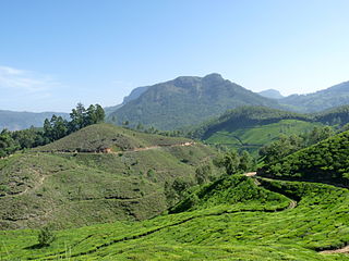
Devikulam is a Grama Panchayat and small hill station about 8 kilometres (5.0 mi) away from Munnar in the Idukki District of Kerala, India. It lies about 1,800 metres (5,900 ft) above sea level.

Kumily, also spelt as Kumaly is a revenue village and Gram Panchayat in the Idukki district of the state of Kerala. It is a town in Cardamom Hills near Thekkady and Periyar Tiger Reserve. Kumily is a gateway town into Kerala from Tamil Nadu.
Udumbanchola is a taluk in Idukki district of the Indian state of Kerala. This is in the high ranges. Nedumkandam is the major town and capital of Udumbanchola taluk. Mathikettan Shola National Park is located in Udumbanchola.

Neerchal is a village in Kasaragod district of Kerala state, India. Neerchal is located 12 kilometers from Kasaragod.

Kuttampuzha is a village and gram panchayat in Ernakulam district in the Indian state of Kerala. Situated 71 km east of Kochi, Kuttampuzha panchayat is home to the 17.7% of total area of the Ernakulam District.
Anavilasam is a village in Idukki district in the Indian state of Kerala.
Anaviratty is a village in Idukki district in the Indian state of Kerala.

Ayyappancoil, also spelt Ayyappankovil is a village in newly formed Idukki taluk in Idukki district in the Indian state of Kerala. The place is popular for having a suspension bridge with a length of 200 meters and an old historic Sastha temple on the banks of Periyar river.

Bison valley is a village in Udumbanchola Taluk in the Idukki district of the southwestern Indian state of Kerala. Bison valley is situated at around 914 metres (3000 ft) above mean sea level, in the Western Ghats range of mountains.
Kannan Devan Hills is a large village located in Devikulam Taluk of Idukki District in the Indian state of Kerala. It is situated near the state border of Tamil Nadu about 25 kilometres northeast of the district seat Painavu and 8 kilometres north of the subdistrict seat Devikulam. In 2011, it was home to 55,738 residents.

Pallivasal is a village in Idukki district in the southwestern Indian state of Kerala.
Santhanpara is a village in Idukki district in the Indian state of Kerala.
Panapuzha is a village in Kannur district in the Indian state of Kerala.
Perinthatta is a village in Kannur district in the Indian state of Kerala.

Karadka is a village, block panchayat and grama panchayat in Kasaragod district in the state of Kerala, India.
Keezhanthoor is a village in Idukki district in the state of Kerala, in southwestern India. The village is in the western ghats and is known for growing apples. A Mariyamman Temple and a Vinayagar Temple are the places of devotion.

Vandiperiyar, IPA:[ʋɐɳɖipːeɾijɐːr], is a spice village in Idukki district, in the Indian state of Kerala. It is known for tourism, tea and coffee plantations, black pepper and other spice products. It is also known as an educational city and a number of tea factories are situated in the town. The Periyar River flows through the town. Colleges: govt poly technic college. Schools : phss, st Joseph, high range, goodluck educations, govt upper primary, fathima school, govt lower primary, trinity garden.
Devikulam taluk is one of the 5 taluks in Idukki district of the Indian state of Kerala. Devikulam taluk comprises 13 villages.

Peerumedu taluk is one of the 5 taluks in Idukki district in the Indian state of Kerala. It consists of 10 revenue villages.