
Barhi is a census town and headquarters of a subdivision in the Barhi CD block in the Barhi subdivision of the Hazaribagh district in the state of Jharkhand, India. It stands at the crossing of NH 19 / Grand Trunk Road and NH 20.. All major buses on the Ranchi-Patna, Ranchi-Gaya, Dhanbad-Patna and Dhanbad-Gaya routes pass through Barhi. Both Tilaiya Dam of DVC and Hazaribagh Wildlife Sanctuary are near Barhi.
Pondar Kanali is a census town in Dhanbad CD block in Dhanbad Sadar subdivision of Dhanbad district in the Indian state of Jharkhand.
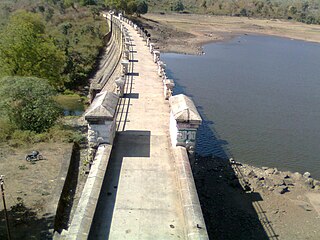
Topchanchi is a census town in Topchanchi CD block in Dhanbad Sadar subdivision of Dhanbad district in the Indian state of Jharkhand.
Sariya Mahraj Mathur is a community development block that forms an administrative division in the Bagodar-Saria subdivision of the Giridih district in the Indian state of Jharkhand.
Chalkusha is a community development block that forms an administrative division in the Barhi subdivision of the Hazaribagh district in the Indian state of Jharkhand.
Dhanwar is a community development block that forms an administrative division in the Khori Mahuwa subdivision of the Giridih district in the Indian state of Jharkhand.
Satgawan is a community development block that forms an administrative division in the Koderma subdivision of the Koderma district, Jharkhand state, India.
Koderma is a community development block that forms an administrative division in the Koderma subdivision of the Koderma district, Jharkhand state, India.
Domchanch is a community development block that forms an administrative division in the Koderma subdivision of the Koderma district, Jharkhand state, India.
Jainagar is a community development block that forms an administrative division in the Koderma subdivision of the Koderma district, Jharkhand state, India.
Markacho is a community development block that forms an administrative division in the Koderma subdivision of the Koderma district, Jharkhand state, India.
Tundi is a community development block that forms an administrative division in Dhanbad Sadar subdivision of Dhanbad district, Jharkhand state, India.
Topchanchi is a community development block that forms an administrative division in Dhanbad Sadar subdivision of Dhanbad district, Jharkhand state, India.
Latani is a village in Purbi Tundi CD block in Dhanbad Sadar subdivision of Dhanbad district in the Indian state of Jharkhand.
Baliapur is a census town in Baliapur CD block in Dhanbad Sadar subdivision of Dhanbad district in the Indian state of Jharkhand.
Chalkusha is a village in the Chalkusha CD block in the Barhi subdivision of the Hazaribagh district in the Indian state of Jharkhand.
Katkamsandi is a village in the Katkamsandi CD block in the Hazaribagh Sadar subdivision of the Hazaribagh district in the Indian state of Jharkhand.
Taratanr is a village in the Gandey CD block in Giridih Sadar subdivision of Giridih district in the Indian state of Jharkhand.
Jamua is a village in the Jamua CD block in the Khori Mahuwa subdivision of the Giridih district in the Indian state of Jharkhand.
Alagdiha is a census town in Baliapur CD block in Dhanbad Sadar subdivision of Dhanbad district in the Indian state of Jharkhand.


