Chestnut Hill Township | |
|---|---|
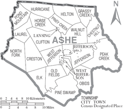
 Location of Chestnut Hill Township within Ashe County | |
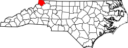 Location of Ashe County within North Carolina | |
| Country | |
| State | North Carolina |
| County | Ashe |
| Population (2020) | |
• Total | 830 |
| Time zone | UTC-5 (EST) |
| • Summer (DST) | UTC-4 (EDT) |
| Area codes | 336, 743 |
Chestnut Hill Township is a township in Ashe County, North Carolina, United States. [1] [2]