Chinnamuttom

Last updated

Chinnamuttom
Village
Cross at sea.JPG
India Tamil Nadu location map.svg
Red pog.svg
Chinnamuttom
Coordinates: 8°05′40″N77°33′41″E / 8.094345°N 77.561445°E / 8.094345; 77.561445 Coordinates: 8°05′40″N77°33′41″E / 8.094345°N 77.561445°E / 8.094345; 77.561445
Country Flag of India.svg India
State Tamil Nadu
District Kanyakumari
Establishedlate 1970s
Government
   Chairman E. Silvester s/o Ennasiyar
Area
  Total0.78 km2 (0.30 sq mi)
Elevation
200 m (700 ft)
Population
 (2012)
  Total15,000
Languages
  Official Tamil
   Spoken languages
Time zone UTC+5:30 (IST)
PIN
629 702
Telephone code91-4652 (Chinnamuttom Village)
Vehicle registration TN 74 & 75

Chinnamuttom is a special-grade village in Kanyakumari District in the state of Tamil Nadu in India. Chinnamuttom is at the southernmost point of the Indian subcontinent. The nearest town is Kanyakumari, a special-grade township and an international tourist spot 1.5 km (1 mi) away. Nagercoil, the administrative headquarters of Kanyakumari District, is 24 km (15 mi) away.

Contents

Etymology

The name comes from Tamil word Muttu (Tamil : முட்டு); (முட்டு = Edge).

Geography

Chinnamuttom is located at 8°05′40″N77°33′41″E / 8.094345°N 77.561445°E / 8.094345; 77.561445 , [1] at an altitude of 200 metres (660 ft). Though the coastal areas of Kanyakumari District are at the juncture of the Western Coastal Plains and Eastern Coastal Plains, Chinnamuttom is the only coastal area that lies on the Eastern Coastal Plains. Chinnamuttom is surrounded by sea on three sides. The coastal area has black sand and is rich in minerals. There are numerous illegal mines near Chinnamuttom's coastal area.

Old mine Old mine.JPG
Old mine

Climate

Chinnamuttom experiences a vast amount of rainfall during the Monsoon season. The annual rainfall is approximately 1,465 millimetres (57.7 in). Temperatures vary from 20 to 35 °C (68 to 95 °F).

The following table shows the climate data for chinnamuttom:

Climate data for Chinnamuttom
MonthJanFebMarAprMayJunJulAugSepOctNovDecYear
Average high °C (°F)28.9
(84.0)
30.6
(87.1)
32.2
(90.0)
32.7
(90.9)
32.4
(90.3)
30.7
(87.3)
31.8
(89.2)
31.9
(89.4)
30.6
(87.1)
30.4
(86.7)
30.1
(86.2)
29.3
(84.7)
31.0
(87.7)
Average low °C (°F)23.4
(74.1)
23.8
(74.8)
25.1
(77.2)
26.1
(79.0)
26.1
(79.0)
24.6
(76.3)
24
(75)
24
(75)
24.3
(75.7)
24.3
(75.7)
24
(75)
23.8
(74.8)
24.5
(76.0)
Average rainfall mm (inches)13.6
(0.54)
13.2
(0.52)
27.3
(1.07)
62.1
(2.44)
54.2
(2.13)
84.1
(3.31)
47.4
(1.87)
39
(1.5)
45
(1.8)
126.6
(4.98)
166.5
(6.56)
55.3
(2.18)
734.3
(28.9)
Average precipitation days1.41.72.64.14.211.396.55.510.111.25.372.9
Source: World Weather Information Service [2]

Religion

Saint Thomas Church Saint thomas oridnary ic.jpg
Saint Thomas Church

After separating from Kanyakumari, a Roman Catholic parish was created during the late 1990s in the name of Thomas the Apostle, who visited India in 52 AD. The first mass was held by Rt. Rev. Fr. Leon Dharmaraj, the Bishop of Roman Catholic Diocese of Kottar. There were about 800 families in this original church. In October, there is a pilgrimage festival that lasts for 10 days.
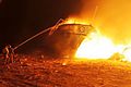
Fishing harbours

Chinnamuttom Harbour Fishing Harbour.jpeg
Chinnamuttom Harbour

Along Tamil Nadu's 1,076 km (669 mi) coastline, there are 3 major fishing harbours, 4 medium fishing harbours, and 10 fish-landing centres developed for safe berthing of boats and for hygienic landing and handling of fish catches.

Chinnamuttom has the only fishing harbour in Kanyakumari District. The harbour was constructed between 1984 and 1994 at the cost of 684.70 lakhs under a 50% Government of India (GOI) grant. [3] The construction of the harbour encouraged the local fishing fleet to grow from 70 mechanized boats and 100 country boats to 143 mechanized boats, 166 country boats and 20 fibre-reinforced boats by 1994.[ citation needed ] The fishing season is June to March. During the months of April and May, the vessels are not allowed into the sea due to the fishes' reproductive season, and are instead moved to dry-land and are repaired, painted, and refreshed in the vessel-building yard.

Expansion of harbour

Expansion of Harbour, 2013 Chinnamuttom harbour construction1.JPG
Expansion of Harbour, 2013

The harbour was badly damaged in the 2004 tsunami. After conducting various studies, the state government decided to carry out an expansion work. The existing eastern breakwaters area were lengthened and a new breakwater area formed on the western side. Once expanded, the harbour could house 150 more mechanized boats, benefiting around 1,500 fishermen.

As of 2013, there are 300 mechanized boats, 115 fibre-reinforced boats and 15 country boats in the harbour. Another 500 mechanized boats from the nearby areas use the harbour. [4]

Marine Police

A three-level Coastal Security Scheme (CSS) is being implemented[ when? ] to safeguard the Indian coast. One of the (CSS) measures is Marine Police, who patrol up to 12 nautical miles from the coast. The Tamil Nadu coastline of 1,076 kilometres (669 mi) is to be guarded by 12 Marine Police stations, 10 outposts, and 100 check posts. In Kanyakumari District, Chinnamuttom and Colachel have Marine Police stations. As of 2009, there are typically 6–7 coastal security boats in Chinnamuttom Harbour. [5]

Indian Ocean Tsunami

The 2004 Indian Ocean earthquake and tsunami caused significant damage to the harbour. The tsunami arrived in the states of Andhra Pradesh and Tamil Nadu along the southeast coast of the Indian mainland shortly after 9:00 a.m. At least two hours later, it arrived in the state of Kerala along the southwest coast. Tamil Nadu and Kerala were extensively damaged, while Andhra Pradesh sustained moderate damage. On the southeast coast it arrived at 9:05 a.m. at Visakhapatnam, 9:05 a.m. at Kakinada, 9:05 a.m. at Chennai, and 9:37 a.m. at Tuticorin. On the southwest coast it arrived at 11:10 a.m. at Kochi and 12:25 p.m. at Marmagoa. There were two to five waves of varying amplitude. The water receded after the first wave struck.

On the western coast, the run-up elevations were 4.5 metres (15 ft) at Kanyakumari District in Tamil Nadu. The time lapse between the waves also varied from about 15 to 90 minutes.

Related Research Articles

<span class="mw-page-title-main">Kanyakumari</span> Town in India

Kanniyakumari, also known as Cape Comorin, is a city in Kanniyakumari district in the state of Tamil Nadu, India. It is the southern tip of the Indian subcontinent and the southernmost city in mainland India, thus referred to as 'The Land's End'. The city is situated 90 kilometres (56 mi) south of Thiruvananthapuram city, and about 20 kilometres (12 mi) south of Nagercoil, the headquarters of Kanniyakumari district.

<span class="mw-page-title-main">Nagapattinam</span> Town in Tamil Nadu

Nagapattinam is a town in the Indian state of Tamil Nadu and the administrative headquarters of Nagapattinam District. The town came to prominence during the period of Medieval Cholas and served as their important port for commerce and east-bound naval expeditions. The Chudamani Vihara in Nagapattinam constructed by the Srivijayan king Sri Mara Vijayattungavarman of the Sailendra dynasty with the help of Rajaraja Chola I was an important Buddhist structure in those times. Nagapattinam was settled by the Portuguese and, later, the Dutch under whom it served as the capital of Dutch Coromandel from 1660 to 1781. In November 1781, the town was conquered by the British East India Company. It served as the capital of Tanjore district from 1799 to 1845 under Madras Presidency of the British. It continued to be a part of Thanjavur district in Independent India. In 1991, it was made the headquarters of the newly created Nagapattinam District. Nagapattinam is administered by a Special grade municipality covering an area of 17.92 km2 (6.92 sq mi) and had a population of 102,905 as of 2011.

<span class="mw-page-title-main">Buckingham Canal</span> Canal that runs in Andhra Pradesh and Tamilnadu in India

The Buckingham Canal is a 796 kilometres (494.6 mi)-long fresh water navigation canal, that parallels the Coromandel Coast of South India from Kakinada City in the Kakinada district of Andhra Pradesh to Viluppuram District in Tamil Nadu. The canal connects most of the natural backwaters along the coast to Chennai (Madras) port.

<span class="mw-page-title-main">Thoothukudi</span> City in Tamil Nadu, India

Thoothukudi is a port city, a municipal corporation and an industrial city in Thoothukudi district in the Indian state of Tamil Nadu. The city lies in the Coromandel Coast of Bay of Bengal. Thoothukudi is the capital and headquarters of Thoothukudi district. It is located about 590 kilometres southwest of Chennai, 190 kilometres northeast of Thiruvananthapuram and 580 kilometres southeast of Bangalore. According to Confederation of Indian Industry, Thoothukudi has the second highest Human Development Index in Tamil Nadu next to Chennai. Thoothukudi City serves as the headquarters of Tamilnad Mercantile Bank Limited. Major educational establishments in the city include Government Thoothukudi Medical College, Fisheries College and Research Institute, Tamil Nadu Maritime Academy, V.O. Chidambaram College, Kamaraj College, Anna University and Government Polytechnic College. V. O. Chidambaranar Port Trust is one of the fastest growing Major Ports in India. Thoothukudi is an "Emerging Energy and Industrial hub of South India".

<span class="mw-page-title-main">Pulicat Lake</span> Body of water

Pulicat Lagoon is the second largest brackish water lagoon in India,, measuring 759 square kilometres (293 sq mi). Major part of the lagoon comes under Tirupati district of Andhra Pradesh. The lagoon is one of the three important wetlands to attract northeast monsoon rain clouds during the October to December season. The lagoon comprises the following regions, which adds up 759 square kilometres (293 sq mi) according to Andhra Pradesh Forest Department: 1) Pulicat Lake 2) Marshy/Wetland Land Region (AP) 3) Venadu Reserve Forest (AP) 4) Pernadu Reserve Forest (AP) The lagoon was cut across in the middle by the Sriharikota Link Road, which divided the water body into lagoon and marshy land. The lagoon encompasses the Pulicat Lake Bird Sanctuary. The barrier island of Sriharikota separates the lagoon from the Bay of Bengal and is home to the Satish Dhawan Space Centre.

<span class="mw-page-title-main">2004 Indian Ocean earthquake and tsunami</span> Earthquake and subsequent tsunami in the Indian Ocean

On 26 December 2004, at 07:58:53 local time (UTC+7), a major earthquake with a magnitude of 9.1–9.3 Mw struck with an epicentre off the west coast of northern Sumatra, Indonesia. The undersea megathrust earthquake, known by the scientific community as the Sumatra–Andaman earthquake, was caused by a rupture along the fault between the Burma Plate and the Indian Plate, and reached a Mercalli intensity up to IX in some areas.

<span class="mw-page-title-main">Gulf of Mannar Marine National Park</span>

The Gulf of Mannar Marine National Park is a protected area of India consisting of 21 small islands (islets) and adjacent coral reefs in the Gulf of Mannar in the Indian Ocean. It lies 1 to 10 km away from the east coast of Tamil Nadu, India for 160 km between Thoothukudi (Tuticorin) and Dhanushkodi. It is the core area of the Gulf of Mannar Biosphere Reserve which includes a 10 km buffer zone around the park, including the populated coastal area. The park has a high diversity of plants and animals in its marine, intertidal and near shore habitats. Public access inside the park is limited to glass-bottom boat rides. It was established as a National Park in 1986.

<span class="mw-page-title-main">Nagapattinam district</span> District of Tamil Nadu in India

Nagapattinam district is one of the 38 districts of Tamil Nadu state in southern India. Nagapattinam district was carved out by bifurcating the erstwhile composite Thanjavur district on 19 October 1991. The town of Nagapattinam is the district headquarters. As of 2011, the district had a population of 697,069 with a sex-ratio of 1,025 females for every 1,000 males. Until Mayiladuthurai district was created out of it on 24 March 2020, Nagapattinam was the only discontiguous district in Tamil Nadu.

<span class="mw-page-title-main">Colachel</span> Town in Tamil Nadu, India

Colachel is a coastal town in the far south of India, located within the administrative jurisdiction of Kanyakumari District. It is a natural harbor on the Malabar coast, located 20 km north-west of Kanyakumari, the southernmost tip of India. As of 2011 the municipality had a population of 23,227 and a metropolitan population of 47,007.

<span class="mw-page-title-main">Fishing in India</span> Major industry employing 14.5 million people

Fishing in India is a major sector within the economy of India contributing 1.07% of its total GDP. The fishing sector in India supports the livelihood of over 28 million people in the country, especially within the marginalized and vulnerable communities. India is the third largest fish producing country in the world accounting for 7.96% of the global production and second largest producer of fish through aquaculture, after China. The total fish production during the FY 2020-21 is estimated at 14.73 million metric tonnes. According to the National Fisheries Development Board the Fisheries Industry generates an export earnings of Rs 334.41 billion. Centrally sponsored schemes will increase exports by Rs 1 lakh crore in FY25. 65,000 fishermen have been trained under these schemes from 2017 to 2020. Freshwater fishing consists of 55% of total fish production.

<span class="mw-page-title-main">Geography of South India</span>

The Geography of South India comprises the diverse topological and climatic patterns of South India. South India is a peninsula in the shape of a vast inverted triangle, bounded on the west by the Arabian Sea, on the east by the Bay of Bengal and on the north by the Vindhya and Satpura ranges.

Kodimunai is a village located 22 km north-west of Kanyakumari at Southern Arabian seashore in the Indian state of Tamil Nadu. The nearest major city is Thiruvananthapuram around 68 km from here. There is a rock located offshore which is the second largest rock in Tamilnadu which located offshore that is a very nice place to visit village full of people are very lovely and friendly

Thoothoor is a coastal town located in the southern district of Tamil Nadu, called Kanyakumari bordering the state of Kerala in India.

<span class="mw-page-title-main">Geography of Tamil Nadu</span>

Tamil Nadu is the tenth largest state in India and covers an area of 130,058 square kilometres (50,216 sq mi). It is bordered by Kerala to the west, Karnataka to the northwest, Andhra Pradesh to the north, the Bay of Bengal to the east and the Indian Ocean to the south. Cape Comorin (Kanyakumari), the southernmost tip of the Indian Peninsula which is the meeting point of the Arabian Sea, the Bay of Bengal, and the Indian Ocean is located in Tamil Nadu.

<span class="mw-page-title-main">Mannar District</span> Administrative District in Northern, Sri Lanka

Mannar District is one of the 25 districts of Sri Lanka, the second level administrative division of the country. The district is administered by a District Secretariat headed by a District Secretary appointed by the central government of Sri Lanka. The capital of the district is Mannar, which is located on Mannar Island.

<span class="mw-page-title-main">Royapuram fishing harbour</span> Major fishing ground in Chennai, India

Royapuram fishing harbour, also known as Chennai fishing harbour or Kasimedu fishing harbour, is one of the major fishing grounds for catching fishes and crustaceans located at Kasimedu in the Royapuram area of Chennai, India. The harbour is located north of the Chennai Port and is under the administrative control of the Chennai Port Trust. The harbour is also a shipbuilding facility, chiefly building fishing boats. The nearest railway station is the Royapuram Railway Station.

<span class="mw-page-title-main">Coastline of Andhra Pradesh</span>

The coastline of Andhra Pradesh is located on the southeast coast of the Indian Peninsula, and forms a part of the Northern Circars, with waters in Bay of Bengal. It has the second longest coastline in India next to Gujarat, with a length of 975 km (606 mi). The coastal corridor consists of several ports, harbours, vast stretches of sandy beaches, wildlife, bird sanctuaries, fresh water lakes and estuaries.

The coastline of Tamil Nadu is located on the southeast coast of Indian Peninsula, and forms a part of Coromandel Coast of Bay of Bengal and Indian Ocean. It is 1076 km long and is the second longest coastline in the country after Gujarat. Chennai, the capital of the state and an important commercial and industrial center in the country is located in the northern part of the coast with Kanniyakumari, forming the southern tip where Indian Ocean, Bay of Bengal and Arabian Sea meet. It also shares maritime border with Sri Lanka across the Palk strait in Gulf of Mannar. The coastal corridor consists of 14 districts with 15 major ports and harbors, sandy beaches, lakes and river estuaries. Tamil Nadu is the only state in India with territory on both the eastern and western coastlines.

<span class="mw-page-title-main">Cyclone Ockhi</span> Category 3 tropical cyclone that struck Sri Lanka and India in 2017

Very Severe Cyclonic Storm Ockhi was a strong tropical cyclone that devastated parts of Sri Lanka and India in 2017, and was the most intense tropical cyclone in the Arabian Sea since Cyclone Megh in 2015. The ninth depression, and the third and strongest named storm of the 2017 North Indian Ocean cyclone season, Ockhi originated from an area of low pressure that formed over the southwest Bay of Bengal on November 28. The storm organized into a Depression off southeast coast of Sri Lanka on November 29, causing damage to property and life in Sri Lanka while passing by. Due to high atmospheric moisture and warmer oceanic surface temperature between Sri Lanka and Kanyakumari in mainland India, Ockhi intensified into a cyclonic storm on November 30.

Kasimedu is a hamlet in the neighbourhood of Royapuram, in Chennai district of Tamil Nadu state in the peninsular India. This hamlet is occupied by fishermen whose families depend on the fishing harbour and the fish market nearby. It stretches for about 2 km, near Ennore fishing harbour along the shore, north of Chennai Port. Large numbers of victims from Kasimedu fishing community were found during the tsunami observed on 26 December 2004. Kasimedu is located at about 5 km from Chennai Beach railway station. Near about 200 tons of fishes are brought to Kasimedu, daily. State Highway 114 passes through Kasimedu.

References

  1. "8.094345, 77.561445 Latitude longitude Map". Latlong.net. Retrieved 14 May 2016.
  2. "Climatological Information for Kanyakumari". World Weather Information Service.
  3. "Development of Infrastructure". Fisheries.tn.gov. Retrieved 20 May 2016.
  4. "Rs. 73.52-crore work for fishing harbour – TAMIL NADU". The Hindu. 27 August 2013. Retrieved 14 May 2016.
  5. "Coastal Security Group: Marine Police Stations in Tamil Nadu". Marinebuzz.com. Retrieved 14 May 2016.