Related Research Articles

Rawalpindi Division, also locally known as Pothohar or North Punjab region, is an administrative division of Punjab Province, Pakistan. Rawalpindi city is the capital of the division. According to the 2017 Census of Pakistan, the total population of division was 10 million. Divisions are the third tier of government below the federal and provincial levels.
Nambal is located in the Kallar Syedan Tehsil of Rawalpindi district of Pakistan.
Narali is one of the oldest and largest towns of Gujar Khan Tehsil, Punjab province of Pakistan. Narali used to be the hub of trade before partition. It had large Hindu and Sikh populations that dominated the trade circle. It still has a number of remains and ruins of Hindu culture and temples. It is culturally richer than the adjoining villages. Narali enjoys a very important position because it has union council office, patwarkhana, health centre and a post office.
Bhopay Wal is a village in the southwest of Pattoki, Pakistan and centre of union council. It has about 520 households and population of about 3,500. It comes under Tehsil administration of Pattoki and District administration of Kasur.
Mamyan ممیان is a village located 20 km south-west of Jhelum, 3 km West of River Jhelum and 0.5 km North of River Bunhar in Pakistan.
Chak No. 56/GB Jassuana is a village 10 km from Jaranwala on the Satiana Road in Faisalabad District, Punjab, Pakistan.
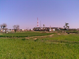
Gulyana is a town in the Gujar Khan Tehsil of Rawalpindi District, in the Punjab province of Pakistan. Gulyana is also chief town of Union Council Gulyana which is an administrative subdivision of the Tehsil.
Beor is a village and union council situated in the Kahuta Tehsil of Rawalpindi District, of Punjab, Pakistan. Its geographical coordinates are 33° 35' 0" North, 73° 34' 0" East.
Motian is a village in Jhelum District, Punjab province, Pakistan.
Bhooma Batth, also spelled as Bhuman Bath, is a village near Kalaske Cheema and Kot Jehangir in Wazirabad Tehsil, Gujranwala District, Punjab, Pakistan.
Kot Suleman is small part of village Dhoong near village Trati in Union Council Narali located in Gujar Khan Tehsil, District Rawalpindi, Punjab, Pakistan. It has a population of 250. Kot Suleman is a historic town of Village Dhoong, Rawalpindi District. Kot Suleman is famous for its natural reserves of oil and natural gas.
Tarati, is a village in Adhi Union Council, Gujar Khan Tehsil, Rawalpindi District, Punjab, Pakistan, in the centre of the Pothohar cultural region. The area has considerable natural resources in the form of petroleum and natural gas. It is approximately 45 kilometres southeast of Islamabad, the capital of Pakistan.
Khurram Colony is a neighborhood and a Union Council of Rawalpindi City of Rawalpindi District in the Punjab province of Pakistan. It is located adjacent to the neighborhoods of Muslim Town, and runs along the southern side of Haji Chowk to the Jaahaz Ground Shop. The former Benazir Bhutto International Airport abuts the southern edge of the suburb.
Wadala Cheema, in short Wadala, is a village located in the Gujranwala district in the province of Punjab, Pakistan. It is situated on the bank of the river Chenab.
Hajika is a village situated 190 kilometres (120 mi) south from Quetta in the Surab Tehsil of Surab District in the province of Balochistan, Pakistan. In 2017 the village had 2,793 residents, belonging mainly to the Mahmasani, Mardashahi, Reki and Harooni tribes.
Mohra Rajgan is a village in Bhalakhar, Kallar Syedan tehsil, Rawalpindi District, Pakistan. The population of Mohra Rajgan peoples belong to Gakhar tribe.
Wara Thatta Muhammad Shah is a village in Chiniot District, Punjab Province, Pakistan.
Sarozai is a village in the tehsil Thal District hangu of Khyber Pakhtunkhwa province of Pakistan, in the Hangu District of KPK (Pakistan). Sarozai is on the right bank of the Kurram River. The total area of the Sarozai is about 2,545 square kilometers. There is a jungle in the village of Sarozai where people come to hunt....

Samote Union Council is a union council in Punjab, Pakistan.
Mujahid Gangal is a village in the Bassali Union Council of the Rawalpindi Tehsil in Rawalpindi District, Punjab, Pakistan. Its postcode is 47651, and its coordinates are 33°21′00″N73°08′52″E. The village has a government elementary school for boys, with 126 students, and one for girls with 152 students.
References
- ↑ Rafiullah Babar (22 May 2018). "Rawalpindi District – Population Of Cities, Towns And Villages 2017-2018". PoliticPK. PoliticPK. Retrieved 5 February 2024.

33°36′27″N73°00′11″E / 33.6076291°N 73.0031906°E
| | This article about a location in Rawalpindi District, Punjab (Pakistan) is a stub. You can help Wikipedia by expanding it. |