Ocuviri District is one of ten districts of the province Lampa in Peru.

Choquetacarpo is a 5,520 metres (18,110 ft) high mountain in the Vilcabamba mountain range in the Andes of Peru. It is located in the Cusco Region, La Convención Province, in the districts Santa Teresa and Vilcabamba. Choquetacarpo lies northwest of the Pumasillo peak. The little river Moyoc (Muyuq) originates east of the mountain. It flows to the south as an affluent of the Yanama River.
Choquesafra or Choquezafra is a 5,152-metre-high (16,903 ft) mountain in the Vilcabamba mountain range in the Andes of Peru. It is located in the Cusco Region, La Convención Province, on the border of the districts of Inkawasi and Vilcabamba. Choquesafra lies west of the Panta group and south of a river named Rancahuayco. The Huajchay River originates northwest of the mountain. It flows to the southwest as a right affluent of the Apurímac River.
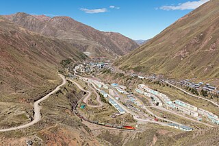
Qullqi is a mountain in the Andes in southern Peru, about 4,916.1 metres (16,129 ft) high. It is situated in the Puno Region, Lampa Province, Pucará District.

Choquepirhua is a mountain in the Chila mountain range in the Andes of Peru, about 5,400 metres (17,717 ft) high. It lies in the Arequipa Region, Castilla Province, on the border of the districts of Chachas and Choco. Choquepirhua is situated south of Chila.
Chuquiananta is a mountain in the Andes of southern Peru, about 5,300 metres (17,388 ft) high. It is situated in the Moquegua Region, Mariscal Nieto Province, Torata District, and in the Tacna Region, Candarave Province, Camilaca District. Chuquiananta lies south-west of Tutupaca volcano, south-east of Pomani.
Qullqi Q'awa is a 5,207-metre-high (17,083 ft) mountain in the Andes of Peru. It is situated in the Cusco Region, Espinar Province, in the west of the Condoroma District. Qullqi Q'awa lies near the border with the Puno Region, southwest of Sawanani Lake (Saguanani) and southeast of Chuqi Pirwa.
Choquechambi is a mountain in the Apolobamba mountain range in Peru, about 5,000 metres (16,404 ft) high. It is situated in the Puno Region, Putina Province, on the border of the Ananea District and the Sina District. Choquechambi lies northwest of Riti Urmasca and southeast of Ritipata, Chapi and Yanauma.
Illani is a mountain in the Andes of Peru, about 5,000 metres (16,404 ft) high. It is located in the Puno Region, Lampa Province, Paratía District. Illani is situated southeast of the mountain Yanawara, east of the lake Sayt'uqucha and northwest of a group of lakes named Kimsaqucha.
Qurini is a mountain in the Peruvian Andes, about 5,400 metres (17,717 ft) high. It is situated in the Moquegua Region, Mariscal Nieto Province, Carumas District, and in the Puno Region, Puno Province, Acora District. Qurini lies northwest of the mountain Wilaquta and north of the lake Aqhuyach'alla.
Hatun Qurini is a mountain in the Peruvian Andes, about 5,000 metres (16,404 ft) high. It is situated in the Puno Region, Azángaro Province, San José District. Hatun Qurini lies northwest of the mountain Surupana.
Pirhuane is a mountain in the northern extensions of the Vilcanota mountain range in the Andes of Peru, about 4,800 metres (15,748 ft) high. It is situated in the Cusco Region, Quispicanchi Province, Ocongate District. Pirhuane lies northeast of the lake named Singrenacocha, between the Ayacachi group in the north and the main range in the south.
Chuqi Chukchu is a 5,154-metre-high (16,909 ft) mountain in the Cordillera Central in the Andes of Peru. It is situated in the Lima Region, Huarochiri Province, Chicla District. Chuqi Chukchu lies near the Antikuna mountain pass, northwest of Wayrakancha and northeast of Quñuq P'ukru. The mining village of Q'asa P'allqa (Casapalca) lies at its feet.
Pirhuani is a mountain in the Vilcanota mountain range in the Andes of Peru, about 5,000 m (16,000 ft) high. It is located in the Puno Region, Carabaya Province, Corani District. Pirhuani lies southwest of Macho Ritti. It is situated at the Lajamayu valley.
Pirwani is a mountain in the Andes of Peru, about 5,000 m (16,000 ft) high. It is located in the Puno Region, Melgar Province, on the border of the districts of Antauta and Nuñoa. Pirwani lies south of Kuntur Pata. The Pirwani River originates near the mountain. It is a right tributary of the Crucero River whose waters flow to Lake Titicaca.
Jañuma Pirwa is a 5,125-metre-high (16,814 ft) mountain in the Andes of Peru. It is located in the Arequipa Region, Caylloma Province, Tisco District. It lies southwest of Chuqi Pirwa and southeast of Pirwa.
Pirwa is a mountain in the Andes of Peru, about 5,125 m (16,814 ft) high. It is located in the Arequipa Region, Caylloma Province, Tisco District. It lies northwest of Jañuma Pirwa.
Chuqi Pirwa is a mountain in the Andes of Peru, about 4,800 m (15,700 ft) high. It is located in the Arequipa Region, Caylloma Province, Tisco District, and in the Espinar Province, Yauri District. It lies northeast of Jañuma Pirwa and east of Pirwa.
Chuqi Pirwa may refer to:
Kirani is a mountain in the Andes of Peru, about 5,000 metres (16,404 ft) high. It is located in the Puno Region, Lampa Province, Paratia District. Kirani lies northeast of Yanawara, east of Ananta Lake.


