Espinar Province

Last updated
Espinar
Kanamarca.jpg
K'anamarka in the Espinar Province
Bandera espinar.png
Location of the province Espinar in Cusco.svg
Location of Espinar in the Cusco Region
Country Peru
Region Cusco
Capital Yauri
Government
  MayorLindley Alfredo Salinas Perez (2007)
Area
  Total5,311.09 km2 (2,050.62 sq mi)
Population
(2005 census)
  Total66,908
  Density13/km2 (33/sq mi)
UBIGEO 0808
Tintaya copper mine as seen from the air. Minas de Tintaya, Peru.JPG
Tintaya copper mine as seen from the air.

Espinar Province is one of thirteen provinces in the Cusco Region in the southern highlands of Peru.

Contents

Geography

Some of the highest mountains of the province are listed below: [1] [2]

Political division

The province is divided into eight districts (Spanish : distritos, singular: distrito), each of which is headed by a mayor (alcalde). The districts, with their capitals in parentheses, are:

History

On 21 May 2012, agricultural leadership in Espinar Province announced a strike against the planned expansion of Tintaya mine, a copper mine owned by the Swiss corporation Xstrata. The leaders' demands included higher environmental standards, more money for area development, and independent oversight of the mine. [3] Strikers occupied the roads to the mine over the following week, blocking all access. In response, President Ollanta Humala declared a state of emergency in the province, suspending constitutional rights, [4] and deployed police commandos against the strikers. [3] Two civilians were killed in the resulting clashes, and seventy police officers were injured. [4] On 30 May, provincial mayor Oscar Mollohuanca was arrested by the national government and accused of inciting protests against an expansion of a copper mine owned by Xstrata. [5] He was conditionally released on 13 July. [3]

Ethnic groups

The people in the province are mainly indigenous citizens of Quechua descent. Quechua is the language which the majority of the population (68.90%) learnt to speak in childhood, 30.75% of the residents started speaking in Spanish (2007 Peru Census). [6]

See also

Related Research Articles

<span class="mw-page-title-main">Tomás Frías Province</span> Province in Potosí Department, Bolivia

Tomás Frías is a province in the northern parts of the Bolivian Potosí Department. Its capital is Potosí which is also the capital of the department. The province is named after the former president Tomás Frías Ametller.

<span class="mw-page-title-main">La Unión Province, Peru</span> Province in Arequipa, Peru

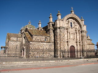
La Unión is a province of the Arequipa Region in Peru. Its seat is Cotahuasi.

<span class="mw-page-title-main">Lampa Province</span> Province in Puno, Peru

Lampa province is a province of the Puno Region in Peru. Its population is about 40,856. The capital is Lampa.

<span class="mw-page-title-main">Chumbivilcas Province</span> Province in Cusco, Peru

Chumbivilcas is a province in the Andes in South Peru. The Inca called it "Chumpiwillka". The seat of the province is Santo Tomás. Officially Chumbivilcas was founded on June 21, 1825.

<span class="mw-page-title-main">Canchis Province</span> Province in Cusco, Peru

Canchis Province is one of thirteen provinces in the Cusco Region in the southern highlands of Peru.

<span class="mw-page-title-main">Castilla Province</span> Province in Arequipa, Peru

Castilla Province is one of eight provinces in the Arequipa Region of Peru. It was named after Ramón Castilla.

<span class="mw-page-title-main">Caylloma Province</span> Province in Arequipa, Peru

Caylloma Province is the largest of eight provinces in the Arequipa Region of Peru.

<span class="mw-page-title-main">Condesuyos Province</span> Province in Arequipa, Peru

Condesuyos Province is one of eight provinces in the Arequipa Region of Peru. Its seat is Chuquibamba.

<span class="mw-page-title-main">Ocongate District</span> District in Cusco, Peru

The Ocongate District is one of the twelve districts in the Quispicanchi Province in Peru. Created on January 2, 1857, its capital is the town of Ocongate.

<span class="mw-page-title-main">Melgar Province</span> Province in Puno, Peru

Melgar Province is a province of the Puno Region in Peru. The capital of the province is the city of Ayaviri.

<span class="mw-page-title-main">Nuñoa District</span> District in Puno, Peru

Nuñuwa District is one of nine districts of the Melgar Province in Peru. The town of Nuñoa has become a destination for tourists as they start the climb to Machu Picchu. The growth of this local tourist industry has been stimulating changes in society, as the anthropologist Morgan Hoke has shown in a study of the impact of tourist eateries, especially pizzerias, on dairy and cheese production and on consequently on women's participation in the Nuñoa economy.

<span class="mw-page-title-main">Marangani District</span> District in Cusco, Peru

Marangani District is one of eight districts of the province Canchis in Peru.

Santo Tomás District is one of eight districts of the province Chumbivilcas in Peru.

Condoroma District is one of eight districts of the province Espinar in Peru.

Coporaque District is one of eight districts of the province Espinar in Peru.

Ocoruro or Uqururu is one of eight districts of the Espinar Province in Peru.

Suykutambo District is one of eight districts of the Espinar Province in Peru.

<span class="mw-page-title-main">Chachas District</span> District in Arequipa, Peru

Chachas District is one of fourteen districts of the province Castilla in Peru.

Cayarani District is one of eight districts of the province Condesuyos in Peru.

The Huanzo mountain range lies in the Andes of Peru. It extends between 14°30 and 15°01'S and 72°10 and 73°15W for about 57 km. It is situated in the Apurímac Region, Antabamba Province, in the Arequipa Region, Castilla Province, La Unión Province, in the Ayacucho Region, Parinacochas Province, and in the Chumbivilcas Province of the Cusco Region.

References

  1. escale.minedu.gob.pe - UGEL map of the Espinar Province (Cusco Region)
  2. Peru 1:100,000, Condoroma 2640, Map prepared and published by the Defense Mapping Agency, Hydrographic/Topographic Center, Bethesda, MD
  3. 1 2 3 Stephanie Boyd (18 June 2012). "Peru's great transformation". Al Jazeera. Retrieved 26 June 2012.
  4. 1 2 "Peru police arrest mayor who led mine protests". The Los Angeles Times. 30 May 2012. Retrieved 26 June 2012.
  5. "Peru: Espinar protest mayor in 'preventative' detention". BBC News. 2 June 2012. Retrieved 26 June 2012.
  6. inei.gob.pe Archived January 27, 2013, at the Wayback Machine INEI, Peru, Censos Nacionales 2007

14°47′32″S71°24′38″W / 14.792145°S 71.410447°W / -14.792145; -71.410447