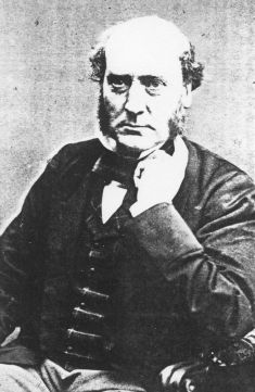
Sir George Gilbert Scott, largely known as Sir Gilbert Scott, was a prolific English Gothic Revival architect, chiefly associated with the design, building and renovation of churches and cathedrals, although he started his career as a leading designer of workhouses. Over 800 buildings were designed or altered by him.

Buckingham is a market town in north Buckinghamshire, England, close to the borders of Northamptonshire and Oxfordshire, which had a population of 12,890 at the 2011 Census. The town lies approximately 12 miles (19 km) west of Central Milton Keynes, 19 miles (31 km) south-east of Banbury, and 24 miles (39 km) north-east of Oxford.

Bonnington is a dispersed village and civil parish on the northern edge of the Romney Marsh in Ashford District of Kent, England. The village is located eight miles (13 km) to the south of the town of Ashford on the B2067.

Postling village and civil parish is situated near the Roman road of Stone Street, about 17 miles (27 km) south of Canterbury, Kent, in South East England. Postlinges is the spelling used in the Domesday Book where it was part of the lands of Hugo de Montfort; Postlinge is also seen in old records. There is much archaeological evidence of continued occupation of the area. Postling Court is, in effect, the old manor-house, although is, more correctly as the name suggests, the one-time meeting place of the local court and magistrate. The population of the civil parish includes the hamlet of Newbarn.

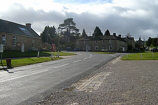
Romaldkirk is a village in Teesdale, in the Pennines of England. The village lies within the historic boundaries of the North Riding of Yorkshire, but has been administered by County Durham since 1974.

Rumbold or Rumwold was a medieval infant saint in England, said to have lived for three days in 662. He is said to have been full of Christian piety despite his young age, and able to speak from the moment of his birth, professing his faith, requesting baptism, and delivering a sermon prior to his early death. Several churches were dedicated to him, of which at least four survive.

Barfrestone is a village and a former civil parish, now in the parish of Eythorne, in the Dover district, in east Kent, England. It is between Shepherdswell, Eythorne and Nonington, close to the pit villages of Elvington and Snowdown. In 1931 the parish had a population of 91. On 1 April 1935 the parish was abolished and merged with Eythorne.

Blean is a village and civil parish in the Canterbury district of Kent, England. The civil parish is large and is mostly woodland, much of which is ancient woodland. The developed village within the parish is scattered along the road between Canterbury and Whitstable, in the middle of the Forest of Blean. The parish of St. Cosmus and St. Damian in the Blean was renamed "Blean" on 1 April 2019.

Bilsington is a village and civil parish in the Ashford district of Kent, England. The village is about 5 miles (8 km) south of Ashford, on the B2067 road, Hamstreet to Hythe road north of the Royal Military Canal.

Iwade is a village and civil parish 2 miles (3.2 km) north of the town of Sittingbourne in the English county of Kent.

Harty is a small hamlet on the Isle of Sheppey in Kent consisting of a few cottages, a church and a public house, the Ferry Inn. It is part of the civil parish of Leysdown.

Lower Halstow is a village and civil parish in the Swale district of Kent, England. The village is northwest of Sittingbourne on the banks of the Medway Estuary. It lies north of Newington on the A2 Roman road.
Goodnestone is a village and former civil parish, now in the parish of Graveney with Goodnestone, in the Swale district of Kent, England. The village is mainly on the road 'Head Hill Road' towards Graveney. In 1961 the parish had a population of 58.

Bredgar is a village and civil parish in the Borough of Swale, Kent, England.

Stockbury is a village and civil parish in the Maidstone district of Kent, England. The population of the civil parish at the Census 2011 was 691.

Coldred is a settlement and former civil parish, now in the parish of Shepherdswell with Coldred, in the Dover district of Kent, England. The main part of the village is Coldred Street which lies 1⁄2 mile (0.80 km) to the south-west. In 1961 the parish had a population of 153.

Brightwell Baldwin is a village and civil parish in Oxfordshire, about 4+1⁄2 miles (7 km) northeast of Wallingford. It was historically in the Hundred of Ewelme and is now in the District of South Oxfordshire. The 2011 Census recorded the parish's population as 208. The parish is roughly rectangular, about 2+1⁄2 miles (4 km) long north–south and about 1+1⁄4 miles (2 km) wide east–west. In 1848 the parish covered an area of 1,569 acres (635 ha). The B4009 road linking Benson and Watlington forms part of the southern boundary of the parish. The B480 road linking Oxford and Watlington forms a small part of its northern boundary. Rumbolds Lane forms much of its western boundary. For the remainder the parish is bounded largely by field boundaries.

All Saints is a parish church in Maidstone, Kent. It is a Grade I listed building, and has been described as the grandest Perpendicular style church in Kent.

The College of All Saints was an ecclesiastical college in Maidstone, Kent, England, founded in 1395 by Archbishop Courtenay. It was part of the establishment of the nearby Archbishop's Palace, but was closed in 1546. The College church was the neighbouring Church of All Saints. Following its closure, the College estate was sold. The buildings and land passed through the ownership of three aristocratic families, being farmed until the late 19th century. A number of the College's buildings survive and all are listed buildings. Additionally, the whole site of the College is protected as a scheduled monument.

St Paul's Church stands off Berry Lane, Longridge, Lancashire, England. It is an active Anglican parish church in the diocese of Blackburn. The church was built in 1886–1888, and the tower was added in 1936–37. The church is recorded in the National Heritage List for England as a designated Grade II listed building.


