Cigudeg | |
|---|---|
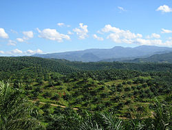 Oil palm plantation in Cigudeg. | |
 Cigudeg  Cigudeg Cigudeg (Java)  Cigudeg Cigudeg (Indonesia) | |
| Coordinates: 6°32′58″S106°32′05″E / 6.54944°S 106.53472°E | |
| Country | |
| Province | West Java |
| Regency | Bogor Regency |
| Area | |
• Total | 161.18 km2 (62.23 sq mi) |
| Elevation | 369 m (1,211 ft) |
| Population (mid 2024 estimate) [1] | |
• Total | 148,182 |
| • Density | 919.36/km2 (2,381.1/sq mi) |
| Time zone | UTC+7 (IWST) |
| Area code | (+62) 251 |
| Vehicle registration | F |
| Villages | 15 |
| Website | kecamatancigudeg |
Cigudeg is a town and an administrative district (Indonesian: kecamatan) in the Bogor Regency of West Java Province, Indonesia and thus part of Jakarta's metropolitan area.
Cigudeg District covers an area of 161.18 km2, and had a population of 117,278 at the 2010 Census [2] and 133,931 at the 2020 Census; [3] the official estimate as at mid 2024 was 148,182 (comprising 77,818 males and 70,364 females). [1] The administrative centre is at the town of Cigudeg, and the district is sub-divided into fifteen villages (desa), all sharing the postcode of 16660, as listed below with their areas and populations as at mid 2024. [1]
| Kode Wilayah | Name of desa | Area in km2 | Population mid 2024 estimate |
|---|---|---|---|
| 32.01.22.2011 | Sukaraksa | 5.24 | 10,411 |
| 32.01.22.2001 | Sukamaju | 6.33 | 11,125 |
| 32.01.22.2002 | Cigudeg (town) | 11.71 | 16,669 |
| 32.01.22.2004 | Banyuresmi | 2.31 | 7,813 |
| 32.01.22.2010 | Wargajaya | 7.72 | 7,928 |
| 32.01.22.2003 | Bunar | 8.97 | 10,173 |
| 32.01.22.2014 | Mekarjaya | 7.37 | 8,427 |
| 32.01.22.2005 | Cintamanik | 23.59 | 10,704 |
| 32.01.22.2012 | Banyuwangi | 8.22 | 6,412 |
| 32.01.22.2013 | Banyuasih | 9.26 | 5,525 |
| 32.01.22.2015 | Tegallega | 9.61 | 9,387 |
| 32.01.22.2009 | Batujajar | 8.60 | 7,847 |
| 32.01.22.2008 | Rengasjajar | 1.24 | 11,785 |
| 32.01.22.2007 | Bangunjaya | 14.20 | 10,995 |
| 32.01.22.2006 | Argapura | 36.81 | 12,981 |
| 32.01.22 | Totals | 161.18 | 148,182 |