| Civer, Illinois | |
|---|---|
| Ghost town | |
 Civer | |
| Coordinates: 40°31′27″N090°06′27″W / 40.52417°N 90.10750°W | |
| Country | United States |
| State | Illinois |
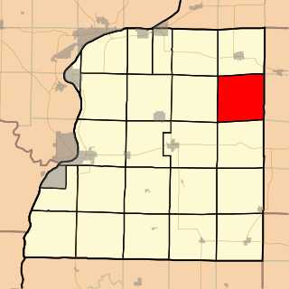
| County | Fulton |
| Township | Putman |
| Elevation | 679 ft (207 m) |
| GNIS feature ID | 1719442 |
Civer is a ghost town in Fulton County, Illinois, United States. Its elevation was 679 feet (207 m). The community no longer exists. [1]

A ghost town is an abandoned village, town, or city, usually one that contains substantial visible remains. A town often becomes a ghost town because the economic activity that supported it has failed, or due to natural or human-caused disasters such as floods, prolonged droughts, government actions, uncontrolled lawlessness, war, pollution, or nuclear disasters. The term can sometimes refer to cities, towns, and neighbourhoods that are still populated, but significantly less so than in past years; for example, those affected by high levels of unemployment and dereliction.

Fulton County is a county in the U.S. state of Illinois. According to the 2010 census, it had a population of 37,069. Its county seat is Lewistown, and the largest city is Canton.

Illinois is a state in the Midwestern region of the United States. It has the 5th largest Gross Domestic Product by state, is the 6th-most populous U.S. state and 25th-largest state in terms of land area. Illinois is often noted as a microcosm of the entire United States. With Chicago in the northeast, small industrial cities and great agricultural productivity in northern and central Illinois, and natural resources such as coal, timber, and petroleum in the south, Illinois has a diverse economic base, and is a major transportation hub. Chicagoland, Chicago's metropolitan area, contains over 65% of the state's population. The Port of Chicago connects the state to other global ports around the world from the Great Lakes, via the Saint Lawrence Seaway, to the Atlantic Ocean; as well as the Great Lakes to the Mississippi River, via the Illinois Waterway on the Illinois River. The Mississippi River, the Ohio River, and the Wabash River form parts of the boundaries of Illinois. For decades, Chicago's O'Hare International Airport has been ranked as one of the world's busiest airports. Illinois has long had a reputation as a bellwether both in social and cultural terms and, through the 1980s, in politics.