
Will County is a county in the northeastern part of the state of Illinois. According to the 2020 census, it had a population of 696,355, an increase of 2.8% from 677,560 in 2010, making it Illinois's fourth-most populous county. The county seat is Joliet. Will County is one of the five collar counties of the Chicago-Naperville-Elgin, IL-IN-WI Metropolitan Statistical Area. The portion of Will County around Joliet uses area codes 815 and 779, while 630 and 331 are for far northern Will County and 708 is for central and eastern Will County.

Williamson County is a county in Southern Illinois. At the 2020 census, it had a population of 67,153. The largest city and county seat is Marion.

Whiteside County is a county located in the U.S. state of Illinois. According to the 2010 census, it had a population of 58,498. Its county seat is Morrison. The county is bounded on the west by the Mississippi River. Whiteside County comprises the Sterling, IL Micropolitan Statistical Area, which is also included in the Dixon-Sterling, IL Combined Statistical Area. U.S. President Ronald Reagan was born in 1911 in the Whiteside County community of Tampico.
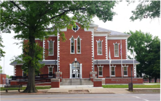
Washington County is a county located in the U.S. state of Illinois. As of the 2010 census, it had a population of 14,716. Its county seat is Nashville. It is located in the southern portion of Illinois known locally as "Little Egypt".

Warren County is a county in the U.S. state of Illinois. According to the 2010 census, it had a population of 17,707. Its county seat is Monmouth.

Tazewell County is a county in the U.S. state of Illinois. According to the 2010 census, it had a population of 135,394. Its county seat and largest city is Pekin. It is pronounced with a short "a", to rhyme with "razz" rather than "raze."

Sangamon County is located in the center of the U.S. state of Illinois. According to the 2010 census, it had a population of 197,465. Its county seat and largest city is Springfield, the state capital.

Saline County is a county in Southern Illinois. At the 2020 census, it had a population of 23,768. The largest city and county seat is Harrisburg. This area of Southern Illinois is known locally as "Little Egypt".

Randolph County is a county located in the U.S. state of Illinois. According to the 2020 census, it had a population of 30,163. Its county seat is Chester.

Perry County is in Illinois. According to the 2010 census, it had a population of 22,350. Its county seat is Pinckneyville. It is located in the southern portion of Illinois known as "Little Egypt".

Lake County is situated in the northeastern corner of the U.S. state of Illinois, along the shores of Lake Michigan. As of the 2020 census, it has a population of 714,342, making it the third-most populous county in Illinois. Its county seat is Waukegan, the tenth-largest city in Illinois. The county is primarily suburban, with some urban areas and some rural areas. Due to its location, immediately north of Cook County, Lake County is one of the collar counties of the Chicago metropolitan area. Its northern boundary is the Wisconsin state line.

Kendall County is a county in the U.S. state of Illinois, within the Chicago metropolitan area. According to the 2020 census, it has a population of 131,869. Its county seat is Yorkville, and its most populous municipality is Oswego.
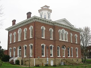
Johnson County is a county in the U.S. state of Illinois. According to the 2010 census, it has a population of 12,582. Its county seat is Vienna. It is located in the southern portion of Illinois known locally as "Little Egypt".
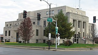
Jefferson County is a county located in the southern part of the U.S. state of Illinois. According to the 2020 census, it has a population of 37,113. The county seat is Mount Vernon.
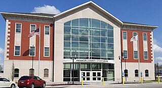
Franklin County is a county in Southern Illinois. At the 2020 census, it had a population of 37,804. The largest city is West Frankfort and the county seat is Benton. This area of Southern Illinois is known locally as "Little Egypt".
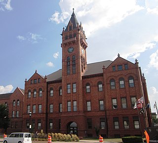
Champaign County is a county in the U.S. state of Illinois. As of the 2020 census, its population was 205,865, making it the 10th-most populous county in Illinois. Its county seat is Urbana.
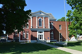
Cass County is a county located in the U.S. state of Illinois. As of the 2010 United States Census, the population was 13,642. Its county seat is Virginia. It is the home of the Jim Edgar Panther Creek State Fish and Wildlife Area.

Carbondale is a city in Jackson County, Illinois, United States, within the Southern Illinois region informally known as "Little Egypt". The city developed from 1853 because of the stimulation of railroad construction into the area. Today the major roadways of Illinois Route 13 and U.S. Route 51 intersect in the city. The city is 96 miles (154 km) southeast of St. Louis, on the northern edge of the Shawnee National Forest. Carbondale is the home of the main campus of Southern Illinois University (SIU).

Bartlett is a village located in Cook, DuPage and Kane counties, Illinois. A small parcel on the western border is in Kane County. The population was 41,105 at the 2020 census.

Southern Illinois, also known as Little Egypt, is the southern third of Illinois, principally along and south of Interstate 64. Although part of a Midwestern state, this region is aligned in culture more with that of the Upland South than the Midwest. Part of downstate Illinois, it is bordered by the two most voluminous rivers in the United States: the Mississippi below its connecting Missouri River to the west and the Ohio River to the east and south with the Wabash as tributary.


