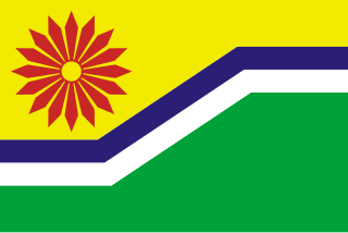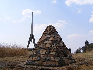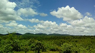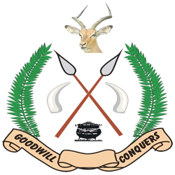
Mpumalanga is a province of South Africa. The name means "east", or literally "the place where the sun rises" in the Swazi, Xhosa, Ndebele and Zulu languages. Mpumalanga lies in eastern South Africa, bordering Eswatini and Mozambique. It constitutes 6.5% of South Africa's land area. It shares borders with the South African provinces of Limpopo to the north, Gauteng to the west, the Free State to the southwest, and KwaZulu-Natal to the south. The capital is Mbombela.

Emalahleni, previously named Witbank, is a city situated on the Highveld of Mpumalanga, South Africa, within the Emalahleni Local Municipality. The name Witbank is Afrikaans for "white ridge", and is named after a white sandstone outcrop where wagon transport drivers rested. The city is known for its coal-mining in the surrounding region.

Belfast is a small town in Mpumalanga Province, South Africa. It is situated in the eMakhazeni Local Municipality in the Nkangala District Municipality.

Ermelo is the educational, industrial and commercial town of the 7,750 km2 Gert Sibande District Municipality in Mpumalanga province, Republic of South Africa. It is both a mixed agriculture and mining region. It is located 210 km east of Johannesburg.

Bethal is a farming town in Mpumalanga, South Africa. The farms in the region produce maize, sunflower seeds, sorghum, rye and potatoes. The town lies 155 km east of Johannesburg.

Bushbuckridge (Mapulaneng) is the main town in Bushbuckridge Local Municipality, Ehlanzeni District, Mpumalanga, South Africa. The name Bushbuck Ridge was given because of the large herds of bushbuck found here in the 1880s, and the prominent WNW-ESE ridge in the southeastern part of the municipality. The town of Bushbuckridge grew around a trading store that opened in 1884.

Bushbuckridge Local Municipality is a third-level administrative division in the Ehlanzeni District of Mpumalanga in South Africa. Commercial farming, which consists of pine /bluegum plantations, tobacco, cotton, sub-tropical fruits and vegetables is practised in the municipality's countryside. The municipality includes the southern part of the Kruger National Park. Bushbuckridge is the largest local municipality in Mpumalanga, both in terms of land size and population figures.

Leslie is a town in Gert Sibande District Municipality in the Mpumalanga province of South Africa. It is part of Leandra. The village is 63 km west of Bethal, Mpumalanga and 56 km east-south-east of Springs, Gauteng. Administered by a village council, it was laid out on the farm Brakkefontein and proclaimed in December 1939, an extension being proclaimed in December 1957. The village is thought to be named after Leslie in Fife, Scotland.

Madras is a town in Ehlanzeni District Municipality in the Mpumalanga province of South Africa.

Klarinet is a town in the Greater city of eMalahleni. The town lies within the Nkangala District Municipality in the Mpumalanga province of South Africa. It is governed by the eMalahleni Local Municipality. The city was renamed because of the coal mines that are found in the area.

Ludlow is a town in Ehlanzeni District Municipality in the Mpumalanga province of South Africa.

Alexandria is a town in Bushbuckridge Local Municipality under Ehlanzeni District Municipality in the Mpumalanga province of South Africa. Its got its theme of footprints on rock in the mountains of Simeleni. It borders two rivers Bhejane and Ngwenyameni that connect with the giant Sabie River. It is the birthplace of well known businessman Solly Ndlovu and also the birthplace of the South African drone sketch drawing and electrician ( ).

Dundonald is a village in Gert Sibande District Municipality in the Mpumalanga province of South Africa. It was formerly part of the KaNgwane homeland.

Ngodwana is a town in Ehlanzeni District Municipality in the Mpumalanga province of South Africa.

Boschfontein is a town in Ehlanzeni District Municipality in the Mpumalanga province of South Africa.

Okkerneutboom is a town in Bushbuckridge Local Municipality in the Mpumalanga province of South Africa.

Clare is a town in Bushbuckridge Local Municipality, Mpumalanga, South Africa. It lies south of the R531, west of Hluvukani. It is divided into Clare A, B & C; which together have a population of 9,586.

Zwelisha is a rural settlement in Mbombela Local Municipality in Ehlanzeni District of the Mpumalanga province, South Africa. How populated it is and racial it is

Swalala is a rural settlement in Mbombela Local Municipality in Ehlanzeni District of the Mpumalanga province, South Africa.
Islington is a settlement in the Ehlanzeni District Municipality in the Mpumalanga Province of South Africa. It is located east of Acornhoek.


