In Colonial times the Spanish Empire diverted significant resources to fortify the Chilean coast as consequence of Dutch and English raids. [1] The Spanish attempts to block the entrance of foreign ships to the eastern Pacific proved fruitless due to the failure to settle the Strait of Magellan and the discovery of the Drake Passage. As result of this the Spanish settlement at Chiloé Archipelago became a centre from where the west coast of Patagonia was protected from foreign powers. [2] In face of the international wars that involved the Spanish Empire in the second half of the 18th century the Crown was unable to directly protect peripheral colonies like Chile leading to local government and militias assuming the increased responsibilities. [3]
The following is a list of expedition and seafarers who landed or sailed in Chile with hostile intentions towards Spain or during times the country they served was at war with Spain.
Year(s) | Commander | Places attacked | Details |
---|---|---|---|
1578–1580 | Francis Drake | Valparaíso, La Serena, Arica | Francis Drake was one of the first corsairs to attack the Chilean coast. With his ship the Golden Hind Drake sailed north along the Pacific coast of South America, attacking Spanish ports and pillaging towns. Some Spanish ships were captured, and Drake used their more accurate charts. Before reaching the coast of Peru, Drake visited Mocha Island, where he was seriously injured by hostile Mapuche. Later he sacked the port of Valparaíso further north in Chile where he also captured a ship full of Chilean wine. [4] |
1587 | Thomas Cavendish | Quintero | Thomas Cavendish's expedition begun once he sailed off Plymouth in 1586. He entered the Strait of Magellan and after finding the settlement of Ciudad del Rey Don Felipe abandoned, which he named Port Famine, he sailed north to the thriving Spanish settlements in Chile. At the ruins of Ciudad del Rey Don Felipe Cavendish rescued a survivor who later escaped and alarmed Spanish authorities of Cavendish's presence. Cavendish made a failed attempt at attacking the port of Quintero in Central Chile before he left Chile for Peru, Mexico and the Philippines. [5] |
1593 | Richard Hawkins | Valparaíso | In 1593, the English privateer Richard Hawkins led an expedition to the Pacific with three ships. Passing the Strait of Magellan, he had one ship left, the Dainty, with which Hawkins transited some parts of the Chilean coast and attacked Valparaíso. [6] He was later captured by a Spanish squadron from the Fleet of the South Sea. Hawkins was pardoned and deported back to England. [7] [8] |
1600 | Olivier van Noort | None | Visited Santa María Island |
1600 | Simon de Cordes Baltazar de Cordes | Castro | In 1600 local Huilliche joined the Dutch corsair Baltazar de Cordes to attack the Spanish settlement of Castro. [9] [10] While this was a sporadic attack the Spanish believed the Dutch could attempt to ally the Mapuches and establish a stronghold in southern Chile. [11] |
1614 | Joris van Spilbergen | None | Visited Santa María Island |
1643 | Hendrik Brouwer Elias Herckman | Carelmapu, Castro | The Spanish knew of the Dutch plans to establish themselves at the ruins of Valdivia so they attempted to re-establish Spanish rule there before the Dutch arrived again. [12] The Spanish attempts were thwarted in the 1630s when Mapuches did not allow the Spanish to pass by their territory. [12] The Dutch occupation of Valdivia in 1643 caused great alarm among Spanish authorities and triggered the construction of the Valdivian Fort System that begun in 1645. [13] [14] |
1670 | John Narborough | None | In response to John Narborough's explorations and Cristóbal Talcapillán's claims of English bases in Patagonia the Spanish organized the Antonio de Vea expedition which ran the 1675–1676 summer seeking to find out any news about English presence. [15] |
1680–1681 | Bartholomew Sharp | La Serena, Iquique, Arica | In 1680 the English corsair Bartholomew Sharp raided in turn La Serena, Iquique, Arica to then continue to attack Spanish possessions in Peru. The Spanish governor José de Garro had foreknowledge of Sharps incursion and ordered Valparaíso, Concepción and Valdivia to prepare. In this view the raid on La Serena was a complete surprise for the Spanish. At the very last moment a militia was formed in La Serena but it was dispersed after a confrontation with Sharps troops. La Serena's inhabitants fled the city and Sharp occupied it for three days. [16] |
1686 | William Knight | La Serena | In May 1686 he landed in Tongoy near La Serena. The Spanish engaged the pirates who left. One pirate was taken prisoner and sent to Lima. |
1686 | Edward Davis | La Serena | In September 1686 Davis led a failed attack on La Serena. Upon meeting resistance pirates took up a defensive position in a local church. When finally leaving the city the pirates had lost 11 men, including a prisoner who died shortly thereafter. |
1704 | Thomas Stradling | None | Left Alexander Selkirk on Robinson Crusoe Island. |
1709 | Woodes Rogers | None | Picked up Alexander Selkirk on Robinson Crusoe Island. |
1720 | George Shelvocke | None | On 25 May 1720 the Shelvocke's ship Speedwell was wrecked on an island of Juan Fernández called Más a Tierra by the Spanish. Shelvocke and his crew were marooned there for five months but managed to build a 20-ton boat using some timbers and hardware salvaged from the wreck, in addition to wood obtained from locally felled trees. They left the island on 6 October to continue hostilities against the Spanish Empire. |
1721 | John Clipperton | Arica | |
1741 | George Anson David Cheap | None | The arrival of George Anson's expedition to Chilean waters happened at a time Spain and Britain were at war. After a troublesome passage into the Pacific from the Atlantic the remaining ships ( Centurion and Tryal) regrouped in Juan Fernández Islands. HMS Wager wrecked in Guayaneco Archipelago leading to various searches by the Spanish after the survivors or any further British activity in western Patagonia. [2] |
As consequence of the Seven Years' War the Valdivian Fort System, a Spanish defensive complex in southern Chile, was updated and reinforced from 1764 onwards. Other vulnerable localities of colonial Chile such as Chiloé Archipelago, Concepción, Juan Fernández Islands and Valparaíso were also made ready for an eventual English attack. [8] [17]
With Spain and Great Britain at war again in the 1770s due to the American Revolutionary War local Spanish authorities in Chile received in 1779 the warning that a British fleet commanded by Edward Hughes was heading to Chilean coasts for an imminent attack. As consequence of this the Viceroyalty of Peru send economic aid to the garrisons at Valparaíso and Valdivia. The suspected attack did however never happen. In late 1788 suspicion of British attack arose once again, this time stemming from observations of ships off the coast of Coquimbo. A defense plan where militias played a major role was hastily made up. [3]
In the 16th and 17th century Spain considered the Pacific Ocean a Mare clausum – a sea closed to other naval powers. As the only known entrance from the Atlantic the Strait of Magellan was at times patrolled by fleets sent to prevent entrance of non-Spanish ships. On the western end of the Pacific Ocean the Dutch threatened the Spanish Philippines. [18] To end navigation by rival powers in the Strait of Magellan Spanish viceroy Francisco de Toledo ordered Pedro Sarmiento de Gamboa to explore the strait and found settlements on its shores. [19]
The Spanish failure to colonize the Strait of Magellan was so notorious that its precedent ruled out any attempt to settle the strait for centuries to come. [20] Proposals to settle the strait were raised again in Spanish courts in 1671 in connection to John Narborough's expedition to Chile and again in 1702 by the Governor of Chile Francisco Ibáñez de Peralta. [21] In this last proposal, the Captaincy General of Chile would itself finance the settlement with the Real Situado with the sole condition that these payments begin to arrive on time. [21]
In Colonial times the Spanish Empire diverted significant resources to fortify the Chilean coast as consequence of Dutch and English raids. [1] This was particularly true for the expensive Valdivian Fort System built after what would be the last Dutch incursion into Chile since Dutch rule in Brazil, from where the expedition to Chile was made, collapsed in 1645. [22] However the investments in the defense of Corral Bay validated in 1670 when a fully armed ship commanded by John Narborough's arrived to the bay rising suspicions of an imminent English attack. [23]
A Spanish fort near Taitao Peninsula was manned for one and half year beginning in 1750 before being abandoned. [2]
Spain's international wars in the second half of the 18th century evidenced the empire's difficulties in reinforcing its colonial possessions and provide them with economic aid. This led to an increased local participation in the financing of the defense and an increased participation in the militias by the Chilean-born. Such development was at odds with the ideals of the centralized absolute monarchy. The Spanish did also formal concessions to strengthen the defense: In Chiloé Spanish authorities promised freedom from the encomienda those indigenous locals who settled near the new stronghold of Ancud (founded in 1768) and contributed to its defense. The increased local organization of the defenses would ultimately undermine metropolitan authority and bolster the independence movement. [3]
In the last decades of the 18th century the Spanish set out to build roads between strategic places in the coast. One such road, Caicumeo, connected the "city-fort" of Ancud with Castro. [24] [25] Another large road was projected to connect Valdivia with the settlements at the northern shores of Chacao Channel providing a pathway for reciprocal military aid. [26] On October 1788 the Governor of Valdivia Mariano Pusterla sent an expedition to traverse the Huilliche-ruled territories to reach Chiloé. The expedition preved successful and by February 1789 the men were back in Valdivia. [27] Pusterla subsequently arranged to improve the path to Chiloé, in particularly to widen it at places is was a narrow path along forests. [27] In a parliament with local Cuncos and Huilliches Pusterla assured the opening of the path along there would not imply a reestablishment of the city of Osorno. [27] However the transit along this road depended on the goodwill of the local tribes [27] and on September 1792 Huilliches revolted against Spanish encroachment. [28]
The Spanish failure at colonizing the Strait of Magellan made Chiloé Archipelago assume the role of protecting the area of western Patagonia from foreign intrusions. [2] Valdivia, reestablished in 1645, and Chiloé acted as sentries being hubs where the Spanish collected information and rumours from all-over Patagonia. [23]
John Narborough's 1670 expedition to Patagonia and Valdiva, despite being done in peace time, caused much suspicion among Spanish authorities. In response the Spanish organized the Jerónimo Diez de Mendoza, Bartolomé Gallardo and Antonio de Vea expeditions which ran three consecutive summers from 1674 to 1676 seeking to find out any news about English bases in western Patagonia. [15] [29] Following the last expedition Spanish interest in the area waned [30] and the focus of Spanish attention to repel tentative English settlements shifted from the Pacific coast of Patagonia to the Straits of Magellan and Tierra del Fuego. [31]
In the aftermath of the wreck of HMS Wager (1741) in Guayaneco Archipelago a series of expeditions and patrolling was done in the coasts of Patagonia by the Spanish. [2] A book based on the Wager wreck published in 1748 in England exposed weaknesses of the Spanish rule in the Southeastern Pacific. This book together with rumors of a new British expedition made the Viceroy of Peru send expeditions to populate Juan Fernandez Islands, establish a fort in the island of Tenquehuén near Taitao Peninsula, and search for a frigate the British would supposedly have sent into the southeast Pacific. [2]
As result of the corsair and pirate menace Spanish authorities ordered to depopulate Guaitecas Archipelago to deprive enemies of any eventual support from native populations. [32] This then led to the transfer of indigenous Chono population to Chiloé Archipelago in the north while some Chonos moved south of Taitao Peninsula effectively depopulating the territory in the 18th century. [32]
When the Spanish learned about the impeding Dutch expedition to Valdivia in the 1640s Pedro de Toledo, Viceroy of Peru, sent letters ordering local Spanish authorities use a scorched earth strategy against the invaders. [33]
The Strait of Magellan, also called the Straits of Magellan, is a navigable sea route in southern Chile separating mainland South America to the north and Tierra del Fuego to the south. The strait is considered the most important natural passage between the Atlantic and Pacific oceans. It was discovered and first traversed by Europeans by the Spanish expedition of Portuguese explorer Ferdinand Magellan in 1520, after whom it is named. Prior to this, the strait had been navigated by canoe-faring indigenous peoples including the Kawésqar.
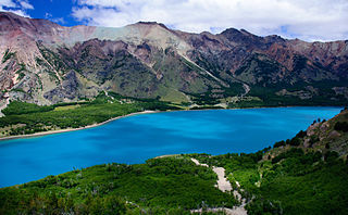
The Aysén Region, often shortened to Aysén Region or Aisén, is one of Chile's 16 first order administrative divisions. Although the third largest in area, the region is Chile's most sparsely populated region with a population of 102,317 as of 2017. The capital of the region is Coihaique, the region's former namesake.
Ancud is a city in southern Chile located in the northernmost part of the island and province of Chiloé, in Los Lagos Region. It is the second largest city of Chiloé Archipelago after Castro. The city was established in 1768 to function as the capital of the archipelago and held that position until 1982. Founded as bulwark against foreign powers in colonial times, the city played an important role in the Chilean colonization of Patagonia in the 19th century.
This is a timeline of Chilean history, comprising important legal and territorial changes and political events in Chile and its predecessor states. To read about the background to these events, see History of Chile. See also the list of governors and presidents of Chile.
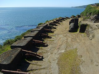
The Fort System of Valdivia are a series of Spanish colonial fortifications at Corral Bay, Valdivia and Cruces River established to protect the city of Valdivia, in southern Chile. During the period of Spanish rule (1645–1820), it was one of the biggest systems of fortification in the Americas. It was also a major supply source for Spanish ships that crossed the Strait of Magellan.
Guaitecas Archipelago is a sparsely populated archipelago in the Aisén region of Chile. The archipelago is made up of eight main islands and numerous smaller ones. The eight largest islands are from northwest to southeast: Gran Guaiteca, Ascención, Betecoy, Clotilde, Leucayec, Elvira, Sánchez and Mulchey. The islands have subdued topography compared to the Andes, with Gran Guaiteca containing the archipelago's high point at 369 m (1,211 ft).
The Chono people, or Guaiteco were a nomadic indigenous people or group of peoples of the archipelagos of Chiloé, Guaitecas and Chonos.
The Conquest of Chile is a period in Chilean historiography that starts with the arrival of Pedro de Valdivia to Chile in 1541 and ends with the death of Martín García Óñez de Loyola in the Battle of Curalaba in 1598, and the destruction of the Seven Cities in 1598–1604 in the Araucanía region.
The southern coast of Chile presents a large number of fjords and fjord-like channels from the latitudes of Cape Horn to Reloncaví Estuary. Some fjords and channels are important navigable channels providing access to ports like Punta Arenas, Puerto Chacabuco and Puerto Natales.
In late 19th and early 20th centuries, sheep farming expanded across the Patagonian grasslands making the southern regions of Argentina and Chile one of the world's foremost sheep farming areas. The sheep farming boom attracted thousands of immigrants from Chiloé and Europe to southern Patagonia. Early sheep farming in Patagonia was oriented towards wool production but changed over time with the development of industrial refrigerators towards meat export. Besides altering the demographic and economic outlook of Southern Patagonia the sheep farming boom also changed the steppe ecosystem.
In Colonial times the Spanish Empire diverted significant resources to fortify the Chilean coast as a consequence of Dutch and English raids. During the 16th century the Spanish strategy was to complement the fortification work in its Caribbean ports with forts in the Strait of Magellan. As attempts at settling and fortifying the Strait of Magellan were abandoned the Spanish began to fortify the Captaincy General of Chile and other parts of the west coast of the Americas. The coastal fortifications and defense system was at its peak in the mid-18th century.
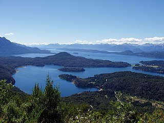
The Mission of Nahuel Huapi was an intermittent Jesuit mission that existed in colonial times on the shores of Nahuel Huapi Lake, northern Patagonia. The exact locations of the missions are not known but it has been suggested, based on a Christian grave finding, that the mission of the early 18th century was located in Huemul Peninsula.
José Manuel de Moraleda y Montero was a Spanish naval officer and cartographer known for his explorations of Chiloé and the archipelagos of Patagonia in the late 18th century. During his lifetime he gained a reputation of sorcerer in Chiloé and is remembered so in local folklore. The first-order waterway of Moraleda Channel is named after him.
The Antonio de Vea expedition of 1675–1676 was a Spanish naval expedition to the fjords and channels of Patagonia aimed to find whether rival colonial powers—specifically, the English—were active in the region. While this was not the first Spanish expedition to the region, it was the largest up to then, involving 256 men, one ocean-going ship, two long boats and nine dalcas. The expedition dispelled suspicion about English bases in Patagonia. Spanish authorities' knowledge of western Patagonia was greatly improved by the expedition, yet Spanish interest in the area waned thereafter until the 1740s.
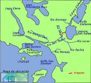
San Tadeo River is a river in the Isthmus of Ofqui, Aysén Region, Chile. San Tadeo River flows in a SSW direction into the Gulf of San Esteban. It drains much of the swampy Isthmus of Ofqui and the meltwater from San Quintín Glacier's proglacial lake.
Antonio de Vea was a 17th-century Spanish sailor best known for leading the Antonio de Vea expedition to the fjords and channels of Patagonia in 1675–1676. The map of the archipelagoes of southern Chile made by Antonio de Vea was a milestone in local cartography. As far as it is known no new Spanish maps were made of the west coast of Patagonia until José de Moraleda y Montero's explorations in the late 18th century.
Bartolomé Diez Gallardo y Andrade was a criollo soldier from Chiloé. He is known for leading a 1674–1675 expedition to the fjords and channels of Patagonia, participating in the following year in the Antonio de Vea expedition to the same area and for serving as Governor of Chiloé from 1686 to 1688.
Morohuinca was a term used among the indigenous peoples of southern Chile, chiefly Mapuches and Chonos, during the Colonial Epoch to refer to the European enemies of Spain. This meant chiefly the Dutch and English. The term derives from the fusion of the Spanish word "moro" (Moor) and Mapudungun word "huinca" meaning Spaniard or foreigner but meant originally to mean Inca invaders. For example the expedition of John Narborough in 1670 was recognised as a morohuinca. A few years later Cristóbal Talcapillán referred to supposed English settlers in Patagonia as morohuincas.
The Spanish Empire attempted to settle the Strait of Magellan in the 1580s with the aim to control the by then only known passage between the Atlantic and Pacific oceans. The project was a direct response to Francis Drake's unexpected entrance to the Pacific using the strait in 1578 and the subsequent havoc his men wreaked upon Spanish America's Pacific coast. The colonizing project materialized as a naval expedition led by veteran explorer Pedro Sarmiento de Gamboa which set sail from Cádiz on December 1581. The expedition founded two short-lived settlements in the strait, Nombre de Jesús and Ciudad del Rey Don Felipe. The settlers proved poorly prepared for the cool and windy environment of the strait, and starvation and disease was soon rampant. A resupply expedition assembled in Río de Janeiro in 1585 by Sarmiento was unable to reach the strait given adverse weather. Aid to the failing colony was later hampered by Sarmiento falling prisoner to English corsairs in 1586 and likely the increasing strain on Spain's resources as a result of Philip II's wars with England and Dutch rebels. The last known survivor was rescued by a passing ship in 1590.
By the late 1660s, the English rulers had considered invading Spanish-ruled Chile for several years. In 1655 Simón de Casseres proposed to Oliver Cromwell a plan to take over Chile with only four ships and thousand men.