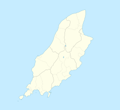
Castletown is a town in the Isle of Man, geographically within the historical parish of Malew but administered separately. Lying at the south of the island, it was the Manx capital until 1869. The centre of town is dominated by Castle Rushen, a well-preserved medieval castle, originally built for a Viking king.

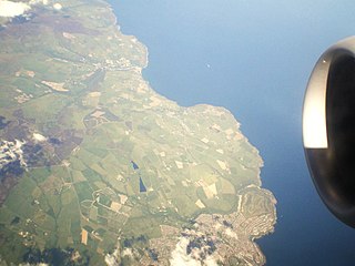
Laxey is a village on the east coast of the Isle of Man. Its name derives from the Old Norse Laxa meaning 'Salmon River'. Its key distinguishing features are its three working vintage railways and the largest working waterwheel in the world. It is also the location of King Orry's Grave.
Onchan is a large village in the parish of Onchan on the Isle of Man. It is at the north end of Douglas Bay. Administratively a district, it has the second largest population of settlements on the island, after Douglas, with which it forms a conurbation.

Peel is a seaside town and small fishing port in the Isle of Man, in the historic parish of German but administered separately. Peel is the third largest town in the Island after Douglas and Ramsey but the fourth largest settlement, as Onchan has the second largest population but is classified as a village.
Port St Mary is a village district in the south-west of the Isle of Man. The village takes its name from the former Chapel of St Mary which is thought to have overlooked Chapel Bay in the village. Its population is 1,953 according to the 2011 census. In the 19th century it was sometimes called Port-le-Murray.

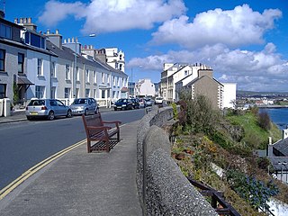
Port Erin is a seaside village in the south-west of the Isle of Man, in the historic parish of Rushen. It was previously a seaside resort before the decline of the tourist trade. Administratively it is designated as a village district, with its own board of commissioners. The district covers around 1 square mile, and is adjacent to: Port St Mary to the south-east; the main part of Arbory and Rushen parish district to the north and east; the sea to the west; and an exclave of Arbory and Rushen parish district to the south. Following recent residential expansion, the settlement is now contiguous with that of Port St Mary, and on 18 July 2018 Tynwald authorised a public enquiry into the proposed expansion of the district boundary to include some of this expansion.
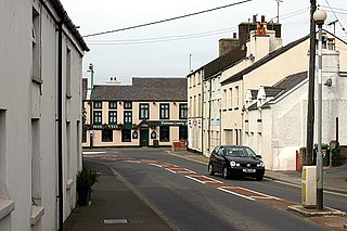
Ballasalla is a village in the parish of Malew in the south-east of the Isle of Man. The village is situated close to the Isle of Man Airport and 2 miles (3 km) north-east of the town of Castletown.

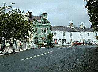
Ballabeg is a village on the Isle of Man. It is in the parish of Arbory in the sheading of Rushen, in the south of the island near Castletown. There are several small villages and hamlets with the name, although Ballabeg in Arbory is the most well-known and populous.

Michael is one of the six sheadings of the Isle of Man. It is located on the west of the island and consists of the three historic parishes of Ballaugh, Jurby and Michael.

Marown is one of the seventeen historic parishes of the Isle of Man. It is the only landlocked parish on the Island.
Ballaugh is a small village in the Isle of Man in the parish of the same name, in the sheading of Michael. It is the only village in the parish.

Lezayre, formally Kirk Christ Lezayre, is one of the seventeen historic parishes of the Isle of Man.

Colby railway station is a small railway station on the southern edge of the village of Colby in the south of the Isle of Man served by the Isle of Man Railway; it forms part of the sole remaining section of the network which once covered over 46 miles island-wide.
Union Mills is a village in the parish of Braddan on the A1, the primary road which connects Douglas and Peel in the Isle of Man, close to the River Dhoo.

Baldrine Station is a railway halt in the Isle of Man. It is an intermediate request stop on the east coast route of the Manx Electric Railway in the village of Baldrine in the parish of Lonan, on the route to Ramsey.
Glen Mona Railway Station is an intermediate stopping place on the northerly section of the Manx Electric Railway on the Isle of Man.

Andreas or Kirk Andreas is a village on the Isle of Man, lying in the north of the island, 5 km from the island's second town, Ramsey. There is a large, and nowadays little used, airfield in the vicinity.
Crosby is a small village located 3+3⁄4 miles west of Douglas in the parish of Marown in the Isle of Man.

Ballakilpheric is a small village in the parish of Rushen in the southwest of the Isle of Man, 1 kilometre (0.6 mi) northwest of the larger village of Colby, and 8 kilometres (5 mi) by road northeast of Port Erin. It is the main settlement on the B44 road. The small Colby River flows to the east of the village, and forms the boundary with Arbory parish. Ballakilpheric Methodist Chapel lies at the top of the hill.

Baldrine is a village in the Isle of Man. It is close to the east coast of the island, about 3 km south of Laxey and 6 km NE of Douglas. It is in the historic parish of Lonan, in the sheading of Garff. For administrative purposes it is in the parish district of Garff, and it is also in the House of Keys constituency of Garff.