The Isle of Man has an extensive communications infrastructure consisting of telephone cables, submarine cables, and an array of television and mobile phone transmitters and towers.

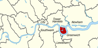
The Isle of Dogs is a large peninsula. It is bounded on three sides by a large meander in the River Thames in East London, England, which includes the Cubitt Town, Millwall and Canary Wharf districts. The area was historically part of the Manor, Hamlet, Parish and, for a time, the wider borough of Poplar. The name had no official status until the 1987 creation of the Isle of Dogs Neighbourhood by Tower Hamlets London Borough Council. It has been known locally as simply "the Island" since the 19th century.

Camillus is a town in Onondaga County, New York, United States. As of the 2020 Census, the population was 25,346.

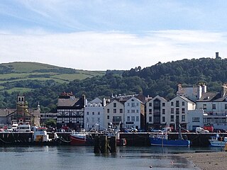
Ramsey is a coastal town in the north of the Isle of Man. It is the second largest town on the Island after Douglas. Its population is 8,288 according to the 2021 Census. It has one of the biggest harbours on the Island, and has a prominent derelict pier, called the Queen's Pier. It was formerly one of the main points of communication with Scotland. Ramsey has also been a route for several invasions by the Vikings and Scots.

Blackwall is an area of Poplar, in the London Borough of Tower Hamlets, East London. The neighbourhood includes Leamouth and the Coldharbour conservation area.

The Island of Sodor is a fictional island that is the setting for The Railway Series books by the Rev. Wilbert Awdry. It is also the setting of the Thomas & Friends television series, though it is significantly different from the island in the books. Sodor lies in the Irish Sea between Cumbria and the Isle of Man.

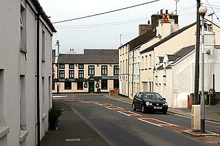
Ballasalla is a village in the parish of Malew in the south-east of the Isle of Man. The village is situated close to the Isle of Man Airport and 2 miles (3 km) north-east of the town of Castletown.

Ballabeg is a village on the Isle of Man. It is in the parish of Arbory in the sheading of Rushen, in the south of the island near Castletown. There are several small villages and hamlets with the name, although Ballabeg in Arbory is the most well-known and populous.

Newbridge is a hamlet on the Isle of Wight. It is situated on a small hill, nine kilometres to the west of Newport on the western half of the island. According to the Post Office the 2011 Census population of the hamlet was included in the civil parish of Shalfleet.

Manx English, or Anglo-Manx, is the historic dialect of English spoken on the Isle of Man, though today in decline. It has many borrowings from Manx, a Goidelic language, and it differs widely from any other variety of English, including dialects from other areas in which Celtic languages are or were spoken, such as Welsh English and Hiberno-English.

Rushen is one of the six sheadings of the Isle of Man.

Malew is one of the seventeen parishes of the Isle of Man.

Gugh could be described as the sixth inhabited island of the Isles of Scilly, but is usually included with St Agnes with which it is joined by a sandy tombolo known as "The Bar" when exposed at low tide. The island is only about 1 km (0.62 mi) long and about 0.5 km (0.31 mi) wide, with the highest point, Kittern Hill at 34 m (112 ft). The geology consists of Hercynian granite with shallow podzolic soils on the higher ground and deeper sandy soils on the lower ground. The former Gugh farm is just north of the neck across the middle of the island between the two hills. The two houses were designed and built in the 1920s by Charles Hamlet Cooper.

Luccombe is a hamlet a short distance south of Shanklin, on the south coast of the Isle of Wight, England.

Braaid is a hamlet in the parish of Marown on the Isle of Man, about 6 km west of the capital Douglas. It is best known for the nearby ancient settlement of The Braaid. In Manx, braaid means 'gullet, gorge; breast of a hill', the latter meaning possibly in reference to the aforementioned ancient settlement.

Dalby is a small hamlet on the Isle of Man, near the western coast. It lies on the A27 Port Erin to Peel road, five miles south of Peel, in the parish of Patrick.
Downend is a settlement on the Isle of Wight, off the south coast of England. It is the location of the Robin Hill adventure park. According to the Post Office the population of the settlement at the 2011 Census was included in the civil parish of Arreton.

Orrisdale North is situated adjacent the 16th TT Milestone on the primary A3 Castletown to Ramsey road with the nearby junction with the tertiary C19 Orrisdale Loop Road and D13 Bollyn Road in the parish of Ballaugh in the Isle of Man.

Ballure is a small hamlet about 0.75 mile southeast of Ramsey on the Isle of Man. A stop on the Manx Electric Railway which runs through it is the Ballure Halt station. The latter lies just to the south of the boundary of Ramsey, and thus lies in the ward of Maughold within the current administrative parish of Garff.
The geology of the Isle of Man consists primarily of a thick pile of sedimentary rocks dating from the Ordovician period, together with smaller areas of later sedimentary and extrusive igneous strata. The older strata was folded and faulted during the Caledonian and Acadian orogenies The bedrock is overlain by a range of glacial and post-glacial deposits. Igneous intrusions in the form of dykes and plutons are common, some associated with mineralisation which spawned a minor metal mining industry.


