
Lechlade is a town at the southern edge of the Cotswolds in Gloucestershire, England, 55 miles (89 km) south of Birmingham and 68 miles (109 km) west of London. It is the highest point at which the River Thames is navigable, although there is a right of navigation that continues south-west into Cricklade, in the neighbouring county of Wiltshire. The town is named after the River Leach that joins the Thames near the Trout Inn and St. John's Bridge.

Michael Edward Hicks Beach, 1st Earl St Aldwyn,, known as Sir Michael Hicks Beach, Bt, from 1854 to 1906 and subsequently as The Viscount St Aldwyn to 1915, was a British Conservative politician. Known as "Black Michael", he notably served as Chancellor of the Exchequer from 1885 to 1886 and again from 1895 to 1902 and also led the Conservative Party in the House of Commons from 1885 to 1886. Due to the length of his service, he was Father of the House from 1901 to 1906, when he took his peerage.

Earl St Aldwyn, of Coln St Aldwyn in the County of Gloucester, is a title in the Peerage of the United Kingdom. It was created in 1915 for the prominent Conservative politician Michael Hicks Beach, 1st Viscount St Aldwyn, known from 1854 to 1907 as Sir Michael Hicks Beach, 9th Baronet, of Beverston. He was Chancellor of the Exchequer from 1885 to 1886 and again from 1895 to 1902. Hicks Beach had already been created Viscount St Aldwyn, of Coln St Aldwyn in the County of Gloucester, in 1906, and was made Viscount Quenington, of Quenington in the County of Gloucester, at the same time he was given the earldom. Both titles are in the Peerage of the United Kingdom. He was succeeded by his grandson, the second Earl, the son of Michael Hicks Beach, Viscount Quenington, Member of Parliament for Tewkesbury, who was killed in action in 1916. Lord St Aldwyn was also a Conservative politician and was Captain of the Honourable Corps of Gentlemen-at-Arms between 1958 and 1964 and 1970 and 1974. As of 2018 the titles are held by his eldest son, the third Earl, who succeeded in 1992.
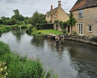
Fairford is a small market town in Gloucestershire, England. The town lies in the Cotswold hills on the River Coln, 6 miles (9.7 km) east of Cirencester, 4 miles (6.4 km) west of Lechlade and 9 miles (14 km) north of Swindon. Nearby are RAF Fairford and the Cotswold Water Park.
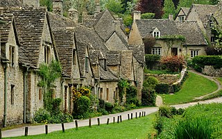
Bibury is a village and civil parish in Gloucestershire, England. It is on the River Coln, a Thames tributary that rises in the same (Cotswold) District. The village centre is 6+1⁄2 miles northeast of Cirencester. Arlington Row is a nationally notable architectural conservation area depicted on the inside cover of some British passports. It is a major destination for tourists visiting the traditional rural villages, tea houses and many historic buildings of the Cotswold District; it is one of six places in the country featured in Mini-Europe, Brussels.

Ampney Crucis is a village and civil parish in the Cotswolds, part of the Cotswold District of Gloucestershire, England.

Quenington is a nucleated village and larger rural civil parish in the Cotswold district of Gloucestershire, England, on the River Coln 8 miles (13 km) east of Cirencester and 2 miles (3.2 km) north of Fairford. It has a recorded population of 603 people as at the 2011 census.

Barnsley is a village and civil parish in the Cotswold district of Gloucestershire, England, 3.7 miles (6.0 km) northeast of Cirencester. It is 125 kilometres (78 mi) (geodesically) west of London.

Broadwell is a village and civil parish in the English county of Gloucestershire. It is about 1.5 miles (2.4 km) north of Stow-on-the-Wold, In the 2001 United Kingdom census, the parish had a population of 384. decreasing to 355 at the 2011 census.

The twin villages of Shipton Oliffe and Shipton Solars are situated just 7 miles (11 km) from Cheltenham. The River Coln, just a small stream at this point, flows through the village over two fords and innumerable little water splashes, creating ornamental lakes in private properties. The population of the parish at the 2011 census was 365.

Upper Slaughter is a village in the Cotswold district of Gloucestershire, England, 4 miles (6.4 km) south west of Stow-on-the-Wold. The village lies off the A429, which is known as the Fosse Way, and is located one mile away from its twin village Lower Slaughter, as well as being near the villages Bourton-on-the-Water, Daylesford, Upper Swell and Lower Swell. As of 2021, the village had a population of 181 inhabitants, an increase of 4 from 2011.
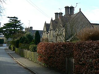
Hatherop is a village and civil parish in the Cotswolds Area of Outstanding Natural Beauty, about 2.5 miles (4.0 km) north of Fairford in Gloucestershire, England. The River Coln forms part of the western boundary of the parish.
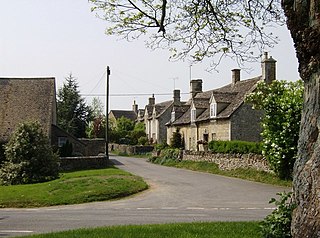
Cold Aston is a village and civil parish in Gloucestershire, England, approximately 18 miles (29 km) to the east of Gloucester. It lies in the Cotswolds, an Area of Outstanding Natural Beauty. In the 2011 census, the population was 255.
Ozleworth is a village and civil parish in Gloucestershire, England, approximately 30 km (19 mi) south of Gloucester. It lies in the Cotswolds, an Area of Outstanding Natural Beauty.

Duntisbourne Rouse is a village and civil parish in Gloucestershire, England. It lies in the Cotswolds, an Area of Outstanding Natural Beauty. At the 2001 census, it had a population of 70.

Notgrove is a village and civil parish in Gloucestershire, England, approximately 28.5 to the east of Gloucester. It lies in the Cotswolds, an Area of Outstanding Natural Beauty.
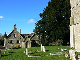
Latton is a village and civil parish in Wiltshire, England, 1.5 miles (2.4 km) north of Cricklade, on the county border with Gloucestershire. The village is bypassed by the A419 road from Swindon to Cirencester. The parish includes the hamlet of Eysey, formerly a village with its own church and parish.

Turkdean is a village and civil parish in Gloucestershire, England, approximately 30 km (19 mi) to the east of Gloucester. It lies in the Cotswolds, an Area of Outstanding Natural Beauty.

Poulton is a village and civil parish in the English county of Gloucestershire, approximately 24 miles (39 km) to the south-east of Gloucester. It lies in the south of the Cotswolds, an Area of Outstanding Natural Beauty. In the 2001 United Kingdom census, the parish had a population of 398, increasing to 408 at the 2011 census.

The Anglican Church of St James at Coln St. Dennis in the Cotswold District of Gloucestershire, England was built in the 12th century. It is a grade I listed building.


