Combe Gibbet

Last updated

Combe Gibbet and Long Barrow
Combe jibbet jan 7 2007 128.jpg
The 1992 replica gibbet, seen in 2007
Type Gibbet and Long barrow
Location Combe, Berkshire
Coordinates 51°21′21″N1°29′04″W / 51.35594°N 1.48439°W / 51.35594; -1.48439 Coordinates: 51°21′21″N1°29′04″W / 51.35594°N 1.48439°W / 51.35594; -1.48439
OS grid reference SU360620
Built1676
Rebuilt1992
Official nameLong barrow at Combe Gibbet, Gallows Down.
Designated26 August 1924
Reference no.1013198 [1]
Berkshire UK location map.svg
Red pog.svg
Location of Combe Gibbet and Long Barrow in Berkshire

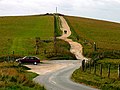
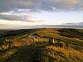
Combe Gibbet is a gibbet at the top of Gallows Down, near the village and just within the civil parish of Combe in Berkshire (formerly Hampshire).

Contents

Location

The gibbet is located at grid reference SU360620 , on the Test Way close to the Berkshire-Hampshire border, it is named after the village of Combe, but it is also close to Inkpen. The nearest sizeable town is Newbury in Berkshire. It is built on top of a long barrow known as the Inkpen long barrow. The long barrow is 60 m long and 22 m wide, and is a Scheduled Monument. [2] [3] [4] [1] Walbury Hill (the highest point in South East England) is just a little further to the east.

History

It was erected in 1676 for the purpose of gibbeting the bodies of George Broomham and Dorothy Newman and has only ever been used for them. The gibbet was placed in such a prominent location as a warning, to deter others from committing crimes. [5]

Broomham and Newman were having an affair and were hanged for murdering Broomham's wife Martha, and their son Robert after they discovered them together on the downs. Unfortunately for the lovers, the murder was witnessed by "Mad Thomas", who managed to convey what he had seen to the authorities. The pair were hanged in Winchester before being gibbeted at Combe. [5] [6] [7] [8]

After the 1676 gibbet rotted, a total of 7 replica gibbets have stood in its place, the most recent having been erected in 1992. [5] [9]

Tourism and leisure

Nowadays it is a popular local tourist attraction with good views of the surrounding area. It is also popular with hang gliders and paragliders. The hill is frequently used by the Thames Valley Hang Gliding and Paragliding Club.

The Combe Gibbet is also the start of a scenic 16-mile (26 km) off-road race to Overton organised by the Overton Harriers and Athletic Club. The race, which is typically in late March / early April of each year, is one of the few true off-road point to point running races in the UK, coaches taking competitors to the start. [10]

The "Combe Gibbet" Race takes in the highest hill in the South East of England, Walbury Hill; the highest in Hampshire, Pilot Hill; as well as Ladle Hill and the edge of Watership Down before entering Overton the source of the River Test.

Related Research Articles

Berkshire County of England

Berkshire is a historic county in South East England. One of the home counties, Berkshire was recognised by Queen Elizabeth II as the Royal County of Berkshire in 1957 because of the presence of Windsor Castle, and letters patent were issued in 1974. Berkshire is a county of historic origin, a ceremonial county and a non-metropolitan county without a county council. The county town is Reading.

Newbury, Berkshire Market town in England

Newbury is a market town in the county of Berkshire, England, and is home to the administrative headquarters of West Berkshire Council. The town centre around its large market square retains a rare medieval Cloth Hall, an adjoining half timbered granary, and the 15th-century St Nicolas Church, along with 17th- and 18th-century listed buildings. As well as being home to Newbury Racecourse, it is the headquarters of Vodafone and software company Micro Focus International. In the valley of the River Kennet, 26 mi (42 km) south of Oxford, 25 mi (40 km) north of Winchester, 27 mi (43 km) southeast of Swindon and 20 mi (32 km) west of Reading.

West Berkshire Local government district in England

West Berkshire is a local government district in Berkshire, England, administered from Newbury by West Berkshire Council.

Hungerford Town in England

Hungerford is a historic market town and civil parish in Berkshire, England, 8 miles (13 km) west of Newbury, 9 miles (14 km) east of Marlborough, 27 miles (43 km) northeast of Salisbury and 60 miles west of London. The Kennet and Avon Canal passes through the town alongside the River Dun, a major tributary of the River Kennet. The confluence with the Kennet is to the north of the centre whence canal and river both continue east. Amenities include schools, shops, cafés, restaurants, and facilities for the main national sports. Hungerford railway station is a minor stop on the Reading to Taunton Line.

North Wessex Downs Area of Outstanding Natural Beauty in England

The North Wessex Downs Area of Outstanding Natural Beauty (AONB) is located in the English counties of Berkshire, Hampshire, Oxfordshire and Wiltshire. The name North Wessex Downs is not a traditional one, the area covered being better known by various overlapping local names, including the Berkshire Downs, the North Hampshire Downs, the White Horse Hills, the Lambourn Downs, the Marlborough Downs, the Vale of Pewsey and Savernake Forest.

Combe, Berkshire Human settlement in England

Combe is a village and civil parish in the English county of Berkshire. It is situated in West Berkshire, on the top of the downs near Walbury Hill and Combe Gibbet, overlooking the village of Inkpen and the valley of the River Kennet. Historically part of Hampshire, Combe was transferred to Berkshire in 1895.

River Enborne River in Hampshire and Berkshire, England

The River Enborne is a river that rises near the villages of Inkpen and West Woodhay, to the West of Newbury, Berkshire and flows into the River Kennet. Its source is in the county of Berkshire, and part of its course forms the border between Berkshire and Hampshire. Despite the name, the river does not run through the village of Enborne, although it does run through Enborne Row.

East Woodhay Human settlement in England

East Woodhay is a village and civil parish in Hampshire, England. The village is approximately 5.5 miles (9 km) south-west of Newbury in Berkshire. At the 2011 census the parish had a population of 2,914.

Test Way

The Test Way is a 44-mile (71 km) long-distance footpath in England from Walbury Hill in West Berkshire to Eling in Hampshire, which follows much of the course of the River Test.

Walbury Hill Hill in, and highest point of, the English county of Berkshire

Walbury Hill is a summit of the North Wessex Downs in Berkshire, England. With an elevation of 297 metres (974 ft), it is the highest natural point in South East England. On the hill's summit is the Iron Age hill fort of Walbury Camp, whilst the flanks of the hill lie within the Inkpen and Walbury Hills SSSI. The hill is one of three nationally important chalk wild grasslands in the North Wessex Downs, the others being in the Rushmore and Conholt Downs SSSI and the Hog's Hole SSSI. The summit is popular with walkers and paragliders.

Wayfarers Walk

The Wayfarer's Walk is a 71 mile long distance footpath in England from Walbury Hill, Berkshire to Emsworth, Hampshire.

Inkpen Human settlement in England

Inkpen is a village and civil parish in West Berkshire 3.5 miles (5.6 km) southeast of Hungerford, most of the land of which is cultivated fields with scattered woodland was once part of a former forest of Savernake. Inkpen has boundaries with Wiltshire and Hampshire, including part of Walbury Hill, the highest point in South East England.

Pilot Hill, Hampshire Hill in Hampshire, England

Pilot Hill is the highest summit in Hampshire, England, with a maximum elevation of 286 m (938 ft). It lies around 2 miles (3.2 km) to the south-east of Walbury Hill, the county top of Berkshire, which is 297 m (974 ft) high.

Overton, Hampshire Human settlement in England

Overton is a large village and parish in Hampshire, England located west of the town of Basingstoke, and east of Andover and Whitchurch. The village contains smaller hamlets of Southington, Northington, Ashe, Polhampton, and Quidhampton, the latter two lying to the north of the village. The River Test has its source 1 mile (1.6 km) to the east in Ashe.

West Woodhay Human settlement in England

West Woodhay is a rural scattered village and civil parish in West Berkshire, England. At the 2011 census it had 59 households.

Inkpen and Walbury Hills

Inkpen and Walbury Hills is an 86.8-hectare (214-acre) biological Site of Special Scientific Interest south of Kintbury in Berkshire. The site is situated on the flanks of Walbury Hill, the highest point in Berkshire and South East England, and the adjacent Inkpen Hill. A Bronze Age cemetery of three bowl barrows on Inkpen Hill is designated a Scheduled Monument.

Hampshire Downs

The Hampshire Downs form a large area of downland in central, southern England, mainly in the county of Hampshire but with parts in Berkshire and Wiltshire. They are part of a belt of chalk downland that extends from the South Downs in the southeast, north to the Berkshire and Marlborough Downs, and west to the Dorset Downs.

Hungerford Rural District was a rural district in Berkshire, England from 1894 to 1974, covering an area in the south-west of the county.

References

  1. 1 2 Historic England. "Long barrow at Combe Gibbet, Gallows Down. (1013198)". National Heritage List for England . Retrieved 24 July 2021.
  2. "Combe Gibbet - MWB1574". Heritage Gateway. West Berkshire Council . Retrieved 24 July 2021.
  3. L. V. Grinsell (1940). "An Analysis and List of Berkshire Barrows" (PDF). Berkshire Archaeological Journal. Berkshire Archaeological Society (40): 55–56. doi:10.5284/1000017. Archived (PDF) from the original on 25 January 2018. Retrieved 24 July 2021.
  4. F. M. Underhill (1946). "Notes on Recent Antiquarian Discoveries in Berkshire" (PDF). Berkshire Archaeological Journal. Berkshire Archaeological Society (49): 51. doi:10.5284/1000017 . Retrieved 24 July 2021.
  5. 1 2 3 "Combe Gibbet". Hungerford Virtual Museum. Archived from the original on 7 February 2021. Retrieved 24 July 2021.
  6. "Spirit of the South: The hilltop with more than a grisly tale to tell". www.itv.com. ITV. 29 August 2018. Archived from the original on 31 August 2019. Retrieved 24 July 2021.
  7. "Combe Gibbet - MWB1576". Heritage Gateway. West Berkshire Council. Archived from the original on 30 May 2021. Retrieved 24 July 2021.
  8. "Berkshire Way - Hungerford to Combe Gibbet". bbc.co.uk. BBC. Archived from the original on 1 June 2018. Retrieved 24 July 2021.
  9. "Unveiling the new Combe gibbet" (PDF). Newbury Weekly News . 1992. Archived (PDF) from the original on 6 February 2021. Retrieved 24 July 2021.
  10. Steele, Jacqueline (27 June 2021). "Combe Gibbet: The wooden post in Berkshire with a grim history". www.getreading.co.uk. GetReading. Archived from the original on 7 July 2021. Retrieved 24 July 2021.

Further reading