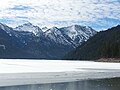
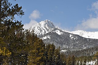
Bannock Peak is a 10,329-foot (3,148-metre) mountain summit in the southern section of the Gallatin Range in Yellowstone National Park, in the U.S. state of Wyoming. The peak ranks as the sixth-highest peak in the Gallatin Range. Precipitation runoff from the mountain drains west into headwaters of the Gallatin River and east into Panther Creek which is a tributary of the Gardner River. Topographic relief is significant as the summit rises nearly 2,000 feet above Panther Creek in one mile (1.6 km). This mountain's toponym was officially adopted in 1897 by the United States Board on Geographic Names.

The Lonesome Bachelor is a summit in Ravalli County, Montana, United States.
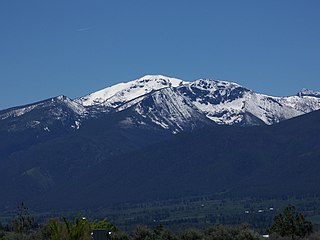
Saint Mary Peak is a 9,351-foot elevation (2,850 m) mountain summit located in Ravalli County, Montana.

Heavenly Twins is a 9,282-foot elevation (2,829 m) double summit mountain located in Ravalli County, Montana.
Taylor Mountain is a 9,863-foot elevation (3,006 m) mountain summit on the common border shared by Beaverhead County, Montana, and Clark County, Idaho.

Sheep Mountain is a 9,688-foot elevation (2,953 m) mountain summit in Beaverhead County, Montana, United States.

Baldy Mountain is a 9,892-foot elevation (3,015 m) mountain summit on the common border shared by Beaverhead County, Montana, and Clark County, Idaho.

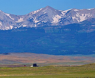
Black Mountain is a 10,941-foot (3,335-metre) summit located in Park County, Montana, United States.
Cedar Mountain is a 10,780-foot (3,286-metre) summit located in Madison County, Montana, United States.

Elephant Peak is a 7,938-foot-elevation (2,420-meter) mountain summit located on the border shared by Lincoln and Sanders counties in Montana.

Flat Top Mountain is a 7,608-foot-elevation (2,319-meter) mountain summit located along the border shared by Lincoln and Sanders counties in Montana.

A Peak is an 8,634-foot-elevation (2,632-meter) mountain summit located on the border shared by Lincoln and Sanders counties in Montana.
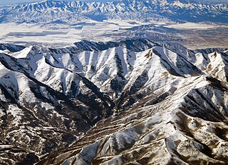
Kelsey Peak is a 10,373-foot-elevation (3,162-meter) mountain summit located on the common boundary that Tooele County shares with Utah County in Utah, United States.

Nelson Peak is a 9,359-foot-elevation (2,853-meter) mountain summit located on the common boundary that Tooele County shares with Salt Lake County in Utah, United States.
Ross Peak is a 9,008-foot-elevation (2,746-meter) mountain summit in Gallatin County, Montana, United States.

Hardscrabble Peak is a 9,571-foot-elevation (2,917-meter) mountain summit in Gallatin County, Montana, United States.
Pomp Peak is a 9,576-foot-elevation (2,919-meter) mountain summit in Gallatin County, Montana, United States.

Saddle Peak is a 9,159-foot-elevation (2,792-meter) mountain summit in Gallatin County, Montana, United States.

Naya Nuki Peak is a 9,591-foot-elevation (2,923-meter) mountain summit in Gallatin County, Montana, United States.

Thunder Mountain is an 11,441-foot (3,487-metre) summit in Carbon County, Montana, United States.