East Haddam is a town in Middlesex County, Connecticut, United States. The town is part of the Lower Connecticut River Valley Planning Region. The population was 8,875 at the time of the 2020 census.

Moodus is a village in the town of East Haddam, Connecticut, United States. The village is the basis of a census-designated place (CDP) of the same name. The population of the CDP was 1,982 as of the census of 2020.

New Hampshire Route 11 is a 108.223-mile-long (174.168 km) east–west state highway in New Hampshire, running completely across the central part of the state. Its western terminus is at the Vermont state line in Charlestown, where it continues west as Vermont Route 11. The eastern terminus is at the Maine state line in Rochester, where it crosses the border with U.S. Route 202 and continues as Maine State Route 11.

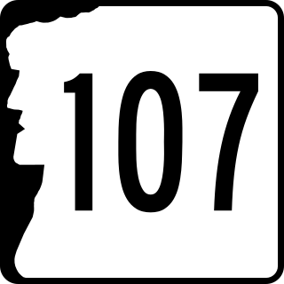
New Hampshire Route 107 is a 69.108-mile-long (111.219 km) north–south state highway in eastern New Hampshire. It connects Laconia in the Lakes Region with Seabrook on the Atlantic coast. The southern terminus of NH 107 is at U.S. Route 1 in Seabrook near the entrance to Seabrook Station Nuclear Power Plant. The northern terminus is at U.S. Route 3 on the Laconia/Gilford town line.

Route 66 is an east-west state highway running from Meriden to Windham, serving as an alternate east–west route to U.S. Route 6 through east-central Connecticut.

Route 70 is a 10.92-mile-long (17.57 km) state highway in the U.S. state of Connecticut, connecting the towns of Cheshire and Meriden. The western half of the route is an important link between the Greater New Haven and the Greater Waterbury areas and is part of the state primary highway system. It runs in a “U” Shaped Pattern.

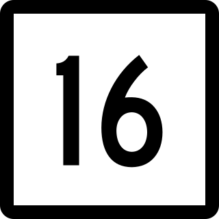
Route 16 is a primary state route connecting Middletown and Colchester via Route 66. It begins in East Hampton at Route 66 then has an interchange with Route 2 in Colchester. It then runs through Colchester center, then goes to the outskirts of Lebanon town as a rural collector road. Route 16 ends at Route 207 in Lebanon.

Louisiana Highway 8 is a state highway in Louisiana. It spans 156 miles (251 km) beginning at the Louisiana/Texas state line west of Leesville and ending at an intersection with U.S. Route 425 and LA 15 in Sicily Island.

Route 45 is a Connecticut state highway from US 202 in Washington to US 7 in Cornwall, in the rural northwest of the state. It is 10.29 miles (16.56 km) long and runs north–south.

Route 82 is an east–west state highway in Connecticut running 28.47 miles (45.82 km) from Route 9 in Chester east to Route 2 in Norwich.

The Salmon River is formed at the confluence of the Blackledge and Jeremy rivers about one mile west of North Westchester, Connecticut. It drains 96,000 acres and courses for 10.4 miles (16.7 km) to Salmon Cove near Moodus where it flows into the Connecticut River. The Salmon River is probably the largest stream and watershed whose sources and mouth are entirely within the limits of Connecticut.

Route 203 is a state highway in eastern Connecticut, running entirely within the town of Windham.

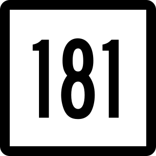
Route 181 is a rural state highway in northern Connecticut, running from Barkhamsted to Hartland.

Route 149 is a state highway in east-central Connecticut running from Route 82 in East Haddam center north to Route 2 in Colchester.

Route 148 is a state highway in southern and southeastern Connecticut running from Route 79 in Killingworth to Route 82 in the village of Hadlyme. Route 148 crosses the Connecticut River using the Chester–Hadlyme Ferry.

Route 190 is a state route in the northern part of the U.S. state of Connecticut. It starts at Route 75 in the town of Suffield and proceeds eastward across the Connecticut River through the towns of Enfield, Somers, and Stafford. It ends at Route 171, in the town of Union. Route 190 was established in 1932 as a route between the state line at Southwick and the town of Enfield. The route was later extended eastward to Union but was truncated in the west to Suffield center.

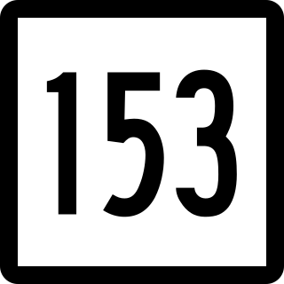
Route 153 is a Connecticut state highway in the Connecticut River valley running from U.S. Route 1 in Westbrook center to Route 9 in Essex Village in the town of Essex.

Route 196 is a Connecticut state highway in the lower Connecticut River valley, running from Haddam to the town center of East Hampton.

Route 197 is a 14.17-mile-long (22.80 km) state highway in northeastern Connecticut and southern Massachusetts, running from Union, Connecticut, to Dudley, Massachusetts. The Connecticut section is signed as an east–west route, while the Massachusetts section is signed north–south.

East Hampton is a town in Middlesex County, Connecticut, United States. The town is part of the Lower Connecticut River Valley Planning Region. The population was 12,717 at the 2020 census. The town center village is listed as a census-designated place (CDP). East Hampton includes the communities of Cobalt, Middle Haddam, and Lake Pocotopaug.


