
Gympie is a city and a locality in the Gympie Region, Queensland, Australia. Located in the Greater Sunshine Coast, Gympie is about 170.7 kilometres (110 mi) north of the state capital, Brisbane. The city lies on the Mary River, which floods Gympie occasionally. The locality of Gympie is the central business district for the city of Gympie and also the administrative centre for the Gympie Region local government area. In the 2021 census, Gympie had an urban population of 22,424 people.

Cooroy is a rural town and locality in the Shire of Noosa, Queensland, Australia. In the 2021 census, the locality of Cooroy had a population of 4,801 people.

Caboolture is a town and suburb in the City of Moreton Bay, Queensland, Australia. It is located on the northern side of the Caboolture River. In the 2021 census, the suburb of Caboolture had a population of 29,534 people.

Kedron is a northern suburb in the City of Brisbane, Queensland, Australia. It is home to the Queensland Fire and Emergency Services headquarters. In the 2021 census, Kedron had a population of 9,907 people.
St Joseph's Catholic School is an independent Roman Catholic co-educational primary school, located in the Townsville suburb of Mundingburra, Queensland, Australia. It is administered by the Queensland Catholic Education Commission, with an enrolment of 360 students and a teaching staff of 29, as of 2023. The school serves students from Prep to Year 6, and is part of the Roman Catholic Diocese of Townsville.

Rainbow Beach is a coastal rural town and locality in the Gympie Region, Queensland, Australia. In the 2021 census, the locality of Rainbow Beach had a population of 1,220 people.
Dalby Christian College is an independent non-denominational Christian co-educational P-12, school, located in the rural town of Dalby, Queensland, Australia. It is administered by Christian Community Ministries Ltd., with an enrolment of 449 students and a teaching staff of 31, as of 2023. The school serves students from Prep to Year 12.
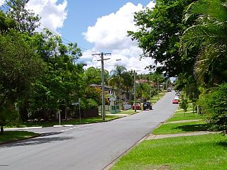
Bray Park is a suburb in the City of Moreton Bay, Queensland, Australia. In the 2021 census, Bray Park had a population of 10,271 people.

Woombye is a rural town and locality in the Sunshine Coast Region, Queensland, Australia. In the 2021 census, the locality of Woombye had a population of 3,944 people.

Chatsworth is a rural locality in the Gympie Region, Queensland, Australia. In the 2021 census, Chatsworth had a population of 1,353 people.

Tin Can Bay is a coastal town and locality in the Wide Bay–Burnett region in Queensland, Australia. The locality is split between the Fraser Coast Region and the Gympie Region, but the town itself is within Gympie Region. In the 2021 census, the locality of Tin Can Bay had a population of 2,293 people.
Assumption College, Warwick is a independent, Roman Catholic, co-educational secondary school, located in Warwick, Queensland, Australia. It is administered by the Queensland Catholic Education Commission, with an enrolment of 454 students and a teaching staff of 46, as of 2023. The school serves students from Year 7 to Year 12, and is the only Catholic, secondary school located in Warwick.
Araluen is a residential locality in Gympie in the Gympie Region, Queensland, Australia. In the 2021 census, Araluen had a population of 649 people.
Southside is a semi-rural locality in the Gympie Region, Queensland, Australia. In the 2021 census, Southside had a population of 6,312 people.
Jones Hill is a rural locality in the Gympie Region, Queensland, Australia. In the 2021 census, Jones Hill had a population of 1,135 people.
Charters Towers State High School (CTSHS) is a public co-educational secondary school, located in the Charters Towers suburb of Charters Towers City, Queensland, Australia. It is administered by the Queensland Department of Education, with an enrolment of 372 students and a teaching staff of 39, as of 2023. The school serves students from Year 7 to Year 12, and is one of the oldest state secondary schools in Queensland still operating.
Albany Creek State High School is a public co-educational secondary school located in the Moreton Bay suburb of Albany Creek, Queensland, Australia. It is administered by the Queensland Department of Education, with an enrolment of 1,549 students and a teaching staff of 121, as of 2023. The school serves students from Year 7 to Year 12.

Bracken Ridge State High School (BRSHS) is a public co-educational secondary school located in the Brisbane suburb of Bracken Ridge, Queensland, Australia. It is administered by the Queensland Department of Education, with an enrolment of 640 students and a teaching staff of 61, as of 2023. The school serves students from Year 7 to Year 12.
Bribie Island State High School is a public co-educational secondary school located in the suburb of Bongaree on Bribie Island, Queensland, Australia. It is administered by the Queensland Department of Education, with an enrolment of 1,176 students and a teaching staff of 98, as of 2023. The school serves students from Year 7 to Year 12.
Cooloola Cove is a coastal locality in the Gympie Region, Queensland, Australia. In the 2021 census, Cooloola Cove had a population of 2,921 people.
