
The Riviera Line is the railway between the city of Exeter, towns Dawlish and Teignmouth, and the English Riviera resorts of Torbay in Devon, England. Its tracks are shared with the Exeter to Plymouth Line along the South Devon sea wall. It is part of the Network Rail Route 12.

A double-track railway usually involves running one track in each direction, compared to a single-track railway where trains in both directions share the same track.
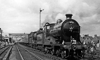
The Waverley Route was a railway line that ran south from Edinburgh, through Midlothian and the Scottish Borders, to Carlisle. The line was built by the North British Railway; the stretch from Edinburgh to Hawick opened in 1849 and the remainder to Carlisle opened in 1862. The line was nicknamed after the immensely popular Waverley Novels, written by Sir Walter Scott.
The Edinburgh and Glasgow Railway was authorised by act of Parliament on 4 July 1838. It was opened to passenger traffic on 21 February 1842, between its Glasgow Queen Street railway station and Haymarket railway station in Edinburgh. Construction cost £1,200,000 for 46 miles (74 km). The intermediate stations were at Corstorphine, Gogar, Ratho, Winchburgh, Linlithgow, Polmont, Falkirk, Castlecary, Croy, Kirkintilloch and Bishopbriggs. There was a ticket platform at Cowlairs. The line was extended eastwards from Haymarket to North Bridge in 1846, and a joint station for connection with the North British Railway was opened on what is now Edinburgh Waverley railway station in 1847.
Greenock Central station is one of eight railway stations serving the town of Greenock in western Scotland, and is the nearest to the town centre. This station, which is staffed, is on the Inverclyde Line, 37 km (23 mi) west of Glasgow Central towards Gourock. It has three platforms, two of which are in use, with one disused bay platform. This disused platform is still connected to the main line.
The Derbyshire and Staffordshire extension of the Great Northern Railway was an English railway network built by the GNR to get access to coal resources in the area to the north and west of Nottingham. The Midland Railway had obstructed the GNR in its attempts to secure a share of the lucrative business of transporting coal from the area, and in frustration the GNR built the line. The line was forked: it reached Pinxton in 1875 and a junction with the North Staffordshire Railway at Egginton, approaching Burton on Trent in 1878. The line cut through Derby, resulting in considerable demolition of housing there.

The Dundee and Newtyle Railway opened in 1831 and was the first railway in the north of Scotland. It was built to carry goods between Dundee and the fertile area known as Strathmore; this involved crossing the Sidlaw Hills, and was accomplished with three rope-worked inclined planes. Newtyle was simply a remote railhead, and the anticipated traffic volumes were not achieved, the inclines incurred heavy operating costs, and the railway never made money.
The Roxburgh Branch was a branch line railway built in the Otago region of New Zealand's South Island that formed part of the country's national rail network. Originally known as the Lawrence Branch, it was one of the longest construction projects in New Zealand railway history, beginning in the 1870s and not finished until 1928. The full line was closed in 1968.
The Edinburgh Suburban and Southside Junction Railway was a railway company that built an east-west railway on the southern margin of Edinburgh, Scotland, primarily to facilitate the operation of heavy goods and mineral traffic across the city. The line opened in 1884. Although its route was rural at the time, suburban development quickly caught up and passenger carryings on the line were buoyant; the passenger service operated on a circular basis through Edinburgh Waverley railway station.

The Trent Valley line is a railway line between Rugby and Stafford in England, forming part of the West Coast Main Line. The line is 51 miles (82 km) long and is named after the River Trent which it follows. It was built to provide a direct route from London to North West England and Scotland, avoiding the slower route via Birmingham, which is congested and 7.75 miles (12.47 km) longer.
The Glasgow Central Railway was a railway line built in Glasgow, Scotland by the Caledonian Railway, running in tunnel east to west through the city centre. It was opened in stages from 1894 and opened up new journey opportunities for passengers and enabled the Caledonian Railway to access docks and industrial locations on the north bank of the River Clyde. An intensive and popular train service was operated, but the long tunnel sections with frequent steam trains were smoky and heartily disliked.
The Lanarkshire and Dumbartonshire Railway was a railway company in Scotland. It was promoted independently but supported by the Caledonian Railway, and it was designed to connect Balloch and Dumbarton with central Glasgow, linking in heavy industry on the north bank of the River Clyde. From Dumbarton to Balloch the line would have closely duplicated an existing railway, and negotiation led to the latter being made jointly operated, and the L&DR terminated immediately east of Dumbarton, trains continuing on the joint section.
The Scottish Central Railway was formed in 1845 to link Perth and Stirling to Central Scotland, by building a railway line to join the Edinburgh and Glasgow Railway near Castlecary.
The Greenock and Ayrshire Railway ran from Greenock, Scotland to Bridge of Weir, connecting there to the Glasgow and South Western Railway and making a through connection between Glasgow and Greenock. It closed progressively between 1959 and 1983.
The Glasgow, Paisley and Greenock Railway (GP&GR) was an early Scottish railway, opened in 1841, providing train services between Greenock and Glasgow. At the time the River Clyde was not accessible to sea-going ships, and the intention was to compete with river boats that brought goods to and from the city. In fact passenger traffic proved surprisingly buoyant, and connecting steamer services to island resorts in the Firth of Clyde provided a very great source of business.
The Queensbury lines was the name given to a number of railway lines in West Yorkshire, England, that linked Bradford, Halifax and Keighley via Queensbury. All the lines were either solely owned by the Great Northern Railway (GNR) or jointly by the GNR and the Lancashire and Yorkshire Railway (L&YR). The terrain was extremely challenging for railway construction, and the lines were very expensive to build. The lines were
The Scottish Midland Junction Railway was authorised in 1845 to build a line from Perth to Forfar. Other companies obtained authorisation in the same year, and together they formed a route from central Scotland to Aberdeen. The SMJR opened its main line on 4 August 1848. Proposals to merge with other railways were rejected by Parliament at first, but in 1856 the SMJR merged with the Aberdeen Railway to form the Scottish North Eastern Railway. The SNER was itself absorbed into the larger Caledonian Railway in 1866. The original SMJR main line was now a small section of a main line from Carlisle and central Scotland to Aberdeen.
The Caledonian Railway lines to Edinburgh started with the main line that reached Edinburgh in 1848 as part of its route connecting the city with Glasgow and Carlisle. The potential of the docks at Granton and Leith led to branch line extensions, and residential development encouraged branch lines in what became the suburbs of Edinburgh. In 1869 a line was opened from Carfin through Shotts giving the Caledonian a shorter route between Glasgow and Edinburgh.
The Caledonian Railway branches in North Lanarkshire built on the Caledonian Railway main line, which opened in 1848. In the following years the considerable increase of iron production and coal extraction in North Lanarkshire led to a progressive expansion of branch lines in the area between the eastern margin of Glasgow and Bellside in the east, and between Coatbridge, Airdrie and Motherwell. Mineral traffic was dominant and for some years passenger operation followed the construction of some of the mineral connections. In 1861 the Rutherglen and Coatbridge line was opened, extended later to Airdrie, rivalling the established Monkland Railways route. In 1869 the connection from Cleland to Midcalder was opened, connecting mineral sites but also forming a new passenger route to Edinburgh.
Carlisle, in North West England, formed the focus for a number of railway routes because of the geography of the area. At first each railway company had its own passenger and goods station, but in 1847 passenger terminal facilities were concentrated at Citadel station, which is in use today. Goods facilities remained dispersed, and goods wagons passing through were remarshalled, incurring delay and expense.
