Kansas is a state in the Midwestern United States. Its capital is Topeka, and its largest city is Wichita. Kansas is a landlocked state bordered by Nebraska to the north; Missouri to the east; Oklahoma to the south; and Colorado to the west. Kansas is named after the Kansas River, which in turn was named after the Kansa Native Americans who lived along its banks. The tribe's name is often said to mean "people of the (south) wind" although this was probably not the term's original meaning. For thousands of years, what is now Kansas was home to numerous and diverse Native American tribes. Tribes in the eastern part of the state generally lived in villages along the river valleys. Tribes in the western part of the state were semi-nomadic and hunted large herds of bison.

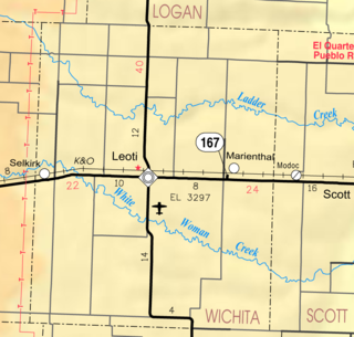
Wichita County is a county located in the U.S. state of Kansas. Its county seat is Leoti. As of the 2020 census, the county population was 2,152. The county was named after the Wichita tribe.

Cowley County is a county located in the U.S. state of Kansas. Its county seat is Winfield, and its most populous city is Arkansas City. As of the 2020 census, the county population was 34,549. The county was named after Matthew Cowley, first lieutenant in Company I, 9th Kansas Cavalry, who died during the American Civil War.

Lincoln Center, more commonly known as Lincoln, is a city in and the county seat of Lincoln County, Kansas, United States. As of the 2020 census, the population of the city was 1,171.

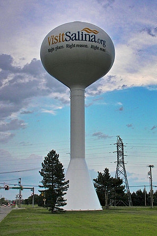
Salina is a city in and the county seat of Saline County, Kansas, United States. As of the 2020 census, the population was 46,889.

Wichita is the most populous city in the U.S. state of Kansas and the county seat of Sedgwick County. As of the 2020 census, the population of the city was 397,532. The Wichita metro area had a population of 647,610 in 2020. It is located in south-central Kansas on the Arkansas River.

Liberal is the county seat of Seward County, Kansas, United States. As of the 2020 census, the population of the city was 19,825. Liberal is home of Seward County Community College.

Leoti is a city in and the county seat of Wichita County, Kansas, United States. As of the 2020 census, the population of the city was 1,475.
The U.S. state of Kansas, located on the eastern edge of the Great Plains, was the home of nomadic Native American tribes who hunted the vast herds of bison. In around 1450 AD, the Wichita People founded the great city of Etzanoa. The city of Etzanoa was abandoned in around 1700 AD. The region was explored by Spanish conquistadores in the 16th century. It was later explored by French fur trappers who traded with the Native Americans. Most of Kansas became permanently part of the United States in the Louisiana Purchase of 1803. When the area was opened to settlement by the Kansas–Nebraska Act of 1854 it became a battlefield that helped cause the American Civil War. Settlers from North and South came in order to vote slavery down or up. The free state element prevailed.

The Wichita people, or Kitikiti'sh, are a confederation of Southern Plains Native American tribes. Historically they spoke the Wichita language and Kichai language, both Caddoan languages. They are indigenous to Oklahoma, Texas, and Kansas.

K-96 is a 300-mile-long (480 km) state highway in central and southern Kansas. Its western terminus is at the Colorado state line east of Towner, Colorado, where it continues as Colorado State Highway 96; its eastern terminus since 1999 is at U.S. Route 54/U.S. Route 400 in eastern Wichita.

Marienthal is a Census designated place in Wichita County, Kansas, United States. As of the 2020 census, the population of the community and nearby areas was 64.

A county seat war is an American phenomenon that occurred mainly in the Old West as it was being settled and county lines determined. Incidents elsewhere, such as in Michigan, Appalachian Ohio, and West Virginia, have also been recorded. As new towns sprang up and county lines were drawn, there was intense competition for the status and tax benefits bestowed by becoming a county seat. These "wars" often involved nothing more than lining up at the ballot box, but sometimes partisans for a particular town would resort to voter fraud, intimidation, or violence.
Quivira was a province of the ancestral Wichita people, located near the Great Bend of the Arkansas River in central Kansas, The exact site may be near present-day Lyons extending northeast to Salina.

Farmer City is a ghost town in Wichita County, Kansas, United States.
The timeline of Kansas details past events that happened in what is present day Kansas. Located on the eastern edge of the Great Plains, the U.S. state of Kansas was the home of sedentary agrarian and hunter-gatherer Native American societies, many of whom hunted American bison. The region first appears in western history in the 16th century at the time of the Spanish conquest of the Aztec Empire, when Spanish conquistadors explored the unknown land now known as Kansas. It was later explored by French fur trappers who traded with the Native Americans. It became part of the United States in the Louisiana Purchase of 1803. In the 19th century, the first American explorers designated the area as the "Great American Desert."

Ronald Gene Estes is an American politician who has been the U.S. representative for Kansas's 4th congressional district since April 2017. A member of the Republican Party, he served as Kansas State Treasurer from 2011 to 2017.

Lydia is an unincorporated community in Wichita County, Kansas, United States. It is located between Leoti and Lakin.

Selkirk is an unincorporated community in Wichita County, Kansas, United States. It is located between Leoti and Tribune.


