County of Ferguson

Last updated
Ferguson
Queensland

Ferguson-county-queensland.png

Location within Queensland
Lands administrative divisions around Ferguson:
Kimberley Pakington Raglan
Kimberley Ferguson Pelham
Bauhinia Dawson Dawson
Map all coordinates using: OpenStreetMap  ·  Google Maps
Download coordinates as: KML  ·  GPX

The County of Ferguson is a county (a cadastral division) in Queensland, Australia, located in the Shire of Banana in Central Queensland. The county was officially named and bounded by the Governor in Council on 7 March 1901 under the Land Act 1897. [1] [2]

County Geographical and administrative region in some countries

A county is a geographical region of a country used for administrative or other purposes, in certain modern nations. The term is derived from the Old French conté or cunté denoting a jurisdiction under the sovereignty of a count (earl) or a viscount. The modern French is comté, and its equivalents in other languages are contea, contado, comtat, condado, Grafschaft, graafschap, Gau, etc..

Lands administrative divisions of Queensland

Lands administrative divisions of Queensland refers to the divisions of Queensland used for the registration of land titles. There are 322 counties, and 5,319 parishes within the state. They are part of the Lands administrative divisions of Australia. Queensland had been divided into 109 counties in the nineteenth century, before the Land Act of 1897 subdivided many of these counties to 319. Some of the eastern counties remained the same, with most of the subdivisions occurring in the west and north. The current counties were named and bounded by the Governor in Council on 7 March 1901.

Queensland North-east state of Australia

Queensland is the second-largest and third-most populous state in the Commonwealth of Australia. Situated in the north-east of the country, it is bordered by the Northern Territory, South Australia and New South Wales to the west, south-west and south respectively. To the east, Queensland is bordered by the Coral Sea and Pacific Ocean. To its north is the Torres Strait, with Papua New Guinea located less than 200 km across it from the mainland. The state is the world's sixth-largest sub-national entity, with an area of 1,852,642 square kilometres (715,309 sq mi).

Parishes

Ferguson is divided into parishes, as listed below:

Parish LGA Coordinates Towns
Banana Banana 24°30′S150°07′E / 24.500°S 150.117°E / -24.500; 150.117 (Banana Parish) Banana
Barfield Banana 24°34′S150°15′E / 24.567°S 150.250°E / -24.567; 150.250 (Barfield Parish) Tarramba
Benleith Banana 24°11′S149°54′E / 24.183°S 149.900°E / -24.183; 149.900 (Benleith Parish) Baralaba
Capayan Banana 24°28′S149°56′E / 24.467°S 149.933°E / -24.467; 149.933 (Capayan Parish)
Cottenham Banana 24°22′S150°08′E / 24.367°S 150.133°E / -24.367; 150.133 (Cottenham Parish)
Fairview Banana 24°20′S149°55′E / 24.333°S 149.917°E / -24.333; 149.917 (Fairview Parish)
Granville Banana 24°10′S150°03′E / 24.167°S 150.050°E / -24.167; 150.050 (Granville Parish) Kokotungo
Moura Banana 24°36′S150°00′E / 24.600°S 150.000°E / -24.600; 150.000 (Moura Parish) Moura
Neimen Banana 24°28′S150°15′E / 24.467°S 150.250°E / -24.467; 150.250 (Neimen Parish)
Olinda Banana 24°02′S149°54′E / 24.033°S 149.900°E / -24.033; 149.900 (Olinda Parish)
Woolein Banana 24°11′S150°10′E / 24.183°S 150.167°E / -24.183; 150.167 (Woolein Parish) Rannes

Related Research Articles

Magnetic Island island offshore the city of Townsville, Queensland, Australia

Magnetic Island is an island 8 kilometres (5.0 mi) offshore from the city of Townsville, Queensland, Australia. This 52 km2 (20.1 sq mi) mountainous island in Cleveland Bay has effectively become a suburb of Townsville, with 2,107 permanent residents. The island is accessible from Townsville Breakwater to Nelly Bay Harbour by ferry. There is a large 27 km2 (10.4 sq mi) National Park and bird sanctuary and walking tracks can be taken between the populated bays and to a number of tourist destinations such as the World War II forts.

Banana, Queensland Town in Queensland, Australia

Banana is a small town and rural locality in the Shire of Banana, Central Queensland, Australia. In the 2011 census, Banana had a population of 377 people.

Tingalpa, Queensland Suburb of Brisbane, Queensland, Australia

Tingalpa is a suburb of Brisbane, Queensland, Australia. It is located 10 kilometres (6.2 mi) east of the CBD, and borders Belmont, Cannon Hill, Hemmant, and Manly West.

Northumberland Islands island chain off the coast of Queensland, Australia

The Northumberland Islands are a scattered island chain off the eastern coast of Queensland, Australia.

Furta Place in Hajdú-Bihar, Hungary

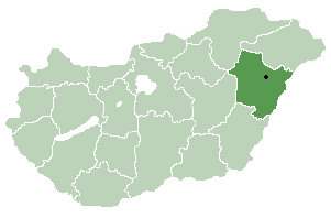
Furta is a village in Hajdú-Bihar county, in the Northern Great Plain region of eastern Hungary.

Cornu Luncii Commune in Suceava County, Romania

Cornu Luncii is a commune located in Suceava County, Romania. It is composed of nine villages: Băișești, Brăiești, Cornu Luncii, Dumbrava, Păiseni, Sasca Mare, Sasca Mică, Sasca Nouă and Șinca.

Balia, Bangladesh may refer to the following locations in Bangladesh:

Zabrodzie, Podlaskie Voivodeship Village in Podlaskie, Poland

Zabrodzie is a village in the administrative district of Gmina Korycin, within Sokółka County, Podlaskie Voivodeship, in north-eastern Poland. It lies approximately 14 kilometres (9 mi) east of Korycin, 26 km (16 mi) west of Sokółka, and 39 km (24 mi) north of the regional capital Białystok.

Murphys Creek is a town and locality in the Lockyer Valley Region, Queensland, Australia, located at the foot of the Great Dividing Range. The town's name is correctly spelled without an apostrophe.

Pusztaradvány is a village in Borsod-Abaúj-Zemplén County in northeastern Hungary.

Mančiagirė Village in Alytus County, Lithuania

Mančiagirė is a village in Varėna district municipality, in Alytus County, in southeastern Lithuania. According to the 2001 census, the village has a population of 24 people.

Manniva Village in Harju County, Estonia

Manniva is a village in Jõelähtme Parish, Harju County in northern Estonia. It's located west of the mouth of the Jägala River to the Ihasalu Bay, and about 7 km (4 mi) east of the town of Maardu.

Haiba is a village in Harju County, Estonia. It is the administrative centre of Kernu Parish.

Unguma is a village in Saaremaa Parish, Saare County in western Estonia.

The Lågkollane Hills are a group of hills standing 7 nautical miles (13 km) north of Bamse Mountain between Kreitzerisen and Hansenbreen in the Sør Rondane Mountains of Antarctica. They were mapped by Norwegian cartographers in 1957 from air photos taken by U.S. Navy Operation Highjump, 1946–47, and named Lågkollane.

County of Dawson Cadastral in Queensland, Australia

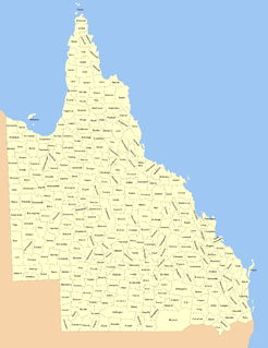
The County of Dawson is a county in Queensland, Australia, located in the Shire of Banana in Central Queensland. The county was officially named and bounded by the Governor in Council on 7 March 1901 under the Land Act 1897.

County of Raglan Cadastral in Queensland, Australia

The County of Raglan is a county in Queensland, Australia, located mostly within the Shire of Banana in Central Queensland. The county was created on 1 September 1855 by royal proclamation under the Waste Lands Australia Act 1846. On 7 March 1901, the Governor issued a proclamation legally dividing Queensland into counties under the Land Act 1897. Its schedule described Raglan thus:

Bounded on the south by the southern boundaries of Winterbourne, Callide and Prairie; on the west by the western boundaries of the parishes of Prairie, Spier, Earlsfield, Bundalba, Dundee, Gelobera and Calliungal; on the north by the county of Livingstone; and on the east by the counties of Livingstone, Deas Thompson, and Clinton.

County of Boondooma Cadastral in Queensland, Australia

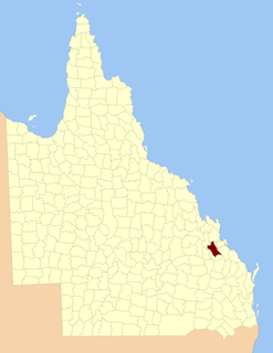
The County of Boondooma is a county in the Wide Bay–Burnett region of Queensland, Australia. It was named and bounded by the Governor in Council on 7 March 1901 under the Land Act 1897.

References

  1. "Ferguson (entry 12279)". Queensland Place Names. Queensland Government . Retrieved 8 September 2015.
  2. Leichhardt District, County of Ferguson Maps - H1 Series at Queensland Archives.

Coordinates: 24°28′S150°08′E / 24.467°S 150.133°E / -24.467; 150.133

Geographic coordinate system Coordinate system

A geographic coordinate system is a coordinate system that enables every location on Earth to be specified by a set of numbers, letters or symbols. The coordinates are often chosen such that one of the numbers represents a vertical position and two or three of the numbers represent a horizontal position; alternatively, a geographic position may be expressed in a combined three-dimensional Cartesian vector. A common choice of coordinates is latitude, longitude and elevation. To specify a location on a plane requires a map projection.