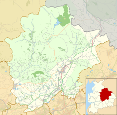
The Forest of Bowland, also known as the Bowland Fells and formerly the Chase of Bowland, is an area of gritstone fells, deep valleys and peat moorland, mostly in north-east Lancashire, England, with a small part in North Yorkshire. It is a western outlier of the Pennines.

Wolfhole Crag is a lonely and seldom-visited hill in the Forest of Bowland in Lancashire, England. Its seclusion is due in part to its low profile and long approach walks. A long path approaches from Ward's Stone in the west which is fraught with bogs. Another tarmac path from Tarnbrook meets this half way. A final path comes from the north east from the Hornby Road in the direction to White Hill. The summit consists of two large buttresses of gritstone some unusually shaped waist-high rocks and the usual trig point. The buttresses contain a number of recorded rock climbs, including the two farthest "hard grit" routes from the road in the entire UK. Both climbs were ascended in 2001 by Neil Kershaw and Greg Chapman. It's quite possible to not see another human being all day there. The East crag has a 'Wolf hole' at the base of the south facing side, presumably how it originally gained the name. Wolfhole Crag marks the northwesternmost boundary of the civil parish of Bowland Forest High, the historic Forest of Bowland as well as the Lordship of Bowland.

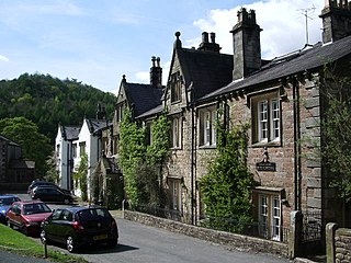
Slaidburn is a village and civil parish within the Ribble Valley district of Lancashire, England. The parish covers just over 5,000 acres of the Forest of Bowland.
Bolton-by-Bowland is a village and civil parish in the Ribble Valley district of Lancashire, England. Before 1974, the village was part of Bowland Rural District in the West Riding of Yorkshire. According to the census of 2001, the parish had a population of just 498, rising marginally to 499 at the census of 2011.

Bowland Forest Low is a civil parish in the Ribble Valley district of Lancashire, England, covering some 5,500 acres (22 km2) of the Forest of Bowland. According to the 2001 census, the parish had a population of 168, falling to 160 at the 2011 Census. The parish includes the hamlets of Whitewell and Cow Ark. From northwards clockwise, it borders the civil parishes of Newton, Bashall Eaves, Aighton, Bailey and Chaigley, Bowland-with-Leagram and Bowland Forest High. Before 1974, it formed part of Bowland Rural District in the West Riding of Yorkshire.

Bowland Forest High is a civil parish in the Ribble Valley district of Lancashire, England, covering some 20,000 acres (80 km2) of the Forest of Bowland. It fell within the ancient boundaries of the West Riding of Yorkshire. According to the 2001 census, the parish had a population of 163, falling to 144 at the 2011 Census. The parish includes the settlements of Hareden, Sykes, and Dunsop Bridge. It covers Sykes Fell, Whins Brow, Croasdale Fell and Wolfhole Crag. Before 1974, it formed part of Bowland Rural District in the West Riding of Yorkshire.

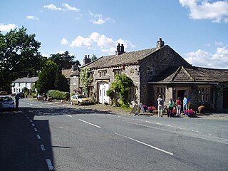
Whitewell is a village within the civil parish of Bowland Forest Low and Ribble Valley borough of Lancashire, England. It is in the Forest of Bowland Area of Outstanding Natural Beauty. Historically, the village fell just within the boundaries of the West Riding of Yorkshire. It was transferred to Lancashire for administrative purposes on 1 April 1974, under the provisions of the Local Government Act 1972. It stands above a bend in the River Hodder.

A housebarn is a building that is a combination of a house and a barn under the same roof. Most types of housebarn also have room for livestock quarters. If the living quarters are only combined with a byre, whereas the cereals are stored outside the main building, the house is called a byre-dwelling.
Twiston is a village and a civil parish in the Ribble Valley District, in the English county of Lancashire. It is near the town of Clitheroe and the village of Downham. The parish is part of the Forest of Bowland Area of Outstanding Natural Beauty (AONB). It adjoins the Ribble Valley parishes of Downham and Rimington, and the Pendle parish of Barley-with-Wheatley Booth.

Browsholme Hall is a privately owned Tudor house in the parish of Bowland Forest Low in the borough of Ribble Valley, Lancashire, England. It is claimed to be the oldest surviving family home in Lancashire. Since 1954, it has been designated a Grade I listed building by English Heritage.
Easington is a civil parish within the Ribble Valley district of Lancashire, England, with a population in 2001 of 52. The Census 2011 population details have been grouped with the parish of Slaidburn. Before 1974, it formed part of Bowland Rural District in the West Riding of Yorkshire. It covers just over 9000 acres.
Bolton-by-Bowland is a civil parish in Ribble Valley, Lancashire, England. It contains 44 listed buildings that are recorded in the National Heritage List for England. Of these, one is listed at Grade I, the highest of the three grades; three are at Grade II*, the middle grade; and the others are at Grade II, the lowest grade. The parish contains the village of Bolton-by-Bowland and the settlement of Holden, and surrounding countryside. Most of the listed buildings are houses and associated structure, farmhouses, and farm buildings. Also listed are crosses, cross bases, churches and associated structures, bridges, a wellhouse, a school, a public house, and stocks.
Bowland Forest High is a civil parish in Ribble Valley, Lancashire, England. It contains eight listed buildings that are recorded in the National Heritage List for England. All of the listed buildings are designated at Grade II, the lowest of the three grades, which is applied to "buildings of national importance and special interest". The parish contains the village of Dunsop Bridge, and otherwise consists of farmland and moorland. The listed buildings comprise houses, a bridge, a milestone and a boundary stone.
Bowland Forest Low is a civil parish in Ribble Valley, Lancashire, England. It contains 28 listed buildings that are recorded in the National Heritage List for England. Of these, one is listed at Grade I, the highest of the three grades, one is at Grade II*, the middle grade and the others are at Grade II, the lowest grade. The parish contains the settlements of Whitewell and Cow Ark, and is otherwise almost completely rural. The most important building in the parish is Browsholme Hall; this and a number of associated structures are listed. Most of the other listed buildings are houses and associated structures, farmhouses, and farm buildings. The River Hodder passes along the boundary of the parish, and two bridges crossing it are listed. Also listed are a church, a folly, a former smithy, a limekiln, and a hotel.
Bowland-with-Leagram is a civil parish in Ribble Valley, Lancashire, England. It contains twelve listed buildings that are recorded in the National Heritage List for England. All of the listed buildings are designated at Grade II, the lowest of the three grades, which is applied to "buildings of national importance and special interest". The parish is entirely rural. All but one of the listed buildings are farmhouses or farm buildings, the other building being a bridge.
Newton is a civil parish in Ribble Valley, Lancashire, England. It contains 28 listed buildings that are recorded in the National Heritage List for England. Of these, one is at Grade II*, the middle grade, and the others are at Grade II, the lowest grade. The parish contains the village of Newton-in-Bowland, and is otherwise rural. The listed buildings are mainly houses with associated structures, farmhouses, and farm buildings, both in the village and in the surrounding countryside. The other listed buildings include bridges, a public house, a Friends' meeting house, and a former school.

Lower Lees Farmhouse is a historic building in the English parish of Bowland Forest Low, Lancashire. It is Grade II listed, built in 1678, and is a sandstone farmhouse with a slate roof and a pebbledashed left gable. There are two storeys and three bays, and outshuts at the rear. The windows are mullioned, those in the left bay dating from the 19th century and containing sashes. The doorway has moulded jambs, the moulding continuing to form semicircular arches on the lintel, which is also inscribed.

Higher Lees Farmhouse is an historic building in the English parish of Bowland Forest Low, Lancashire. It is Grade II listed, built around 1780, and is in sandstone with a slate roof, in two storeys and two bays. The windows have three lights and are mullioned. There is a central porch formed by sandstone slabs, and the doorway has a plain surround.
Whitewell Hotel is an historic building in the English parish of Bowland Forest Low, Lancashire. It is Grade II listed, built in 1836, and is in sandstone with a slate roof in two storeys with attics. It consists of a cross wing at the left, and a long main range that has two gables with dormers. The windows are mullioned with chamfered surrounds. On the front is a gabled porch that has a doorway with a chamfered surround. There are ball finials on all the gables.

The Bowland Forest High milestone is an historic milestone marker in the English parish of Bowland Forest High, in the Trough of Bowland, Lancashire. A Grade II listed structure, erected in 1739, the milestone is in sandstone and has a rectangular plan and a shaped top. It is inscribed with the distances in miles, on one face to Lancaster and to Clitheroe, and on the other face to Slaidburn and to Hornby.