List of mills in Clitheroe

Last updated

Map all coordinates using: OpenStreetMap

Clitheroe in Lancashire, England is known for limestone quarrying, but it also developed a cotton industry.

Contents

The mills

NameArchitectLocationBuiltDemolishedServed
(Years)
Albion Mill  SD 53°52′23″N2°23′13″W / 53.873°N 2.387°W / 53.873; -2.387 ("Albion Mill ") [1]
Brewery Mill aka Claremont Mill  SD749415 53°52′08″N2°22′59″W / 53.869°N 2.383°W / 53.869; -2.383 ("Brewery Mill ")
Notes: Built in 1788 as a brewery, it became a printworks in 1809 and a sizing house in 1823. In 1834 a 7 storey spinning mill with weaving sheds was built, the engine was by William Roberts & Co of Nelson.The mill burnt down in 1896 but was reconstructed. In 2006 it had become a furniture warehouse with shops. [1] [2] [3]
Brooks Mill  SD 53°52′26″N2°23′10″W / 53.874°N 2.386°W / 53.874; -2.386 ("Brooks Mill ") [1]
Commercial Mill  SD 53°51′47″N2°24′00″W / 53.863°N 2.400°W / 53.863; -2.400 ("Commercial Mill ") [1]
Foulsykes Mill  SD 53°52′05″N2°23′56″W / 53.868°N 2.399°W / 53.868; -2.399 ("Foulsykes Mill ") [1]
Holmes Mill aka Thornbers Mill and possibly Greenacre Mill SD742414 53°52′05″N2°23′42″W / 53.868°N 2.395°W / 53.868; -2.395 ("Holmes Mill ") 1820 Standing 204
Holmes Mill Clitheroe 8464.JPG Notes: This is a complex combined mill which has housed spinning, weaving and printing, spinning and sizing in an 1823 four storey 13 bay block, and an 1830s block. The offices and warehouses were built in 1843 and weaving sheds in 1853. At this time there were 16,000 mule spindles and 707 looms. It was powered by at least two beam engines supplemented by a 24" x 3' stroke horizontal. These were replaced in 1910 by a 350 IHP Clayton, Goodfellow & Co. Ltd horizontal cross-compound type. This worked at 68rpm [4] [5] [6]
Jubilee Mill  SD 53°52′23″N2°22′59″W / 53.873°N 2.383°W / 53.873; -2.383 ("Jubilee Mill ") 1887 Standing 137
Jubilee Mill from Clitheroe Castle 8239.JPG Notes: These were single storey stone built power weaving sheds built in 1887 by The Clitheroe Jubilee Mill Company Ltd. There was a sandstone engine house with a brick chimney. The current occupants are Trutex, the large school uniform manufacturing company. [3] [7]
Low Moor Mill  SD729418 53°52′19″N2°25′01″W / 53.872°N 2.417°W / 53.872; -2.417 ("Low Moor Mill ")
Clitheroe museum Low Moor Mill medal 8551.JPG 
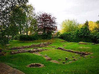
Notes: The first mill, a five storey spinning mill opened in 1782. It and 28 workers cottage were sold to Parker and Parker in 1791, and then in 1799 to Garnett and Horsfall. The mill was demolished and replaced. In 1840, power looms were introduced further buildings and a substantial number of houses were added, creating Low Moor, Lancashire, by 1928 when the mill closed, there were 200 houses, nine shops, a school, church and chapels. The 1840 mill was powered by 3 iron waterwheels on a leet from the River Ribble, supplemented by beam engines. [8] [1]
Primrose Mills  SD738407 53°51′43″N2°24′00″W / 53.862°N 2.400°W / 53.862; -2.400 ("Primrose Mill") 1810 Standing 214
Mill, Primrose, Clitheroe - geograph.org.uk - 777203.jpg Notes: This site contained a late eighteenth century spinning mill, which was replaced by a calico printworks in 1810. This became a bleachworks and a dyeworks and a new spinning mill was added in 1860. The site contains a mill-pond and a mill-lodge, both fed by the Mearley Brook. [9]
Queensway Mill  SD 53°52′05″N2°23′31″W / 53.868°N 2.392°W / 53.868; -2.392 ("Queensway Mill ")
The demise of Queensway Mill, Clitheroe - geograph.org.uk - 656634.jpg Notes: Maybe now Homebase [1]
Salford Bridge Mill  SD 53°52′05″N2°23′31″W / 53.868°N 2.392°W / 53.868; -2.392 ("Salford Bridge Mill ") 1833 173
Notes: Salford derives from 'the ford between willows'and was where the main road south crossed the Mearley Brook. A weaving shed and a spinning mill was set up here between from 1833 to 1860, though there was an earlier mill on the site. The weaving sheds survived until 2006, the current occupants are now Sainsburys [1] [3]
Shaw Bridge Mill  SD 53°52′12″N2°23′17″W / 53.870°N 2.388°W / 53.870; -2.388 ("Shaw Bridge Mill ") [10]
Shaw Bridge Old Mill  SD 53°52′19″N2°23′13″W / 53.872°N 2.387°W / 53.872; -2.387 ("Shawbridge Old Mill ") [11]
Upbrooks Mill  SD 53°52′30″N2°22′26″W / 53.875°N 2.374°W / 53.875; -2.374 ("Upbrooks Mill ") [12]
Victoria Mill  SD 53°52′05″N2°23′56″W / 53.868°N 2.399°W / 53.868; -2.399 ("Victoria Mill ")
Notes: Demolished and the site is used for housing. [1]
Waterloo Mill  SD 53°52′08″N2°22′59″W / 53.869°N 2.383°W / 53.869; -2.383 ("Waterloo Mill ")
Wall of the former Waterloo Mill - geograph.org.uk - 1257305.jpg Notes: History of the Jet Engine see:Frank Whittle
[13]

See also

Related Research Articles

<span class="mw-page-title-main">Brierfield, Lancashire</span> Town in Lancashire, England

Brierfield is a town and civil parish in the Borough of Pendle, in Lancashire, England. It is 3 miles (4.8 km) north east of Burnley, 1 mile (1.6 km) south west of Nelson, and 1 mile (1.6 km) north east of Reedley. The parish had a population of 8,193, at the census of 2011.

<span class="mw-page-title-main">History of Lancashire</span> Aspect of history

Lancashire is a county of England, in the northwest of the country. The county did not exist in 1086, for the Domesday Book, and was apparently first created in 1182, making it one of the youngest of the traditional counties.

<span class="mw-page-title-main">Dunnockshaw</span> Human settlement in England

Dunnockshaw or Dunnockshaw and Clowbridge is a civil parish in the borough of Burnley, in Lancashire, England. The parish is situated between Burnley and Rawtenstall. According to the United Kingdom Census 2011, the parish has a population of 185.

<span class="mw-page-title-main">Blacko</span> Human settlement in England

Blacko is a village and civil parish in the Pendle district of Lancashire, England. Before local government reorganisation in 1974 the village lay on the border with the West Riding of Yorkshire. The parish has a population of 672. The village is on the old turnpike road from Nelson to Gisburn (A682). The village enjoys views towards Boulsworth Hill to its southeast, the former cotton town of Nelson, about two miles to its south and Pendle Hill to its west across the valley of Pendle Water.

<span class="mw-page-title-main">River Calder, Lancashire</span> Tributary of the River Ribble in England

The River Calder is a major tributary of the River Ribble in Lancashire, England, and is around 20 miles (32 km) in length.

<span class="mw-page-title-main">Cliviger</span> Human settlement in England

Cliviger is a civil parish in the Borough of Burnley, in Lancashire, England. It is situated to the southeast of Burnley, and northwest of Todmorden. According to the 2011 census, the parish has a population of 2,238.

<span class="mw-page-title-main">Low Moor, Lancashire</span> Hamlet in Lancashire, UK

Low Moor is a hamlet which is part of the town of Clitheroe, located in Lancashire, England. It is situated two miles southwest of Clitheroe proper. It is significant for being a well documented mill village.

<span class="mw-page-title-main">Helmshore Mills Textile Museum</span> Wool and cotton mills in Lancashire, England

Helmshore Mills are two mills built on the River Ogden in Helmshore, Lancashire. Higher Mill was built in 1796 for William Turner, and Whitaker's Mill was built in the 1820s by the Turner family. In their early life they alternated between working wool and cotton. By 1920 they were working shoddy as condensor mule mills; and equipment has been preserved and is still used. The mills closed in 1967 and they were taken over by the Higher Mills Trust, whose trustees included historian and author Chris Aspin and politician Dr Rhodes Boyson, who maintained it as a museum. The mills are said to the most original and best-preserved examples of both cotton spinning and woollen fulling left in the country that are still operational.

<span class="mw-page-title-main">Burnley Way</span> Long-distance footpath in Lancashire, England

The Burnley Way is a 40-mile (64 km) long distance footpath in Lancashire, England. As a circular walk it can be walked from any point, but it is common to start and finish at the Weavers' Triangle Visitor Centre in Burnley. It covers a range of terrain from canal towpaths to open moorland.

<span class="mw-page-title-main">Worsthorne-with-Hurstwood</span> Human settlement in England

Worsthorne-with-Hurstwood is a civil parish in the Borough of Burnley, in Lancashire, England. Situated on the eastern outskirts of Burnley, in 2011 it had a population of 2,963.

<span class="mw-page-title-main">Coppull Mill</span> Cotton mill in Chorley, Lancashire, England

Coppull Mill is a former cotton spinning mill in Coppull, Chorley, Lancashire. It was opened in 1906 by the Coppull Ring Spinning Co, followed by its sister mill, Mavis Mill in 1908. Together they employed 700 workers. The mill was taken over by the Lancashire Cotton Corporation in 1941 and passed to Courtaulds in 1964. The building is a Grade II listed building and is now used as an enterprise centre. This was a ring mill. It was driven by a 1600 hp triple-expansion four-cylinder engine by J & E Wood built in 1906. Its 26-foot (7.9 m) flywheel operated at 68 rpm and ran 36 ropes.

<span class="mw-page-title-main">Wilton Mill, Radcliffe</span> Cotton mill in Greater Manchester, England

Wilton Mill, Radcliffe was a cotton spinning mill in Radcliffe, Bury, Greater Manchester. It was built in 1907 and was taken over by the Lancashire Cotton Corporation in the 1930s and passed to Courtaulds in 1964. Production finished, it was used by the East Lancashire Paper Company but has now been demolished leaving an empty site next to the railways and the River Irwell.

<span class="mw-page-title-main">Queen Street Mill</span> Building in Harle Syke, to the north-east of Burnley, Lancashire

Queen Street Mill is a former weaving mill in Harle Syke, a suburb to the north-east of Burnley, Lancashire, that is a Grade I listed building. It now operates as a museum and cafe. Currently open for public tours between April and November. Over winter the café is opened on Wednesdays. It is also viewable with private bookings.

<span class="mw-page-title-main">Little Marton Mill</span> Windmill in Marton in Lancashire, England

Little Marton Mill is a 19th-century English tower windmill in Marton, Blackpool, Lancashire, England. It was built in 1838 by John Hays for grinding corn, and worked until 1928. It has been designated a Grade II listed building by Historic England.

<span class="mw-page-title-main">Scheduled monuments in Lancashire</span>

This is a list of scheduled monuments in the English county of Lancashire.

References

  1. 1 2 3 4 5 6 7 8 9 Lancashire? (Map) (1st? ed.). 1 : 2,534. County Series?. Ordnance Survey. 1890.
  2. Historic England. "Brewery Cotton Mill (1587360)". Research records (formerly PastScape). Retrieved 26 September 2015.
  3. 1 2 3 Egerton Lee Consultancy (2006). Clitheroe:Historic Towns Survey. Lancashire County Council. p. 38.
  4. Historic England, "Holmes Mill, Clitheroe (1413649)", National Heritage List for England, retrieved 26 September 2015
  5. Historic England. "Holmes Mill (1572997)". Research records (formerly PastScape). Retrieved 26 September 2015.
  6. Nazia Parveen (18 August 2010). "Clitheroe's last surviving mill taken over". Lancashire Telegraph. Newquest. Retrieved 26 September 2015.
  7. Historic England. "Jubilee Mill (44723)". Research records (formerly PastScape). Retrieved 26 September 2015.
  8. Egerton Lee Consultancy (2006). Clitheroe:Historic Towns Survey. Lancashire County Council. p. 26.
  9. Historic England. "Primrose Mill (1584617)". Research records (formerly PastScape). Retrieved 26 September 2015.
  10. Historic England. "Shaw Bridge Mill (1576845)". Research records (formerly PastScape). Retrieved 26 September 2015.
  11. Historic England. "Shawbridge Old Mill (1591704)". Research records (formerly PastScape). Retrieved 26 September 2015.
  12. Historic England. "Upbrooks Mill (1576845)". Research records (formerly PastScape). Retrieved 26 September 2015.
  13. Ashmore 1982, pp. 197, 198

Bibliography