
Cranaghan is a townland in the Parish of Tomregan, Barony of Loughtee Lower, County Cavan, Ireland.
Cranaghan is a townland in the Parish of Tomregan, Barony of Loughtee Lower, County Cavan, Ireland.
The townland name is an anglicisation of the Gaelic placename Crannachan which means ‘Woodland’. The earliest surviving mention of the townland is on the 1609 Ulster Plantation map of the Barony of Loughtee, where it is spelled Granchinah. A 1610 grant spells it as Granchinagh. A 1627 grant spells it as Granchynagh, or Craynkyney, and Cronaghan. The 1790 Cavan Carvaghs list spells the name as Cranaghan. [1] Ambrose Leet's 1814 Directory spells the name as Cranaghan. [2]
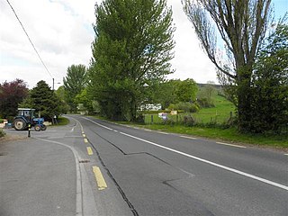
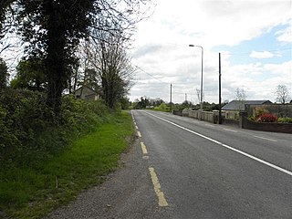
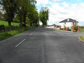
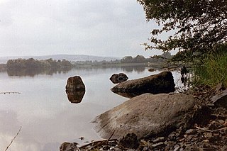
It is bounded on the north by Killywilly townland, on the east by Ardue, Ture, Drumlane and Greaghrahan townlands, on the south by Aghavoher and Carrigan townlands and on the west by Cavanagh (townland) and Mullaghduff townlands. Its chief geographical features are Killywilly Lough, Agavoher Lough, Lough Rud, the Rag River and several small drumlin hills reaching to an altitude of 250 feet above sea-level. Cranaghan is traversed by the N87 road (Ireland) and some minor lanes. The townland covers 492 acres, including 108 acres of water.
In an Ulster Plantation grant of the Manor of Monaghan dated 21 June 1610 from King James I to Sir Hugh Wyrral, it was specified that the two polls of Granchinagh containing 90 acres are excepted from this grant. The reason they were excepted is that they were intended as glebe-land for the Protestant Church. On 25 January 1627 a grant was made of two poles of Granchynagh, or Craynkyney, and Cronaghan to Thomas Groves, the Rector or Vicar of the parish of Dromlaghan. [3] Cranaghan then passed down as churchland until the 20th century.
The Tithe Applotment Books for 1827 list the following tithepayers in the townland- Kane, Reilly, Story, Green, Taylor, Brady, Dolan, McGauran, Laurence, Shewell, Corry, Ross, Gillon, McIlroy, Rooney. [4]
In 1829 a Sunday school was kept in the townland, funded by the Hibernian Sunday School Society. [5]
The Ordnance Survey Name Books for 1836 give the following description of the townland-Crannachan, 'wood-land'. It lies in the East of the parish. This is glebe land. The residence of the Revd J. Story is a neat building with a garden plantation. Rent is 25 shillings per arable acre. Soil is gravelly. Produce is oats, flax and potatoes. There is a large limestone quarry in the land, much used for building and agricultural purposes. Cranaghan Glebe House is the residence of Reverend Story. It has planting and a good garden. In good repair. [6]
The Cranaghan Valuation Office Field books are available for December 1838. [7] [8] [9]
Griffith's Valuation of 1857 lists thirty-eight occupiers in the townland. [10]
In the Dúchas Folklore Collection, Mrs Reilly in 1938 relates a treasure story that occurred in Cranaghan. [11]
| Year | Population | Males | Females | Total Houses | Uninhabited |
|---|---|---|---|---|---|
| 1841 | 211 | 94 | 117 | 39 | 4 |
| 1851 | 126 | 64 | 62 | 25 | 3 |
| 1861 | 116 | 54 | 62 | 25 | 1 |
| 1871 | 118 | 58 | 62 | 25 | 0 |
| 1881 | 120 | 56 | 64 | 24 | 0 |
| 1891 | 102 | 51 | 51 | 24 | 2 |
In the 1901 census of Ireland, there are twenty-eight families listed in the townland. [12]
In the 1911 census of Ireland, there are twenty-six families listed in the townland. [13]

Cullyleenan is a townland in the Parish of Tomregan, Barony of Tullyhaw, County Cavan, Ireland.
Derryginny is a townland in the Parish of Tomregan, Barony of Tullyhaw, County Cavan, Ireland.
Aghavoher is small a townland in the civil parish of Tomregan, County Cavan, Ireland. It is approximately 0.9 square kilometres (0.35 sq mi) in area and lies in the former barony of Loughtee Lower.
Cloncollow is a townland in the Parish of Tomregan, Barony of Loughtee Lower, County Cavan, Ireland.
Cavanagh is a townland in the civil parish of Tomregan, County Cavan, Ireland. It lies within the former barony of Tullyhaw.
Gortoorlan is a townland in the Parish of Tomregan, Barony of Tullyhaw, County Cavan, Ireland.
Mucklagh is a townland in the Parish of Tomregan, Barony of Tullyhaw, County Cavan, Ireland.

Aughrim is a townland in the Parish of Tomregan, Barony of Tullyhaw, County Cavan, Ireland.

Carrowmore, County Cavan is a townland in the Parish of Tomregan, Barony of Tullyhaw, County Cavan, Ireland.
Corranierna is a townland in the Parish of Tomregan, Barony of Tullyhaw, County Cavan, Ireland. (Disambiguation see also- Corranierna townland, County Cavan, Republic of Ireland.)
Mullynagolman is a townland in the Parish of Tomregan, Barony of Loughtee Lower, County Cavan, Ireland.

Slievebrickan is a townland in the Parish of Tomregan, Barony of Loughtee Lower, County Cavan, Ireland.

Clifton is a townland in the Parish of Tomregan, Barony of Loughtee Lower, County Cavan, Ireland.

Mackan is a townland in the civil parish of Kildallan, barony of Tullyhunco, County Cavan, Ireland.
Laheen is a townland in the civil parish of Killashandra, barony of Tullyhunco, County Cavan, Ireland.
Coppanaghmore, an Anglicisation of the Gaelic ‘Copanach Mór’ meaning The Big Place covered with Dock-leaves, is a townland in the civil parish of Templeport, County Cavan, Ireland. It lies in the Roman Catholic parish of Glangevlin and barony of Tullyhaw.

Greaghrahan is a townland in the civil parish of Drumlane, Barony of Loughtee Lower, County Cavan, Ireland.

Ardue is a townland in the civil parish of Drumlane, Barony of Loughtee Lower, County Cavan, Ireland.
Killywilly is a townland in the civil parish of Drumlane, Barony of Loughtee Lower, County Cavan, Ireland.

Ture is a townland in the civil parish of Drumlane, Barony of Loughtee Lower, County Cavan, Ireland.
