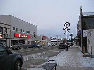
Flin Flon is a mining city, located on a correction line on the border of the Canadian provinces of Manitoba and Saskatchewan, with the majority of the city located within Manitoba. Residents thus travel southwest into Saskatchewan, and northeast into Manitoba. The city is incorporated in and is jointly administered by both provinces.
Creighton is a northern town in the Canadian province of Saskatchewan, named after Thomas Creighton. It had a 2016 census population of 1,402 inhabitants, down 0.3% from 1,498 inhabitants in 2011.

Bakers Narrows, Manitoba, is a small residential community approximately 20 km (12 mi) southeast of Flin Flon on Lake Athapapuskow. There are five subdivisions located near the lakeshore with a total of approximately 150 cottages, many of which are permanent residences.

Cumberland House is a community in Census Division No. 18 in northeast Saskatchewan, Canada on the Saskatchewan River. It is the oldest community in Saskatchewan and has a population of about 2,000 people. Cumberland House Provincial Park, which provides tours of an 1890s powder house built by the Hudson's Bay Company, is located nearby.

Island Falls is a hydroelectric power station operated by SaskPower, a Saskatchewan crown corporation. It is located on the Churchill River, about 97 kilometres (60 mi) northwest of Flin Flon, Manitoba, Canada.

Provincial Trunk Highway 10 is a provincial primary highway located in the Canadian province of Manitoba.

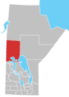
Division No. 21, also informally known as Flin Flon-Northwest, is a census division within the Province of Manitoba, Canada. Unlike in some other provinces, census divisions do not reflect the organization of local government in Manitoba. These areas exist solely for the purposes of statistical analysis and presentation; they have no government of their own.

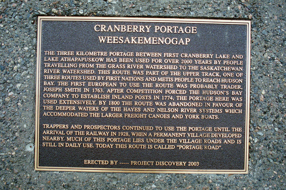
Kelsey is a Manitoban rural municipality embedded within the province's Northern Region. It consists of several disjoint parts. The largest part is Carrot Valley, located around and southwest of The Pas along the Carrot River, but the communities of Wanless and Cranberry Portage, located further north, are also part of the municipality. It is 867.64 km2 large. Also lying in the area around The Pas is the Opaskwayak Cree Nation Indian reserve.

Amisk Lake is a lake in the east-central part of the Canadian province of Saskatchewan, about 22 kilometres (14 mi) south-west of Flin Flon, Manitoba. 'Amisk' means beaver in Cree. Along the lake's shores is the community of Denare Beach, a provincial recreation site with lake access and camping, and prehistoric limestone crevices. Access to the lake and its amenities is from Highway 167. Amisk Lake was on an important fur trade route in the 18th century.
Sandy Bay is a northern village in the boreal forest of northern Saskatchewan, Canada. It is located on the Churchill River about 70 kilometres (43 mi) north of the community of Pelican Narrows and 190 kilometres (120 mi) northwest of Creighton and Flin Flon via Highway 135 and the Hanson Lake Road. The community consists of two parts the Northern Village of Sandy Bay and the Wapaskokimaw 202 reserve of the Peter Ballantyne Cree Nation.

The NorMan Junior Hockey League (NJHL) was Junior A hockey league in Northern Manitoba, Canada from 1978 until 1985. The NJHL was a member of the Manitoba Amateur Hockey Association, a part of the Canadian Amateur Hockey Association.
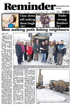
The Reminder is a weekly newspaper published every Wednesday in Flin Flon, Canada, a city located on the border of Manitoba and Saskatchewan. It is the only locally published newspaper in the area.
Fur trading on the Assiniboine River and the general area west of Lake Winnipeg, in what is now Manitoba, Canada, began as early as 1731.
Schist Lake is approximately 3 kilometres (1.9 mi) southeast of Flin Flon, Manitoba. The lake has a maximum depth of 30 metres (98 ft). It is composed of four main channels, the West Arm, Northwest Arm, Inlet Arm and Northeast Arm. It drains into Lake Athapapuskow via Schist Creek and is part of the Nelson River watershed. The Flin Flon/Channing Water Aerodrome is located on the north end of the Northwest Arm.

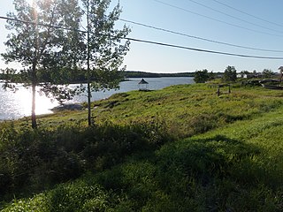
Lake Athapapuskow is a glacial lake in Manitoba and Saskatchewan, Canada, located 15 kilometres (9.3 mi) southeast of Flin Flon, Manitoba. The lake is in the Hudson Bay drainage basin and is the source of the Goose River.
Goose River is a river in the Hudson Bay drainage basin in the Northern Region of Manitoba and Division No. 18 in Saskatchewan, Canada, approximately 19 kilometres (12 mi) south-east of Bakers Narrows.
The Pineroot River is a waterway in the Hudson Bay drainage basin in the Northern Region of Manitoba, Canada, approximately 3 km (1.9 mi) north of Bakers Narrows. The river begins at the south end of Mikanagan Lake, continues in a southerly direction over the Mikanagan Falls, to Whitefish Lake then drains in Lake Athapapuskow.

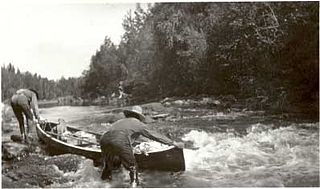
The Grass River is a historically important waterway in the Hudson Bay drainage basin in the Northern Region of Manitoba, Canada. It begins at the Cranberry Lakes approximately 27 kilometres (17 mi) east of Cranberry Portage and runs northeast 500 kilometres (310 mi) to its mouth on the Nelson River. The river was a critical route for earlier European explorers and was part of the "Upper Tract" of the fur trade into Canadian interior.


