
Malton is a neighbourhood in the northeastern part of the city of Mississauga, Ontario, Canada, located to the northwest of Toronto.
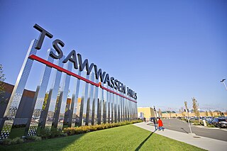
Tsawwassen is a suburban, mostly residential community on a peninsula in the southwestern corner of the City of Delta in British Columbia, Canada. It provides the only road access to the American territory on the southern tip of the peninsula, the community of Point Roberts, Washington, via 56th Street. It is also the location of Tsawwassen Ferry Terminal, part of the BC Ferries, built in 1959 to provide foot-passenger and motor vehicle access from the Lower Mainland to the southern part of Vancouver Island and the southern Gulf Islands. Because Tsawwassen touches a shallow bank, the ferry terminal is built at the southwestern end of a 3 km (1.9 mi) causeway that extends into the Strait of Georgia. Boundary Bay Airport, a major training hub for local and international pilots which also provides local airplane and helicopter service, is ten minutes away. The Roberts Bank Superport is also nearby.
The Saskatchewan Rivers School Division #119 comprises 33 schools in the Prince Albert, Saskatchewan area, and is the third largest school division in the province. This division has over 9500 students enrolled, with 365 support personnel, 475 teachers, and 88 division owned buses. There are a total of 14 microwave towers in the rural centres of the district, which ensure that rural students have access to high speed networking. There are six community schools, and three schools providing French immersion. A police liaison program is provided in the urban centre where the officer has a school office. This division contains the largest high school in Saskatchewan: Carlton Comprehensive High School. The division is located mainly in the Aspen parkland and boreal forest biomes, and is named for the North Saskatchewan, South Saskatchewan, and Saskatchewan Rivers which are all found in the area it encompasses.

Varsity View is a mostly residential neighbourhood located near central Saskatoon, Saskatchewan, Canada. It is immediately south of the University of Saskatchewan campus. It is an older suburban subdivision, comprising a mixture of low-density, single detached dwellings, detached duplexes and apartment-style units. As of 2007, the area is home to 3,611 residents. The neighbourhood is considered a middle-income area, with an average family income of $50,587, an average dwelling value of $284,710 and a home ownership rate of 38.7%. Its proximity to the university gives this area its relatively high student population, almost 25% in 2005. According to MLS data, the average sale price of a home as of 2013 was $402,332.

Arbor Creek is a primarily residential neighbourhood located in northeast Saskatoon, Saskatchewan, Canada. It is mostly made up of low-density single detached dwellings. As of 2006, the area is home to 4,654 residents. The neighbourhood is considered a high-income area, with an average family income of $99,631, an average dwelling value of $327,262 and a home ownership rate of 92.5%.

City Park is a mixed-use neighbourhood located near the center of Saskatoon, Saskatchewan, Canada. It comprises a mix of single-family detached homes, apartment buildings and other semi-detached dwellings. It also contains a number of commercial zones with businesses. As of 2009, the area was home to 4,405 residents. The neighbourhood is considered a middle-income area, with an average family income of $42,236, an average dwelling value of $245,254 and a home ownership rate of 28.6%.

Holiday Park is a neighbourhood in south-central Saskatoon, Saskatchewan. Located within Saskatoon's Ward 2, Councillor Hilary Gough represents the area's interests at City Hall.

Lakeview is a primarily residential neighbourhood located in the southeast part of Saskatoon, Saskatchewan, Canada. The majority of its residents live in low-density, single detached dwellings, with a sizeable minority of semi-detached or apartment-style multiple unit dwellings. As of 2011, the area is home to 7,732 residents. The neighbourhood is considered a high income area, with an average family income of $120,042, an average dwelling value of $277,070 and a home ownership rate of 71.0%. It was the first community in Saskatoon to feature a man-made lake amenity.

Brevoort Park is a primarily residential neighbourhood located in the southeast part of Saskatoon, Saskatchewan, Canada. It includes part of the 8th Street business district. Just over half of its dwellings are single detached houses, with a sizeable minority of duplex or apartment-style multiple unit dwellings. As of 2007, the area is home to 3,424 residents. The neighbourhood is considered a middle-income area, with an average family income of $52,098, and a home ownership rate of 54.0%.

Greystone Heights is a mostly residential neighbourhood located in east-central Saskatoon, Saskatchewan, Canada. It is a suburban subdivision, consisting mostly of low-density, single detached dwellings and a sizeable minority of apartment-style multiple-unit dwellings. As of 2007, the area is home to 2,525 residents. The neighbourhood is considered a middle-income area, with an average family income of $58,811, an average dwelling value of $241,850 and a home ownership rate of 58.1%.

North Park is a community which is just to the north of the Meewasin Riverworks observation area and the CPR Bridge. It has access along its eastern perimeter to the scenic walking trails along the South Saskatchewan River developed by the Meewasin Valley Authority. The average home selling price in 2006 was $101,176- $139,704. Each family was approximately 2.1 residents, and 63.9% of the residents owned their own home. According to MLS data, the average sale price of a home as of 2013 was $290,594.

Dundonald is a neighbourhood located in the northwest corner of Saskatoon, Saskatchewan. The neighbourhood was built in the 1980s, and served as the last development of the northwest corner of the city, prior to the development of Hampton Village. Dundonald is surrounded by a large landscaped park, with a storm pond. In comparison, the neighbourhood of Dundonald with a 2001 census population of 5,285 is larger than the Saskatchewan city of Melville which had a population of 4,149 in 2006, and 4,453 in 2001 and Dundonald is also larger than the provincial city of Humboldt which was 4,998 in 2006, and 5,161 in 2001. In Saskatchewan rural towns must maintain a population above 5,000 to apply for city status.

Hudson Bay Park is geographically located in north west Saskatoon just south of Circle Drive along 33rd Street and Avenue P North. It is mainly characterized by single detached homes along with apartments that are less than five stories in height. Oliver Place and St. Joseph's Home are seniors residences located in this residential neighbourhood. This locale honours the pioneers of Saskatoon, as well as providing two very large park spaces which curve through the neighbourhood. The community was under construction mainly during the post war years between 1940 and 1960 when there was a housing shortage. The land for this neighbourhood was annexed during the City expansion around the time of 1910 to 1915. Following elementary school, students usually attend Mount Royal Collegiate in the neighboring area of Mount Royal or E.D. Feehan Catholic High School on Avenue M North a part of Westmount community. In 2006, the average family size was 2.1 residents. Statistics c2005 -
Pacific Heights is geographically located in north west Saskatoon. The main construction boom for this community was the 1970s, during which the City of Saskatoon annexed the land. Following elementary school, students usually attend Tommy Douglas Collegiate or Bethlehem Catholic High School on Bowlt Crescent a part of Blairmore SDA community. According to MLS data, the average sale price of a home as of 2013 was $279,500.

Nutana Park is a mostly residential neighbourhood located in south-central Saskatoon, Saskatchewan, Canada. It is a suburban subdivision, consisting mostly of low-density, single detached dwellings. As of 2007, the area is home to 2,748 residents. The neighbourhood is considered a middle-income area, with an average family income of $66,555, an average dwelling value of $257,789 and a home ownership rate of 85.1%. According to MLS data, the average sale price of a home as of 2013 was $356,116.

The Central Business District or downtown is located in the heart of Prince Albert's downtown core. It is the dominant hub for retail, financial, personal and professional services in the city. Only regional shopping centres are permitted in the area. Many national businesses were housed in the area, but most have moved to other parts of the city.
Carlton Park is a small neighbourhood that is located between Marquis Road, 6th Avenue East, 28th Street East, and 15th Avenue East. It is part of the east side of Prince Albert.

The Confederation Park subdivision of Saskatoon, Saskatchewan, Canada, is located west of the South Saskatchewan River, Saskatoon's west side.
Westview is a suburban community in the Confederation Suburban Development Area (SDA) of Saskatoon, Saskatchewan. Originally named "Tuxedo Park" by real estate developers in 1912, the area remained undeveloped until the 1960s. The east half of Westview is located on land annexed by the city in 1911, while the western half did not become part of Saskatoon until 1960.
Kensington is a neighbourhood located in west Saskatoon, Saskatchewan, Canada that began construction in 2013. Around 2028, Kensington will reach completion and have an estimated population of 8,300. Kensington will feature Saskatoon's first application of the fused grid street network.