
Saguaro Lake is the fourth reservoir on the Salt River, formed by the Stewart Mountain Dam in the U.S. state of Arizona. The lake is off State Route 87, about halfway between Phoenix and the ghost town of Sunflower. The dammed end of the lake is at 33.5656°N 111.5361°W, at an elevation of 1,506 feet (459 m).

Greer is an unincorporated community and census-designated place in Apache County, Arizona, United States. Located within the White Mountains of Arizona and surrounded by the Apache-Sitgreaves National Forest, Greer is the highest town in the state at an elevation of approximately 8,400 feet. As of the 2020 census it had a population of 58. Greer was founded circa 1879 by Mormon settlers from Utah. The Greer post office has the ZIP code of 85927.

The Kaibab Plateau is a plateau almost entirely in Coconino County, Arizona in the Southwestern United States. The high plain is also known as the Buckskin Mountain, Buckskin Plateau, and Kaibab Mountain.
Luna Lake is a natural body of water that covers approximately 75 acres (0.30 km2) of land. It is located about three miles (5 km) southeast of Alpine, Arizona, at the elevation of 7,890 ft (2,400 m), and is the centerpiece of the Luna Lake Wildlife Area.
Knoll Lake is part of the Blue Ridge Ranger District of the Coconino National Forest. It gets its name from a rocky island located in the middle of the lake. Knoll Lake is located in Leonard Canyon, Arizona, along the Mogollon Rim. This 75-acre (30 ha) lake is located at 7,340 feet (2,240 m) elevation and is closed to visitors in the winter months. Bald eagles may be seen during the winter months if the roads are open late into the season. The facilities are maintained by Coconino National Forest division of the USDA Forest Service.

Alamo Lake State Park is a state park of Arizona, USA, centered on Alamo Lake, a flood control and recreational reservoir. The park is located in western Arizona about 38 miles (61 km) north of Wenden. It is accessed via a paved two-lane road off either U.S. Route 60 to the south or U.S. Route 93 to the east. Owing to its remoteness, the park is often considered one of the "best kept secrets" of the state park system.

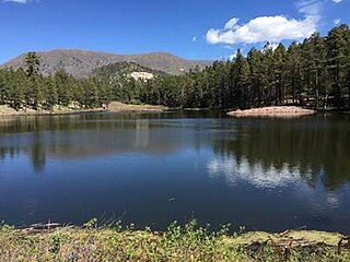
Ashurst Lake is a small lake located on the Anderson Mesa 20 miles (32 km) southeast of Flagstaff. It is one of the few natural lakes in the state of Arizona, the bulk of which reside in the area.
Becker Lake is a reservoir managed as a trophy trout lake. Located near Springerville, Arizona, Becker Lake is part of the 622-acre (252 ha) Becker Lake Wildlife Area. Built around the year 1880, it is one of the oldest reservoirs in the White Mountains. The Arizona Game and Fish Department acquired the lake and property around it in 1973. The lake is located at 6,910 feet (2,110 m).
Black Canyon Lake is a lake in Navajo County, Arizona, United States.

Big Lake is a reservoir in Arizona's White Mountains', with attractive size, recreational activities, and visitor amenities. As with most trout waters in Arizona, catch rates are best in spring, during late April and May after the winter ice thaws. Fishing gets even better later in the summer and into fall until the lake freezes over again in late November. Big Lake is in Apache County and is managed by the Apache-Sitgreaves National Forests.
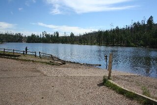
Bunch Reservoir is one of a trio of lakes on the Little Colorado River that provides trout fishing opportunities in and around the town of Greer.
Carnero Lake is a high elevation shallow lake in Apache County, Arizona. Built in 1979, the lake quickly became popular with anglers, to the dismay of downstream water users. Because of the dispute, the Arizona Game and Fish discontinued stocking for many years. In 1999, the Arizona Game and Fish has acquired a major share of the water rights, setting the stage for a new and vigorous trout fishery.
Concho Lake is an irrigation reservoir situated in the town of Concho, in the eastern Arizona grasslands at 6,300 feet (1,900 m). Much of the surrounding land is privately owned; the rest is owned by the Bureau of Land Management, but is managed for sport fisheries and wildlife resources by the Arizona Game and Fish.
Nelson Reservoir is a reservoir located in Apache County, Arizona between Springerville and Alpine. The Reservoir is a long and narrow lake which follows the Nutrioso Creek Valley for nearly a mile. Fish that remain in Nelson Reservoir after summer stockings can grow to good size, making it a popular fishing site with local anglers.
Built in 1896 on the Little Colorado River, River Reservoir is the largest and deepest of a trio of lakes collectively known as the Greer Lakes. Drained since 2004 because of safety issues, the dam at River Reservoir was repaired in 2005. Like the other two Greer Lakes, it has new amenities. River Reservoir is located at 8,220 feet (2,510 m) on the Apache-Sitgreaves National Forests.
Kinnikinick Lake is located 38 mi (61 km) south of Flagstaff in North Central Arizona within the Coconino National Forest. Prairies of juniper surround the lake and typically abound with pronghorn. Bald eagles are often seen during the fall and winter months. The facilities are maintained under the authority of the Coconino National Forest.
Lee Valley Lake is Arizona's highest elevation reservoir, situated at 9,420 feet (2,870 m) in the Apache-Sitgreaves National Forests near Mount Baldy. It is located approximately 35 miles from Pinetop-Lakeside, connected by Arizona highways 260 and 273 and forest road 113. Access is restricted in the winter when roads are closed due to snow, generally December to early April.
Hulsey Lake is a lake near Escudilla Peak in the Apache National Forest, Arizona. It is located at 8,620 feet (2,630 m) on the Apache-Sitgreaves National Forests. It is an impoundment of Hulsey Creek, a tributary of Nutrioso Creek. Due to snow and ice, the lake is usually inaccessible from November to mid-April.

Fool Hollow Lake is a public lake located in Navajo County, Arizona, near the city of Show Low. The lake is operated by the Arizona State Parks Department, and consists of 150 acres (61 ha), with an average depth of 23 feet (7.0 m) together with a variety of fish species.

Worthen Meadow Reservoir is a reservoir located in the Shoshone National Forest. The reservoir is fed by Roaring Fork Creek, and it holds around 1,500 acre feet of water with a surface elevation of 8,819 ft (2,688 m). The reservoir's two section earth-fill dam was constructed in 1958, and the reservoir acts as a supplemental supply of water for the City of Lander, Wyoming. The total length of the dam is 917 ft (280 m) with a maximum height of 43 ft (13 m) above the stream bed of Roaring Fork Creek.

