Lansing is the capital of the U.S. state of Michigan. It is mostly in Ingham County, although portions of the city extend west into Eaton County and north into Clinton County. The 2020 census placed the city's population at 112,644, making it the sixth largest city in Michigan. The population of its metropolitan statistical area (MSA) was 541,297 at the 2020 census, the third largest in the state after metropolitan Detroit and Grand Rapids. It was named the new state capital of Michigan in 1847, ten years after Michigan became a state.

Kent County is located in the U.S. state of Michigan. As of the 2020 Census, the county had a population of 657,974, making it the fourth most populous county in Michigan, and the largest outside of the Detroit area. Its county seat is Grand Rapids. The county was set off in 1831, and organized in 1836. It is named for New York jurist and legal scholar James Kent, who represented the Michigan Territory in its dispute with Ohio over the Toledo Strip.

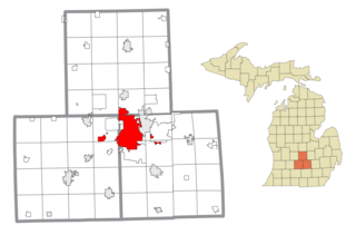
Grand Traverse County is a county located in the U.S. state of Michigan. As of the 2020 census, the population was 95,238, making it the largest county in Northern Michigan. Its county seat is Traverse City. The county is part of the Traverse City micropolitan area, which also includes neighboring Benzie, Kalkaska, and Leelanau counties.
Wyoming is a city in Kent County in the U.S. state of Michigan. The population was 76,501 at the 2020 census. Wyoming is the second most-populated community in the Grand Rapids metropolitan area and is bordered by Grand Rapids on the northeast. After Grand Rapids, it is also the second most-populated city in West Michigan.

Western Michigan University is a public research university in Kalamazoo, Michigan. It was initially established as Western State Normal School in 1903 by Governor Aaron T. Bliss for the training of teachers. In 1957, G. Mennen Williams signed a bill into law that made Western a university and gave the school its current name of Western Michigan University.
Gerald R. Ford International Airport is a commercial airport in Cascade Township approximately 13 miles (21 km) southeast of Grand Rapids, Michigan, United States. The facility is owned by the Kent County Board of Commissioners and managed by an independent authority. The Federal Aviation Administration (FAA) National Plan of Integrated Airport Systems for 2017–2021 categorized it as a small hub primary commercial service facility.

Grand Valley State University is a public university in Allendale, Michigan. It was established in 1960 as Grand Valley State College. Its main campus is situated on 1,322 acres (5.35 km2) approximately 12 miles (19 km) west of Grand Rapids. The university also features campuses in Grand Rapids and Holland and regional centers in Battle Creek, Detroit, Muskegon, and Traverse City.

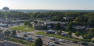
West Michigan and Western Michigan are terms for an arbitrary region in the U.S. state of Michigan's Lower Peninsula. Most narrowly it refers to the Grand Rapids-Muskegon-Holland area, and more broadly to most of the region along the Lower Peninsula's Lake Michigan shoreline, but there is no official definition.
M-6, or the Paul B. Henry Freeway, is a 19.7-mile-long (31.7 km) east–west freeway and state trunkline highway in the United States that serves portions of southern Kent and eastern Ottawa counties south of Grand Rapids, Michigan. Although the freeway is named for Paul B. Henry, local residents and the press continue to use the original name, South Beltline as well on occasion. The freeway connects Interstate 196 (I-196) on the west with I-96 on the east. M-6 also provides a connection to U.S. Highway 131 (US 131) in the middle of its corridor while running through several townships on the south side of the Grand Rapids metropolitan area in Western Michigan. Each end is in a rural area while the central section has suburban development along the trunkline.
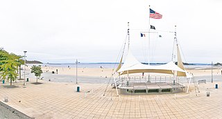
Orchard Beach is the only public beach in the New York City borough of the Bronx. The 115-acre (47 ha), 1.1-mile-long (1.8 km) beach is part of Pelham Bay Park and is situated on the western end of Long Island Sound. The beach consists of a 13-section sandy shorefront, a hexagonal-block promenade, and a central pavilion with food stores and specialty shops. The recreational facilities include two playgrounds, two picnic areas, a large parking lot, and 26 courts for basketball, volleyball, and handball. It is operated by the New York City Department of Parks and Recreation.

Amway Grand Plaza Hotel is located in Grand Rapids, Michigan and is named after Amway Corporation, which is based in nearby Ada Township.

US Highway 131 (US 131) is a north–south United States Highway, of which all but 0.64 of its 269.96 miles are within the state of Michigan. The highway starts in rural Indiana south of the state line as a state road connection to the Indiana Toll Road. As the road crosses into Michigan it becomes a state trunkline highway that connects to the metropolitan areas of Kalamazoo and Grand Rapids before continuing north to its terminus at Petoskey. US 131 runs as a freeway from south of Portage through to Manton in the north. Part of this freeway runs concurrently with Interstate 296 (I-296) as an unsigned designation through Grand Rapids. US 131 forms an important corridor along the western side of the Lower Peninsula of Michigan, running through rural farm and forest lands as well as urban cityscapes. Various names have been applied to the roadway over the years. The oldest, the Mackinaw Trail, originated from an Indian trail in the area while other names honored politicians. An attempt to dedicate the highway to poet James Whitcomb Riley failed to gain official support in Michigan.
The Grand Rapids Public Schools is a public school district serving Grand Rapids, Michigan.
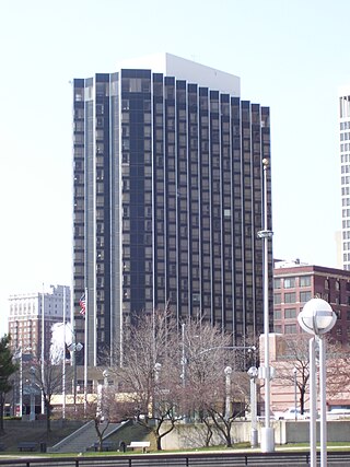
The Fort Pontchartrain a Wyndham Hotel, is a 367-room, 25-story high-rise hotel opened in 1965, adjacent to TCF Center in Downtown Detroit, Michigan.

Grand Rapids Medical Mile is a designated area within the city of Grand Rapids, Michigan. It began with medical-related development in the Hillside District of Grand Rapids, Michigan, bordering both sides of Michigan Street. More than a decade later it encompasses an area five times larger, expanding east further down Michigan St.and north across Interstate 196. It has also been referred to as Grand Rapids Medical Corridor, Michigan Street Medical Corridor, Health Hill, Medical Hill, and Pill Hill, among other names.
Grand Rapids is a city and county seat of Kent County in the U.S. state of Michigan. At the 2020 census, the city had a population of 198,917 which ranks it as the second most-populated city in the state after Detroit. Grand Rapids is the central city of the Grand Rapids metropolitan area, which has a population of 1,087,592 and a combined statistical area population of 1,383,918.

Plaza Towers is a mixed-use highrise building in Grand Rapids, Michigan. At 345 feet (105 m), it was the tallest building in the city until the completion of the River House Condominiums in 2008. The building contains apartments on floors 8–14, individually owned condominiums on floors 15–32, and a 214-room Courtyard by Marriott hotel on floors 1–7.

The Old Cadillac City Hall is a government building located at 201 Mitchell Street in Cadillac, Michigan. It was designated a Michigan State Historic Site in 1983 and listed on the National Register of Historic Places in 1986.
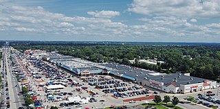
Rogers Plaza is an enclosed shopping mall in Wyoming, Michigan, a suburb of Grand Rapids, Michigan. Opened in 1961, it was the first shopping mall in Western Michigan and the first enclosed one in the state of Michigan. The center features Planet Fitness and Citi Trends among its major stores.

