Crows, Arkansas | |
|---|---|
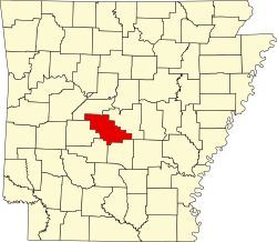
 Crows, Arkansas Crows's position in Arkansas.  Crows, Arkansas Crows, Arkansas (the United States) | |
| Coordinates: 34°36′51″N92°46′10″W / 34.61417°N 92.76944°W [1] | |
| Country | United States |
| State | Arkansas |
| County | Saline |
| Township | Dyer |
| Elevation | 410 ft (120 m) |
| Time zone | UTC-6 (Central (CST)) |
| • Summer (DST) | UTC-5 (CDT) |
| Area code | 870 |
Crows is an unincorporated community in Dyer Township, Saline County, Arkansas. [1] It is located in the valley of the Middle Fork Saline River at the intersection of Arkansas highways 5 and 9. [2] [3]