Cushing Municipal Airport | |||||||||||||||||||||||
|---|---|---|---|---|---|---|---|---|---|---|---|---|---|---|---|---|---|---|---|---|---|---|---|
| Summary | |||||||||||||||||||||||
| Airport type | Public | ||||||||||||||||||||||
| Owner | City of Cushing | ||||||||||||||||||||||
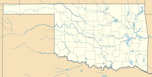
| Serves | Cushing, Oklahoma | ||||||||||||||||||||||
| Elevation AMSL | 925 ft / 282 m | ||||||||||||||||||||||
| Coordinates | 35°57′00″N096°46′24″W / 35.95000°N 96.77333°W | ||||||||||||||||||||||
| Map | |||||||||||||||||||||||
 CUH  CUH | |||||||||||||||||||||||
 | |||||||||||||||||||||||
| Runways | |||||||||||||||||||||||
| |||||||||||||||||||||||
| Statistics (2011) | |||||||||||||||||||||||
| |||||||||||||||||||||||
Source: Federal Aviation Administration [1] | |||||||||||||||||||||||
Cushing Municipal Airport( IATA : CUH [2] , ICAO : KCUH, FAA LID : CUH) is two miles south of Cushing, in Payne County, Oklahoma. [1] The National Plan of Integrated Airport Systems for 2021-2025 categorized it as a general aviation airport. [3]