Custer, Washington

Last updated

Custer, Washington
CDP
Whatcom County Washington Incorporated and Unincorporated areas Custer Highlighted.svg
Location of Custer, Washington
Coordinates: 48°55′4″N122°38′27″W / 48.91778°N 122.64083°W / 48.91778; -122.64083
CountryUnited States
State Washington
County Whatcom
Area
  Total1.8 sq mi (4.7 km2)
  Land1.8 sq mi (4.7 km2)
  Water0.0 sq mi (0.0 km2)
Elevation
43 ft (13 m)
Population
 (2020)
  Total518
  Density290/sq mi (110/km2)
Time zone UTC-8 (Pacific (PST))
  Summer (DST) UTC-7 (PDT)
ZIP code
98240
Area code 360
FIPS code 53-16375 [1]
GNIS feature ID1512132 [2]

Custer is a census-designated place (CDP) in Whatcom County, Washington, United States. The population was 518 at the 2020 census, up from 366 at the 2010 census. [3]

Contents

Geography

According to the United States Census Bureau, the CDP has a total area of 1.8 square miles (4.7 km2), all of it land.

Demographics

As of the census [1] of 2000, there were 299 people, 108 households, and 81 families residing in the CDP. The population density was 164.4 people per square mile (63.5 people/km2). There were 116 housing units at an average density of 63.8 units per square mile (24.6 units/km2). The racial makeup of the CDP was 92.31% White, 1.67% Asian, 5.35% from other races, and 0.67% from two or more races. Hispanic or Latino of any race were 7.69% of the population.

There were 108 households, out of which 35.2% had children under the age of 18 living with them, 67.6% were married couples living together, 5.6% had a female householder with no husband present, and 24.1% were non-families. 18.5% of all households were made up of individuals, and 10.2% had someone living alone who was 65 years of age or older. The average household size was 2.77 and the average family size was 3.23.

In the CDP, the age distribution of the population shows 28.8% under the age of 18, 7.7% from 18 to 24, 24.7% from 25 to 44, 26.8% from 45 to 64, and 12.0% who were 65 years of age or older. The median age was 36 years. For every 100 females, there were 96.7 males. For every 100 females age 18 and over, there were 104.8 males.

The median income for a household in the CDP was $24.094, and the median income for a family was $30,625. Males had a median income of $38,135 versus $23,977 for females. The per capita income for the CDP was $13,371. About 18.2% of families and 27.7% of the population were below the poverty line, including 31.1% of those under the age of eighteen and 41.7% of those 65 or over.
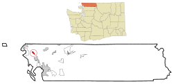
History

Custer was named in 1886 after Albert W. Custer, an early settler and the first storekeeper and postmaster of the town. [4] Originally the town was located at the intersection of the current Valley View and Bay Roads. In 1890-1892 the town moved to the current location with the coming of the railroad.

In December 2020, a train derailment led to the spill of approximately 30,000 gallons of oil. Most of the oil burned or evaporated, but possibly up to 8,000 gallons of a type of crude oil could not be recovered. Within weeks, air quality was considered normal and soil mitigation was completed, but the testing of groundwater and ongoing cleanup has been determined to take several years. [5] [6]

Notable people

Country singer Loretta Lynn was a resident of Custer in the 1950s and early 1960s when she was a young wife and mother at the start of her legendary career.[ citation needed ]

Related Research Articles

<span class="mw-page-title-main">Custer, Montana</span> Census-designated place in Montana, United States

Custer is a census-designated place (CDP) in Yellowstone County, Montana, United States. The population was 145 at the 2000 census.

<span class="mw-page-title-main">Concord, Missouri</span> Place in Missouri, United States

Concord is an unincorporated community and census-designated place (CDP) in St. Louis County, Missouri, United States. The population was 16,421 at the 2010 census. It should not be confused with Concord Township, which the CDP shares much land with, but these areas' boundaries are not identical.

<span class="mw-page-title-main">Fruit Hill, Ohio</span> Census-designated place in Ohio, United States

Fruit Hill is a census-designated place (CDP) in Hamilton County, Ohio, United States. The population was 3,748 at the 2020 census.

<span class="mw-page-title-main">Groesbeck, Ohio</span> Census-designated place in Ohio, United States

Groesbeck is a census-designated place (CDP) in Hamilton County, Ohio, United States. The population was 7,365 at the 2020 census. It is a suburb of Cincinnati.

<span class="mw-page-title-main">Northgate, Ohio</span> Census-designated place in Ohio, United States

Northgate is a census-designated place (CDP) in Colerain Township, Hamilton County, Ohio, United States. The population was 7,277 at the 2020 census.

<span class="mw-page-title-main">Baidland, Pennsylvania</span> Census-designated place in Pennsylvania, United States

Baidland is a census-designated place (CDP) in Washington County, Pennsylvania, United States. The population was 1,563 at the 2010 census.

<span class="mw-page-title-main">South Wenatchee, Washington</span> Census-designated place in Washington, United States

South Wenatchee is an unincorporated community and census-designated place (CDP) in Chelan County, Washington, United States. It is part of the Wenatchee–East Wenatchee Metropolitan Statistical Area. The population was 1,522 at the 2020 census.

<span class="mw-page-title-main">West Wenatchee, Washington</span> Unincorporated community in Washington, United States

West Wenatchee is a former census-designated place (CDP) and now an unincorporated community in Chelan County, Washington, United States. The United States Census Bureau removed the community at the 2010 census, with most of its former area being merged into Wenatchee city limits, raising the population significantly. The area that was West Wenatchee is part of the Wenatchee–East Wenatchee Metropolitan Statistical Area.

<span class="mw-page-title-main">River Road, Washington</span> Census-designated place in Washington, United States

River Road is a census-designated place (CDP) in Clallam County, Washington, United States. The population was 454 at the 2010 census. It is a primarily residential area next to the city of Sequim.

<span class="mw-page-title-main">Lake Shore, Washington</span> Census-designated place in Washington, United States

Lake Shore is a census-designated place (CDP) in Clark County, Washington, United States. The population was 7,056 at the 2020 census.

<span class="mw-page-title-main">Markham, Washington</span> CDP in Washington, United States

Markham is a census-designated place (CDP) in Grays Harbor County, Washington, United States. The population was 119 at the 2020 census.

<span class="mw-page-title-main">Kingston, Washington</span> Census-designated place in Washington, United States

Kingston is an unincorporated community and census-designated place (CDP) in Kitsap County, Washington, United States. The population was 2,515 at the 2020 census. Kingston is along the shores of Appletree Cove and Puget Sound, and is home to a major Washington State Ferry terminal linking it to Edmonds.

<span class="mw-page-title-main">Centerville, Washington</span> Census-designated place in Washington, United States

Centerville is an unincorporated community and census-designated place (CDP) in Klickitat County, Washington, United States. Settled in 1877 by Albert J. Brown, the population was 94 at the 2020 census.

<span class="mw-page-title-main">Greenwater, Washington</span> CDP in Washington, United States

Greenwater is a census-designated place (CDP) in the northwest United States in Pierce County, Washington. Southeast of Seattle, the population was 67 at the 2010 census, down from 91 in 2000. At the 2020 census, the population was 95.

<span class="mw-page-title-main">Lake Goodwin, Washington</span> Former CDP in Washington, United States

Lake Goodwin is a former census-designated place (CDP) in Snohomish County, Washington, United States. The population was 3,354 at the 2000 census. The CDP was discontinued at the 2010 census.

<span class="mw-page-title-main">Lake Roesiger, Washington</span> CDP in Washington, United States

Lake Roesiger is a census-designated place (CDP) in Snohomish County, Washington, United States. The population was 611 at the 2020 census, up from 503 at the 2010 census.

<span class="mw-page-title-main">Fort Riley (CDP), Kansas</span> Unincorporated community in Geary and Riley Counties of Kansas

Fort Riley is a census-designated place (CDP) in Geary and Riley counties in the U.S. state of Kansas, on the grounds of Fort Riley. As of the 2020 census, the population was 9,230. Fort Riley is part of the Manhattan, Kansas Metropolitan Statistical Area.

Woodland is a census-designated place (CDP) in the town of Baileyville, Washington County, Maine, United States. The population was 952 at the 2010 census.

<span class="mw-page-title-main">Limestone (CDP), Maine</span> Census-designated place in Maine, United States

Limestone is a census-designated place (CDP) comprising the main village within the town of Limestone in Aroostook County, Maine, United States. The population was 1,075 at the 2010 census, out of a population of 2,314 for the entire town.

Machias is a census-designated place (CDP) corresponding to the central village area within the town of Machias in Washington County, Maine, United States. The population of the CDP was 1,274 at the 2010 census.

References

  1. 1 2 "U.S. Census website". United States Census Bureau . Retrieved January 31, 2008.
  2. "US Board on Geographic Names". United States Geological Survey. October 25, 2007. Retrieved January 31, 2008.
  3. "Census Bureau profile: Custer, Washington". United States Census Bureau. May 2023. Retrieved May 9, 2024.
  4. Phillips, James W. (1971). Washington State Place Names . Seattle and London: University of Washington Press. p. 34. ISBN   0-295-95498-1.
  5. McCarthy, Grace (January 27, 2021). "Custer derailment leaked nearly 30,000 gallons of crude oil". The Northern Light. Retrieved March 9, 2023.
  6. Taft, Molly. "America's Worst Toxic Train Disasters". Gizmodo. Retrieved March 9, 2023.