Everson, Washington Lummi: Kwánech | |
|---|---|
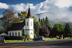 Bethany Chapel in Everson | |
 Location of Everson, Washington | |
| Coordinates: 48°54′26″N122°21′50″W / 48.90722°N 122.36389°W | |
| Country | United States |
| State | Washington |
| County | Whatcom |
| Government | |
| • Type | Mayor-Council |
| • Mayor | John Perry [1] |
| Area | |
• Total | 1.37 sq mi (3.56 km2) |
| • Land | 1.35 sq mi (3.49 km2) |
| • Water | 0.031 sq mi (0.08 km2) |
| Elevation | 85 ft (26 m) |
| Population | |
• Total | 2,888 |
| • Density | 2,146/sq mi (828.4/km2) |
| Demonym | Eversonian |
| Time zone | UTC-8 (Pacific (PST)) |
| • Summer (DST) | UTC-7 (PDT) |
| ZIP codes | 98247, 98276 |
| Area code | 360 |
| FIPS code | 53-22745 |
| GNIS feature ID | 2410471 [3] |
| Website | www.ci.everson.wa.us |
Everson is a city in Whatcom County, Washington, United States. The population was 2,888 at the time of the 2020 census. [4] It is the fifth Largest city within the Bellingham Metropolitan Area.
Contents
- History
- Geography
- Demographics
- 2010 census
- 2000 census
- Education
- Notable people
- References
- External links
Everson and the nearby city of Nooksack lie near the foothills of the Cascade mountains in Northwest Washington. Located on the banks of the Nooksack River, the businesses support the surrounding farms and logging industries. The valley is heavily influenced by Dutch settlers who established dairy farms on the fertile flood prone land. Fruit orchards and berry fields also play an important part of the town's economy.
The town's small business district provides all the basic services. There are restaurants, a pharmacy and grocery store, an auto-repair shop, and agricultural supply stores. The city park is located a half-block south off West Main Street, and Riverside Park is on the banks of the Nooksack River.
Throughout the year, the area hosts small festivals in town or in the surrounding area, including a summer festival and harvest festival.
