Alta Sierra is a census-designated place (CDP) in Nevada County, California, United States. The population was 6,911 at the 2010 census, up from 6,522 at the 2000 census.

North Auburn is a census-designated place (CDP) in Placer County, California, United States. It is part of the Sacramento–Arden-Arcade–Roseville Metropolitan Statistical Area. The population was 13,022 at the 2010 census, up from 11,847 at the 2000 census.

East Glacier Park is an unincorporated community and census-designated place (CDP) in Glacier County, Montana, United States. The population was 363 on the 2010 United States Census.

Ames Lake is an unincorporated community and census-designated place (CDP) in King County, Washington, United States. The population was 1,486 at the 2010 census.

Lake Marcel-Stillwater is a census-designated place (CDP) in King County, Washington, United States. The population was 1,277 at the 2010 census.

Riverbend is an unincorporated community and census-designated place (CDP) in King County, Washington, United States. The population was 2,132 at the 2010 census.
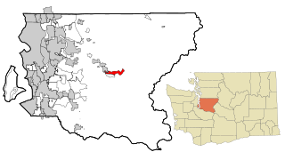
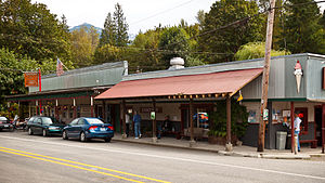
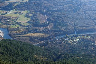
Tanner is an unincorporated community and census-designated place (CDP) in east King County, Washington, United States. As of the 2010 census, it had a population of 1,018.

Greenwater is a census-designated place (CDP) in the northwest United States in Pierce County, Washington. Southeast of Seattle, the population was 67 at the 2010 census, down from 91 in 2000.

Lake Cavanaugh is a census-designated place (CDP) in Skagit County, Washington, United States. The population was 167 at the 2010 census. It is included in the Mount Vernon–Anacortes, Washington Metropolitan Statistical Area.
Rockport is a census-designated place (CDP) in Skagit County, Washington, United States. The population was 109 at the 2010 census. It is included in the Mount Vernon–Anacortes, Washington Metropolitan Statistical Area.

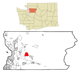
Cathcart is a census-designated place (CDP) in Snohomish County, Washington, United States. The population was 2,458 at the 2010 census. Based on per capita income, one of the more reliable measures of affluence, Cathcart ranks 45th of 522 areas in the state of Washington to be ranked. Cathcart was named for Isaac Cathcart, a businessperson in the lumber industry.

Lake Bosworth is a census-designated place (CDP) in Snohomish County, Washington, United States. The population was 667 at the 2010 census.
Lake Roesiger is a census-designated place (CDP) in Snohomish County, Washington, United States. The population was 503 at the 2010 census.

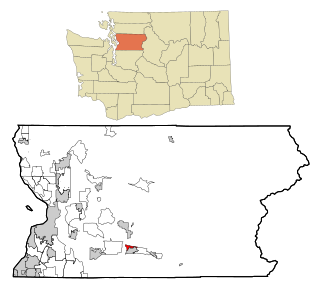
Maltby is a census-designated place (CDP) in Snohomish County, Washington. The population was 10,830 at the 2010 census.

Martha Lake is a census-designated place (CDP) in Snohomish County, Washington, United States. The population was 15,473 at the 2010 census. It lies west of Mill Creek and northeast of Lynnwood, near the lake of the same name.

May Creek is a census-designated place (CDP) in Snohomish County, Washington, United States. The population was 818 at the 2010 census.

North Marysville is a census-designated place (CDP) in Snohomish County, Washington, United States. The majority of the community and its 20,000 residents were annexed into the city of Marysville in 2009. The population was 108 at the 2010 census.
North Sultan is a census-designated place (CDP) in Snohomish County, Washington, United States. The population was 264 at the 2010 census.

Three Lakes is a census-designated place (CDP) in Snohomish County, Washington, United States. The population was 3,184 at the 2010 census.

Woods Creek is a census-designated place (CDP) in Snohomish County, Washington, United States. The population was 5,589 at the 2010 census.