Cyclone Dagmar

Last updated

Cyclone Dagmar
Storm Dagmar IR 26 December 2011.png
Storm Dagmar over Scandinavia 26 December 2011
Type European windstorm, Extratropical cyclone
Formed24 December 2011
Dissipated27 December 2011
Fatalities2 [1] [2]
Damage$45 million (2011 USD)
Areas affected Norway, Sweden, Finland, Estonia, Russia

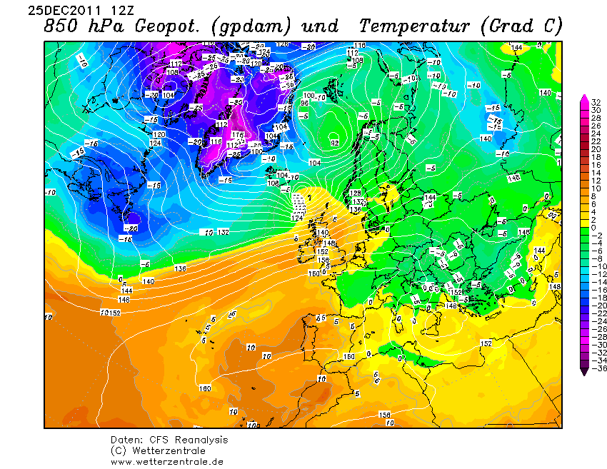
Cyclone Dagmar [3] (also referred to as Cyclone Tapani in Finland [4] ) and as Cyclone Patrick by the Free University of Berlin) was a powerful European windstorm which swept over Norway on Christmas Day 2011, causing severe damage in central coastal areas, before continuing over the Scandinavian peninsula towards the Baltic Sea and Gulf of Finland. The storm caused $45 million (2011 USD) in damage. [5]

Contents

Meteorological history

Patrick formed as a small low just south of Newfoundland on 24 December. [6] The system raced across the north Atlantic, deepening rapidly to 956 mb (28.2 inHg) by Christmas Day. [7] [8] Patricks extraordinary windspeed was due to it being a secondary low to the deep cyclone Oliver to the north and the powerful high Cora to the south, enhancing the southwesterly winds on the south side of the low. [9] On 26 December, Patrick made landfall in western Norway with a central pressure of 964 mb (28.5 inHg). [10] [11] The storm continued to move eastwards at a rapid pace, however, as it was overland it had weakened significantly. [12] It hit Finland the same day, St. Stephen's Day (Tapani in Finnish), and got the Finnish name due to that day. It then moved out of the Free University of Berlin's tracking charts the next day. [13]

Damaged outbuilding in Norway Dagmar2.jpg
Damaged outbuilding in Norway

Impact

Norway

Damage in Molde, Norway After Dagmar.jpg
Damage in Molde, Norway

Patrick (Dagmar) arrived in Norway as a southwesterly storm, with windspeeds estimated to be on average 110 km/h (30 m/s; 67 mph) on the coast. Up to 160 km/h (44 m/s; 98 mph) 10 minute sustained winds was measured at Kråkenes Lighthouse, Sogn og Fjordane, before the anemometer broke. Powerful winds occurred in Sogn og Fjordane, Møre og Romsdal and Trøndelag during the night of 24 December and early morning of 25 December. Extreme high storm surge in Finnmark estimated to be 50–80 cm (20–31 in) over normal sea levels, although this was due to the preceding storm Cato (Oliver). In Norway comparison was made with the New Year's Day Storm of 1992, however this storm was not as strong [14] Patrick (Dagmar) is believed to be the third strongest storm to hit Norway in 50 years. [15] [16] [17] A large landslide on 1 January 2012 close to the Norwegian city of Trondheim has been attributed to the warm weather and large amounts of rain the system brought to the area, which resulted in 50 people being evacuated. [18] [19] [ dubious ] The pier area of Trondheim was badly damaged during the storm, heavily damaging the façade of the Pirbadet water park. [20] A F2 tornado was reported in Hellesylt, Norway. The Tanker BW Thames was disabled and adrift northwest of Bergen as the storm approached, however the crew were able to regain power and survived the storm without incident. [21] The Russian trawler Krasnoselsk sank in Hundeidvika harbour, Sykkylven, Norway. [22] [23] Dagmar knocked out 390 Telenor communication masts leaving 40,000 customers without mobile or landline telephone connections. [2] Royal Dutch Shell's Ormen Lange gas processing plant was inoperable after its electricity was cut off by the storm, which left gas supplies in the UK vulnerable as this facility can supply up to 20 percent of the UK's supply via the Langeled pipeline. [24]

Sweden

Storm Dagmar mostly affected Southern Norrland and northern Svealand. [25] The Swedish transport authority suspended all train traffic north of Gävle at 20:00 on Christmas Day in preparation. [26] Many trees fell in the storm, bringing down power lines and blocking roads and railways. Approximately 170,000 households were left without power between Uppland and Västerbotten, some for several days. Train traffic came to a standstill in Norrland, however the principal north–south route of the country (European route E4) was quickly cleared. [25] Several weather stations in the Norrland interior experienced their strongest wind gusts in 15 years. [25] Winds of 41 metres per second (92 mph) were recorded on the pylons of the Höga Kusten Bridge. [27] 1.2 million Swedish Kronor of damage was caused in Ljusdal when sixteen rail wagons weighing 313 tonnes (345 short tons) were blown along the railway for 500 m (1,600 ft) until they derailed on a road intersection. [28] Some 40,000 homes were still without power around 14:00 on 27 December. [29]

Finland

Patrick (Tapani) was dubbed the worst storm in Finland in 10 years. [30] Thousands of customers were left without electricity in Southern Finland. [31] The storm was a rare event in Finland and gave the warmest Christmas period in half a century. [32] An old man is reported to have died after being hit by a falling tree. [1] [33]

Estonia

Patrick left 100,000 homes without power in Estonia, and triggered 600 rescue operations. Eesti Energia reassigned its customer services personnel to answer emergency calls. [34] Patrick also brought record high temperatures to the country for December. [35] [36] Flooding was reported in the streets of major cities. [1] [37]

Russia

The Saint Petersburg Dam gates were closed to protect the city, preventing 15 ships from entering the port. [1] The storm tore metal sheeting from roofs and many trees were brought down. [38] Leningrad Nuclear Power Plant was also affected, as algae and mud stirred up by the storm were sucked into the cooling system, resulting in one of the generators being shut down. [39] [40]

Aftermath

Deutsche Bank estimated that the price of wood could fall by up to 15%. [41]

See also

Related Research Articles

<span class="mw-page-title-main">Thundersnow</span> Thunderstorm during which there is snowfall

Thundersnow, also known as a winter thunderstorm or a thundersnowstorm, is a thunderstorm in which snow falls as the primary precipitation instead of rain. It is considered a rare phenomenon. It typically falls in regions of strong upward motion within the cold sector of an extratropical cyclone. Thermodynamically, it is not different from any other type of thunderstorm, but the top of the cumulonimbus cloud is usually quite low. In addition to snow, graupel or hail may fall as well. The heavy snowfall tends to muffle the sound of the thunder so that it sounds more like a low rumble than the loud, sharp bang that is heard during regular thunderstorms.

<span class="mw-page-title-main">Cyclone Anatol</span> Cyclone

Anatol is the name given by the Free University of Berlin to a powerful winter storm that hit Denmark, Southwest Sweden, and Northern Germany on December 3, 1999. The storm had sustained winds of 146 km/h and wind gusts of up to 184 km/h, equivalent to an intense category 1 hurricane, which is unusually strong for storms in northern Europe. The storm caused 20 fatalities; in Denmark alone 7 died and more than 800 were injured.

<span class="mw-page-title-main">European windstorm</span> Strongest type of extratropical cyclone that occurs over Europe

European windstorms are powerful extratropical cyclones which form as cyclonic windstorms associated with areas of low atmospheric pressure. They can occur throughout the year, but are most frequent between October and March, with peak intensity in the winter months. Deep areas of low pressure are common over the North Atlantic, and occasionally start as nor'easters off the New England coast. They frequently track across the North Atlantic Ocean towards the north of Scotland and into the Norwegian Sea, which generally minimizes the impact to inland areas; however, if the track is further south, it may cause adverse weather conditions across Central Europe, Northern Europe and especially Western Europe. The countries most commonly affected include the United Kingdom, Ireland, the Netherlands, Norway, Germany, the Faroe Islands and Iceland.

<span class="mw-page-title-main">Mediterranean tropical-like cyclone</span> Hurricane-like storms in the Mediterranean Sea

Mediterranean tropical-like cyclones, often referred to as Mediterranean cyclones or Mediterranean hurricanes, and informally as medicanes, are meteorological phenomena occasionally observed over the Mediterranean Sea. On a few rare occasions, some storms have been observed reaching the strength of a Category 1 hurricane, on the Saffir–Simpson scale, and a storm in 2020 was recorded reaching Category 2 intensity. The main societal hazard posed by medicanes is not usually from destructive winds, but through life-threatening torrential rains and flash floods.

<span class="mw-page-title-main">Cyclone Yasi</span> Category 5 South Pacific and Australian region cyclone in 2011

Severe Tropical Cyclone Yasi was a powerful and destructive tropical cyclone that made landfall in northern Queensland, Australia in early 2011, causing major damage to the affected areas. Originating as a tropical low near Fiji on 26 January, the system intensified to tropical cyclone status during the evening of 30 January. Yasi deepened rapidly over the next 24 hours, and was classified as a Category 3 cyclone at about 5 PM AEST on 31 January 2011. Late on 1 February, the cyclone strengthened to a Category 4 system; then, early on 2 February, the cyclone intensified into a Category 5 Severe Tropical Cyclone. The system had a well-defined eye and continued to track west-southwestward, maintaining a central pressure of 930 hPa and a Dvorak intensity of T6.5 into the evening.

<span class="mw-page-title-main">Hurricane Bawbag</span> Storm in Scotland in 2011

Hurricane Bawbag, also known as Cyclone Friedhelm was an intense extratropical cyclone which brought hurricane-force winds to Scotland at the beginning of December 2011. The storm also brought prolonged gales and rough seas to the rest of the British Isles, as well as parts of Scandinavia. On 8 December, winds reached up to 165 mph (266 km/h) at elevated areas, with sustained wind speeds of up to 80 mph (130 km/h) reported across populous areas. The winds uprooted trees and resulted in the closure of many roads, bridges, schools and businesses. Overall, the storm was the worst to affect Scotland in 10 years, though a stronger storm occurred less than a month afterwards, on 3 January 2012. Although the follow-up storm was more intense, the winter of 2011–12 is usually remembered for Bawbag among Scots.

<span class="mw-page-title-main">Cyclone Hergen</span> European windstorm, December 2011

Cyclone Hergen was an intense European windstorm that moved across Northern Europe during mid December 2011. It was first noted over the central North Atlantic Ocean by the Met Office. It then later reached peak intensity just northwest of Ireland and then crossed the north of Scotland hours later. It hung around the coast of Norway for the next week before being absorbed by another strong windstorm named Joachim.

<span class="mw-page-title-main">Cyclone Ulli</span>

Cyclone Ulli was an intense European windstorm. Forming on December 31, 2011 off the coast of New Jersey, Ulli began a rapid strengthening phase on January 2 as it sped across the Atlantic. Ulli was the costliest disaster in January 2012 globally. The damage from the storm in Glasgow was also compared to a storm in 1968.

<span class="mw-page-title-main">St. Jude storm</span> 2013 European windstorm

The St. Jude storm, also known as Cyclone Christian, and other names, was a severe hurricane-force European windstorm that hit Northwestern Europe on 27 and 28 October 2013 causing at least 17 deaths. The highest windspeed was in Denmark, where a gust of 194.4 km/h (120.8 mph) was recorded in the south of the country on the afternoon of 28 October, the strongest wind recorded in the country's history.

<span class="mw-page-title-main">2013 Nordic storms</span>

2013 Nordic storms were a series of storms affecting predominantly the Nordic nations with other northern European nations also affected. The first storm in the series Hilde, named Otto by Free University of Berlin, and Eino in Finland was an extratropical cyclone affecting parts of northern Europe, causing disruption to electricity supplies and transportation across mid Norway, northern Sweden and central Finland during 15–18 November 2013. The storm brought a new record average wind speed to Sweden, however wind speeds at lower altitudes were less than seen during Cyclone Dagmar of 2011. Most damage was caused by falling trees along the storm's path likely exacerbated by unfrozen ground. The total cost of damage is likely to be low, as the storm passed over relatively unpopulated regions of the Nordic nations.

<span class="mw-page-title-main">Weather system naming in Europe</span> Overview of storm naming in Europe

Weather system naming in Europe follows several multinational schemes under the EUMETNET framework. On the north Atlantic coast, the United Kingdom's Met Office, in collaboration with its Irish counterpart Met Éireann and, since 2019, its Dutch counterpart the Royal Netherlands Meteorological Institute (KNMI), decided to introduce a storm naming system following the St Jude's day storm on 27–28 October 2013 which caused 17 deaths in Europe and the 2013–14 Atlantic winter storms in Europe to give a single, authoritative naming system to prevent confusion with the media and public using different names for the same storms. The first European windstorm to be named was Abigail on 10 November 2015. The definitive list is combined from suggestions from the three countries.

The following lists events that happened in 2011 in Finland.

The 2017–2018 European windstorm season was the third instance of seasonal European windstorm naming. France, Spain and Portugal took part in winter storm naming for the first time this season.

<span class="mw-page-title-main">Cyclone Herwart</span> 2017 European windstorm

Cyclone Herwart was a European windstorm that affected Southern Denmark, Germany, Poland, Austria, Hungary and the Czech Republic on 28–29 October 2017. Named by the Free University of Berlin Meteorology Department, the storm was an extratropical cyclone formed as a secondary low to a more northerly centre of low pressure named Grischa coming southward from the Svalbard Islands region, the latter splitting in two low-pressure areas late on 28 October. The center of Herwart started rotating counterclockwise around the main low pressure area, passing over Norway, Sweden, Latvia and then losing power while moving over western Russia.

The 2018–2019 European windstorm season was the fourth instance of seasonal European windstorm naming in Europe. Most storms form between September and March. The first named storm, Ali, affected primarily the United Kingdom and Ireland on 19 September 2018.

<span class="mw-page-title-main">2019–20 European windstorm season</span> Windstorm season in Europe

The 2019–20 European windstorm season was the fifth instance of seasonal European windstorm naming in Europe. This is the first season in which the Netherlands participates, joining Ireland's and the United Kingdom's meteorological agencies. The new season's storm names were released on 6 September 2019. In July 2019, it was announced that storm seasons would run from 1 September 2019 to 1 September 2020. The Portuguese, Spanish and French meteorological agencies again collaborated too, joined by the Belgian meteorological agency.

The 2020–2021 European windstorm season was the sixth instance of seasonal European windstorm naming in Europe. This is the second season in which the Netherlands participates, joining Ireland's and the United Kingdom's meteorological agencies. The new season's storm names were released on 1 September 2020. Storms that occur up until 31 August 2021 will be included in this season. The Portuguese, Spanish, and French meteorological agencies will again collaborate too, joined by the Belgian meteorological agency.

<span class="mw-page-title-main">2021–22 European windstorm season</span> Windstorm season in Europe

The 2021–22 European windstorm season was the seventh instance of seasonal European windstorm naming in Europe. This was the third season in which the Netherlands participated, alongside the meteorological agencies of Ireland and the United Kingdom. The season's storm names were released on 1 September 2021. Storms that occurred up until 31 August 2022 were included in this season. The Portuguese, Spanish, French and Belgian meteorological agencies collaborated again, for the fifth time, joined by the Luxembourg meteorological agency. This was the first season when Greece, Israel and Cyprus, and Italy, Slovenia, Croatia, Montenegro, North Macedonia and Malta named storms which affected their areas.

<span class="mw-page-title-main">Storm Malik</span> European windstorm in 2022

Storm Malik was an extratropical cyclone that caused damage throughout northern Europe. It was named by the Danish Meteorological Institute in Denmark on 28 January 2022, and lasted until 30 January 2022. It caused 2958 severe wind reports and over 800,000 power outages in multiple countries. Seven people were killed in the storm, and a total of $415 million (USD) in damages were reported.

References

  1. 1 2 3 4 "Cyclone Patrick hits St. Petersburg". ruvr.ru. Archived from the original on 17 April 2013. Retrieved 4 January 2012.
  2. 1 2 "Patient died in Norway storm". theforeigner.no. Archived from the original on 31 January 2012. Retrieved 29 February 2012.
  3. "Norske ekstremvær får navn" (in Norwegian). Norwegian Meteorological Institute. Archived from the original on 27 September 2015. Retrieved 4 January 2012.
  4. "På annandag jul drar årets värsta storm över landet" (in Swedish). hbl.fi. Archived from the original on 11 January 2012. Retrieved 30 January 2012.
  5. "Claims from Windstorm Dagmar in Scandinavia to break $46m". Insurance Insight. 3 January 2012. Retrieved 11 January 2012.
  6. "December 24, 2011 surface analysis". Meteorological Institute. Free University of Berlin. Archived from the original on 6 October 2013. Retrieved 7 February 2012.
  7. "December 25, 2011 surface analysis". Meteorological Institute. Free University of Berlin. Archived from the original on 6 October 2013. Retrieved 7 February 2012.
  8. "December 25, 2011 surface analysis". Met Office. Retrieved 7 February 2012.
  9. "Image". wetterzentrale.de.
  10. "December 26, 2011 surface analysis". Meteorological Institute. Free University of Berlin. Archived from the original on 13 August 2014. Retrieved 7 February 2012.
  11. "December 26, 2011 surface analysis". Met Office. Retrieved 7 February 2012.
  12. "December 27, 2011 surface analysis". Meteorological Institute. Free University of Berlin. Archived from the original on 13 August 2014. Retrieved 7 February 2012.
  13. "December 28, 2011 surface analysis". Meteorological Institute. Free University of Berlin. Archived from the original on 13 August 2014. Retrieved 7 February 2012.
  14. "Sterk orkan- men kraftigare i 1992" (in Norwegian). 26 December 2011. Retrieved 4 January 2012.
  15. "Dagmar could be third worst Norwegian storm of last 50 years". insuranceinsider.com. Archived from the original on 26 May 2012. Retrieved 4 January 2012.
  16. "Record recent storms in Norway cut off several villages and left over 100,000 without electricity". theforeigner.no. Archived from the original on 3 January 2012. Retrieved 4 January 2012.
  17. "Norway storms isolate thousands". theforeigner.no. Archived from the original on 3 January 2012. Retrieved 4 January 2012.
  18. "Evacuees returning after massive landslide". thelocal.no. Retrieved 4 January 2012.
  19. "Residents on alert following Norway landslides". icelandpulse.com. Archived from the original on 3 April 2013. Retrieved 9 February 2012.
  20. "Dagmars herjinger" (in Norwegian). Trondheim Havn. Archived from the original on 12 September 2012. Retrieved 20 March 2012.
  21. "Product tanker BW Thames nearly fell a victim to raging Dagmar storm". Maritime Bulletin. Archived from the original on 4 March 2016. Retrieved 29 February 2012.
  22. "Storm Dagmar sank Russian trawler". Maritime Bulletin. Archived from the original on 4 March 2016. Retrieved 29 February 2012.
  23. "Krasnoselsk". shipwrecklog.com. 25 December 2011. Retrieved 29 February 2012.
  24. "UK gas supplies choppy after North Sea storm". Reuters. 27 December 2011. Retrieved 17 May 2012.
  25. 1 2 3 "December 2011 – Var händelserik med värme, åska och stormar" (in Swedish). SMHI. Archived from the original on 5 March 2012. Retrieved 20 March 2012.
  26. "Christmas storm causes problems for thousands". Sveriges Radio. sr.se. 26 December 2011. Retrieved 4 January 2012.
  27. "Stormen orsakar stora problem på många håll". Sveriges Radio (in Swedish). 26 December 2011. Retrieved 20 March 2012.
  28. "Säkringen höll inte för Dagmar" (in Swedish). Ljusdals-Posten. Retrieved 29 February 2012.
  29. "Sweden struggles with wrath of storm Dagmar". thelocal.se. Retrieved 4 January 2012.
  30. "Värsta stormen på tio år" (in Swedish). HBL.fi. Retrieved 4 January 2012.[ permanent dead link ]
  31. "Stormen drar över Nyland" (in Swedish). HBL.fi. Archived from the original on 9 January 2012. Retrieved 4 January 2012.
  32. "Storm on St Stephen's Day was rare". Finnish Meteorological Institute. Retrieved 4 January 2012.
  33. "Nordisk orkan koster liv i Finland" (in Danish). jp.dk. Archived from the original on 14 July 2012. Retrieved 14 February 2012.
  34. "Storm puts Estonian emergency capacity on the brink". balticbusinessnews.com. Archived from the original on 3 January 2012. Retrieved 4 January 2012.
  35. "Patrick Brings Record High Temperatures, Downed Power Lines". err.ee. 27 December 2011. Retrieved 4 January 2012.
  36. "December 27 Temperature Exceeds Record by Half". err.ee. 27 December 2011. Retrieved 4 January 2012.
  37. "Eesti Energia: storm in December caused more damages than last year's Monika". baltic-course.com. Retrieved 4 January 2012.
  38. "Elements go wild in St. Petersburg". ruvr.ru. Archived from the original on 12 July 2012. Retrieved 4 January 2012.
  39. "Myrsky sulki generaattorin venäläisvoimalassa" (in Finnish). yle.fi. 28 December 2011. Retrieved 14 February 2012.
  40. "Generator stängd vid Sosnovij Bor" (in Swedish). hbl.fi. Archived from the original on 8 December 2015. Retrieved 14 February 2012.
  41. "Stormen Dagmar guld för skogsbolag" (in Swedish). affarsvarlden.se. Archived from the original on 10 January 2012. Retrieved 29 February 2012.