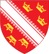
Landau, officially Landau in der Pfalz, is an autonomous (kreisfrei) town surrounded by the Südliche Weinstraße district of southern Rhineland-Palatinate, Germany. It is a university town, a long-standing cultural centre, and a market and shopping town, surrounded by vineyards and wine-growing villages of the Palatinate wine region. Landau lies east of the Palatinate forest, on the German Wine Route.

The Palatinate, or the Rhenish Palatinate (Rheinpfalz), is a historical region of Germany. The Palatinate occupies most of the southern quarter of the German federal state of Rhineland-Palatinate (Rheinland-Pfalz), covering an area of 2,105 square miles (5,450 km2) with about 1.4 million inhabitants. Its residents are known as Palatines (Pfälzer).

Alsace is a cultural region and a territorial collectivity in eastern France, on the west bank of the upper Rhine next to Germany and Switzerland. In January 2021, it had a population of 1,919,745. Alsatian culture is characterized by a blend of German and French influences.

Bas-Rhin is a département in Alsace which is a part of the Grand Est super-region of France. The name means 'Lower Rhine', referring to its lower altitude among the two French Rhine departments: it is downstream of the Haut-Rhin department. Both belong to the European Upper Rhine region. It is, with the Haut-Rhin, one of the two departments of the traditional Alsace region which until 1871, also included the area now known as the Territoire de Belfort. The more populous and densely populated of the pair, it had 1,152,662 inhabitants in 2021. The prefecture is based in Strasbourg. The INSEE and Post Code is 67.

Haut-Rhin is a département in the Grand Est region, France, bordering both Germany and Switzerland. It is named after the river Rhine. Its name means Upper Rhine. Haut-Rhin is the smaller and less populated of the two departments of the former administrative Alsace region, the other being the Bas-Rhin. Especially after the 1871 cession of the southern territory known since 1922 as Territoire de Belfort, although it is still rather densely populated compared to the rest of metropolitan France. It had a population of 767,083 in 2021.

In the Holy Roman Empire, the collective term free and imperial cities, briefly worded free imperial city, was used from the 15th century to denote a self-ruling city that had a certain amount of autonomy and was represented in the Imperial Diet.
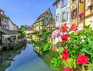
Colmar is a city and commune in the Haut-Rhin department and Alsace region of north-eastern France. The third-largest commune in Alsace, it is the seat of the prefecture of the Haut-Rhin department and of the subprefecture of the Colmar-Ribeauvillé arrondissement.

Mulhouse is a French city of the European Collectivity of Alsace. It is near the France–Switzerland border and France–Germany border. It is the largest city in Haut-Rhin and second largest in Alsace after Strasbourg.

Sélestat is a commune in the Grand Est region of France. An administrative division (sous-préfecture) of the Bas-Rhin department, the town lies on the Ill river, 17 kilometres (11 mi) from the Rhine and the German border. Sélestat is located between the largest communes of Alsace, Strasbourg and Mulhouse.

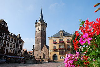
Turckheim is a commune in the Haut-Rhin department in Grand Est in north-eastern France. It lies west of Colmar, on the eastern slopes of the Vosges mountains.
Obernai is commune in the Bas-Rhin department in Alsace in north-eastern France. It lies on the eastern slopes of the Vosges mountains.

Rosheim is a commune in the Bas-Rhin department in Grand Est in north-eastern France.
Several leagues of cities became influential in the history of the Holy Roman Empire. Military alliance and mutual assistance strengthened the position of imperial cities, especially during the interregnum period of the 13th to 14th century.
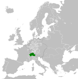
The Old Swiss Confederacy, also known as Switzerland or the Swiss Confederacy, was a loose confederation of independent small states, initially within the Holy Roman Empire. It is the precursor of the modern state of Switzerland.

The Wissembourg Gap is a corridor of open terrain, approximately six kilometres wide, between the hills of the Palatinate Forest to the west and the Bienwald forest to the east. It marks the border between the Palatinate to the north and Alsace to the south, and by extension between Germany and France. The Gap is dominated by the French town of Wissembourg, from which it takes its name. The average altitude of the land in the corridor rises from 150 metres by the Bienwald to 250 metres by the Palatinate Forest.

Seltz is a commune in the Bas-Rhin department of the Grand Est region in north-eastern France. It is located on the Sauer River near its confluence with the Rhine, opposite the German town of Rastatt.
The Battle of Ortenbach, also known as the Battle of Gengenbach, took place on 23 July 1678 during the closing stages of the 1672-1678 Franco-Dutch War, in the modern German state of Baden-Württemberg. It featured a French army commanded by François de Créquy and an Imperial force under Charles V, Duke of Lorraine.

The Province of Alsace was an administrative region of the Kingdom of France and one of the many provinces formed in the late 1600s. In 1648, the Landgraviate of Upper-Alsace was absorbed into the Kingdom of France and subsequently became the Province of Alsace, which it remain an integral part of for almost 150 years. In 1790, as a result of the decree dividing France into departments, the province was disestablished and split into three departments: Bas-Rhin, Haut-Rhin, and part of Moselle.

The Republic of Mulhouse was a Protestant associate of the Old Swiss Confederation in what is now eastern France.
Between the 16th and 18th centuries, Alsace and Lorraine, territories of the Holy Roman Empire located between the Meuse and Rhine rivers, were annexed by the Kingdom of France. Part of these same territories were annexed by the German Empire in the 19th century, then by the Third Reich in the 20th century, before returning to French rule at the end of World War II.