Daisy Lake (Thunder Bay District)

Last updated
Daisy Lake
Lake
Country Canada
Province Ontario
Region Northeastern Ontario
District Thunder Bay
Municipality Greenstone
Elevation 325 m (1,066 ft)
Coordinates 49°45′15″N87°29′09″W / 49.75417°N 87.48583°W / 49.75417; -87.48583 Coordinates: 49°45′15″N87°29′09″W / 49.75417°N 87.48583°W / 49.75417; -87.48583
Mouth Unnamed creek
 - coordinates 49°45′13″N87°29′16″W / 49.75361°N 87.48778°W / 49.75361; -87.48778
Length 500 m (1,640 ft)
Width 200 m (656 ft)
Canada Ontario location map 2.svg
Red pog.svg
Location of Daisy Lake in Ontario.

Daisy Lake is a small lake in the Lake Superior and Lake Nipigon drainage basins in the amalgamated town of Greenstone, Thunder Bay District in northeastern Ontario, Canada.

Lake A body of relatively still water, in a basin surrounded by land

A lake is an area filled with water, localized in a basin, that is surrounded by land, apart from any river or other outlet that serves to feed or drain the lake. Lakes lie on land and are not part of the ocean, and therefore are distinct from lagoons, and are also larger and deeper than ponds, though there are no official or scientific definitions. Lakes can be contrasted with rivers or streams, which are usually flowing. Most lakes are fed and drained by rivers and streams.
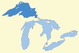
Lake Superior largest of the Great Lakes of North America

Lake Superior, the largest of the Great Lakes of North America, is also the world's largest freshwater lake by surface area, and the third largest freshwater lake by volume. The lake is shared by the Canadian province of Ontario to the north, the U.S. state of Minnesota to the west, and Wisconsin and the Upper Peninsula of Michigan to the south. The farthest north and west of the Great Lakes chain, Superior has the highest elevation of all five great lakes and drains into the St. Mary's River.

Lake Nipigon rift lake

Lake Nipigon is the largest lake entirely within the boundaries of the Canadian province of Ontario. It is part of the Great Lake drainage basin.

The lake is about 500 metres (1,640 ft) long and 200 metres (656 ft) wide, lies at an elevation of 325 metres (1,066 ft), and is located about 8 kilometres (5 mi) north of the community of Jellicoe on Ontario Highway 11. The primary inflow is an unnamed creek at the east, and the primary outflow is an unnamed creek at the west, which flows through Morham Lake to the Namewaminikan River, a tributary of Lake Nipigon.

King's Highway 11, commonly referred to as Highway 11, is a provincially maintained highway in the Canadian province of Ontario. At 1,784.9 kilometres (1,109.1 mi), it is the second longest highway in the province, following Highway 17. Highway 11 begins at Highway 400 in Barrie, and arches through northern Ontario to the Ontario–Minnesota border at Rainy River via Thunder Bay; the road continues as Minnesota State Highway 72 across the Baudette-Rainy River International Bridge. North and west of North Bay, Highway 11 forms part of the Trans-Canada Highway. The highway is also part of MOM's Way between Thunder Bay and Rainy River.

Related Research Articles

Shutze Lake lake in Canada

Schutze Lake is a lake in Kenora District in northwestern Ontario, Canada. It was named after Luther Schuetze, who carved his name on a tamarack tree without the c and e because there was not room for them.

Bitter Lake (Ontario) lake in Canada

Bitter Lake is a lake in the Trent River and Lake Ontario drainage basins located in the municipality of Dysart et al, Haliburton County, Ontario, Canada, about 15 kilometres (9 mi) northwest of the community of Haliburton.

The Whitesand River is a river in Thunder Bay District, Ontario, Canada, part of the Hewitson River system. Another river in Thunder Bay District with the same name, Whitesand River, lies further northwest and flows into Lake Nipigon.

Bolton Lake is a lake in the Moose River drainage basin in Timiskaming District, Ontario, Canada. It is about 640 metres (2,100 ft) long and 380 metres (1,247 ft) wide, and lies at an elevation of 357 metres (1,171 ft), 30 kilometres (19 mi) west southwest of the community of Matachewan. The primary inflow is an unnamed creek from Winding Lake, and the primary outflow is an unnamed creek to Lloyd Lake, which eventually flows into the Grassy River, and then the Mattagami River into the Moose River.

Snowshoe Lake is a lake in Thunder Bay District, Ontario, Canada, and part of the Lake Superior drainage basin. It is about 2.2 kilometres (1.4 mi) long and 1.9 kilometres (1.2 mi) wide, and lies at an elevation of 293 metres (961 ft). The primary inflow is an unnamed creek from Camel Read Lake, and primary outflow is an unnamed creek to Wabinosh Bay on Lake Nipigon which flows via the Nipigon River into Lake Superior.

Tripoli Lake is a lake in the Lake Superior drainage basin in Algoma District, northeastern Ontario, Canada. It is about 2.1 kilometres (1.3 mi) long and 0.9 kilometres (0.6 mi) wide and lies at an elevation of 422 metres (1,385 ft). The Canadian Pacific Railway transcontinental main line passes at the southwest tip of the lake.

West Tripoli Lake is a lake in the Lake Superior drainage basin in Algoma District, northeastern Ontario, Canada. It is about 2.5 kilometres (1.6 mi) long and 0.6 kilometres (0.4 mi) wide and lies at an elevation of 424 metres (1,391 ft). The Canadian Pacific Railway transcontinental main line passes at the northeast tip of the lake.

Summit Lake is a lake in Rainy River District, Ontario, Canada. It is about 790 metres (2,592 ft) long and 360 metres (1,181 ft) wide, and lies at an elevation of 380 metres (1,247 ft) about 18 kilometres (11 mi) southeast of the community of Nestor Falls. The lake is in the Nelson River system in the Hudson Bay drainage basin. There are no primary inflows, and the primary outflow, on the west side of the lake, is an unnamed creek west to Kishkutena Lake on the Sabaskong River, which flows into Lake of the Woods, and then via the Winnipeg River and Nelson River into Hudson Bay. The Height of Land portage runs from the north tip of the lake to Kishkutena Lake.

Summit Lake is a lake in Unorganized Thunder Bay District in Northwestern Ontario, Canada, about 75 kilometres (47 mi) northwest of the community of Nakina, and 22 kilometres (14 mi) northeast of the Auden and Ombabika stops on the Canadian National Railway transcontinental mainline.

Summit Lake is a lake in Timiskaming District, Ontario, Canada, about 7 kilometres (4 mi) southeast of the community of Latchford, and 250 metres (820 ft) north of the Johnson stop and settlement on the Ontario Northland Railway mainline, which runs along the entire east side of the lake. Highway 11 runs just west of the lake.

Summit Lake is a lake in the Madawaska Highlands in North Frontenac, Frontenac County, Ontario, Canada, about 3.5 kilometres (2.2 mi) northwest of the community of Ompah.

Casummit Lake (Ontario) lake in Canada

Casummit Lake is a lake in Kenora District, Ontario, Canada, about 110 kilometres (68 mi) northeast of the community of Red Lake. The settlement of Casummit and a mine are on the northeast shore of the lake. A fishing outfitter has a cabin on the north shore of the lake.

The Summit Lakes are a pair of lakes connected by a short creek in Nipissing District, Ontario, Canada, about 5 kilometres (3.1 mi) southeast of the community of Temagami. The Ontario Northland Railway mainline crosses the southern tip of the south lake on a trestle.

Gorrie Lake is a lake in Timiskaming District, Ontario, Canada, about 23 kilometres (14 mi) east of Temagami.

Daisy Lake (Greater Sudbury)

Daisy Lake is a lake in the city of Greater Sudbury in northeastern Ontario, Canada. It is in the Lake Huron drainage basin and is the source of the Whitefish River.

Daisy Lake (Algoma District) lake in Canada

Daisy Lake is a lake in the Lake Superior drainage basin in the Unorganized North Part of Algoma District in northeastern Ontario, Canada.

Daisy Lake (Nipissing District)

Daisy Lake is a lake in the geographic townships of Butt and McCraney in the Unorganized South Part of Nipissing District, Ontario, Canada. The lake is in the Ottawa River drainage basin and is entirely within Algonquin Provincial Park.

Daisy Lake is a lake in the Arctic Ocean and Great Slave Lake drainage basins in South Slave Region, Northwest Territories, Canada.

Bobs Lake (Timmins)

Bobs Lake is a lake in the James Bay and Abitibi River drainage basins in the city of Timmins, Cochrane District in northeastern Ontario, Canada.

Grand Lake (Timiskaming)

Grand Lake is a lake in the Ottawa River drainage basin in the Unorganized West Part of Timiskaming District in Northeastern Ontario, Canada.

References

The Department of Natural Resources, operating under the FIP applied title Natural Resources Canada (NRCan), is the ministry of the government of Canada responsible for natural resources, energy, minerals and metals, forests, earth sciences, mapping and remote sensing. It was created in 1995 by amalgamating the now-defunct Departments of Energy, Mines and Resources and Forestry. Natural Resources Canada (NRCan) works to ensure the responsible development of Canada's natural resources, including energy, forests, minerals and metals. NRCan also uses its expertise in earth sciences to build and maintain an up-to-date knowledge base of our landmass and resources. To promote internal collaboration, NRCan has implemented a departmental wide wiki based on MediaWiki. Natural Resources Canada also collaborates with American and Mexican government scientists, along with the Commission for Environmental Cooperation, to produce the North American Environmental Atlas, which is used to depict and track environmental issues for a continental perspective.

The Atlas of Canada is an online atlas published by Natural Resources Canada that has information on every city, town, village, and hamlet in Canada. It was originally a print atlas, with its first edition being published in 1906 by geographer James White and a team of 20 cartographers. Much of the geospatial data used in the atlas is available for download and commercial re-use from the Atlas of Canada site or from GeoGratis. Information used to develop the atlas is used in conjunction with information from Mexico and the United States to produce collaborative continental-scale tools such as the North American Environmental Atlas.