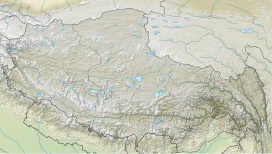
The McMahon Line is the boundary between Tibet and British India as agreed in the maps and notes exchanged by the respective plenipotentiaries on 24–25 March 1914 at Delhi, as part of the 1914 Simla Convention. The line delimited the respective spheres of influence of the two countries in the eastern Himalayan region along northeast India and northern Burma (Myanmar), which were earlier undefined. The Republic of China was not a party to the McMahon Line agreement, but the line was part of the overall boundary of Tibet defined in the Simla Convention, initialled by all three parties and later repudiated by the government of China. The Indian part of the Line currently serves as the de facto boundary between China and India, although its legal status is disputed by the People's Republic of China. The Burmese part of the Line was renegotiated by the People's Republic of China and Myanmar.
Kora is a transliteration of a Tibetan word that means "circumambulation" or "revolution". Kora is both a type of pilgrimage and a type of meditative practice in the Tibetan Buddhist or Bon traditions. A Kora is performed by the practitioner making a circumambulation around a sacred site or object, typically as a constituent part of a pilgrimage, ceremony, celebration or ritual. In broader terms, it is a term that is often used to refer to the entire pilgrimage experience in the Tibetan regions.

Lhünzê County is a county of Shannan located in the south-east of the Tibet Autonomous Region, China. "Lhünzê" means "self-existing pinnacle" in Tibetan. Part of Lhünzê County is claimed by India as part of Arunachal Pradesh, which is a disputed area between China and India.
Yume or Yümé, also spelt Yümai (Tibetan: ཡུལ་སྨད་, Wylie: yul smad, THL: yül mé), is a township in the Lhuntse County in Tibet region of China. Yume is on the bank of the Yume Chu river, a tributary of the Subansiri River, which it joins the China–India border close to Taksing. The township is part of the Tsari district, considered holy by Tibetans.
The East Bodish languages are a small group of non-Tibetic Bodish languages spoken in eastern Bhutan and adjacent areas of Tibet and India. They include:

The Subansiri is a trans-Himalayan river and a tributary of the Brahmaputra River that flows through Tibet's Lhuntse County in the Shannan Prefecture, and the Indian states of Arunachal Pradesh and Assam. The Subansiri is approximately 518 kilometres (322 mi) long, with a drainage basin 32,640 square kilometres (12,600 sq mi). It is the largest tributary of the Brahmaputra contributing 7.92% of the Brahmaputra's total flow.

Arunachal Pradesh is primarily a hilly tract nestled in the foothills of the Himalayas in northeast India. It is spread over an area of 83,743 km2 (32,333 sq mi). 98% of the geographical area is land out of which 80% is forest cover; 2% is water. River systems in the region, including those from the higher Himalayas and Patkoi and Arakan Ranges, eventually drain into the Brahmaputra River.

Demchok , previously called New Demchok, and called Parigas by the Chinese, is a village and military encampment in the Indian-administered Demchok sector, that is disputed between India and China. It is administered as part of the Nyoma tehsil in the Leh district of Ladakh by India, and claimed by China as part of the Tibet Autonomous Region.
The Charding Nullah, traditionally known as the Lhari stream and called Demchok River by China, is a small river that originates near the Charding La pass that is also on the border between the two countries and flows northeast to join the Indus River near a peak called "Demchok Karpo" or "Lhari Karpo". There are villages on both sides of the mouth of the river called by the same name "Demchok", which is presumed to have been a single village originally, and has gotten split into two due to geopolitcal reasons. The river serves as the de facto border between China and India in the southern part of the Demchok sector.
The Demchok sector is a disputed area named after the villages of Demchok in Ladakh and Demchok in Tibet, situated near the confluence of the Charding Nullah and Indus River. It is a part of the greater Sino-Indian border dispute between China and India. Both China and India claim the disputed region, with a Line of Actual Control between the two nations situated along the Charding Nullah.
Demchok, was described by a British boundary commission in 1847 as a village lying on the border between the Kingdom of Ladakh and the Tibet. It was a "hamlet of half a dozen huts and tents", divided into two parts by a rivulet which formed the boundary between the two states. The rivulet, a tributary of the Indus River variously called the Demchok River, Charding Nullah, or the Lhari stream, was set as the boundary between Ladakh and Tibet in the 1684 Treaty of Tingmosgang. By 1904–05, the Tibetan side of the hamlet was said to have had 8 to 9 huts of zamindars (landholders), while the Ladakhi side had two. The area of the former Demchok now straddles the Line of Actual Control, the effective border of the People's Republic of China's Tibet Autonomous Region and the Republic of India's Ladakh Union Territory.
Migyitun, also called Tsari or Zhari, is a town in the Lhöntse County of Tibet's Shannan Prefecture. It is on the banks of the Tsari Chu river close to the McMahon Line, the de facto border with India's Arunachal Pradesh. It is also a key part of the Buddhist Tsari pilgrimage, made once in twelve years, that makes a wide circumambulation of the Dakpa Sheri mountain.

The Tibet–Nepal salt trade route is an ancient salt trading route running between the Tibetan Plateau and the Middle Hills of Nepal and further on to India. After the annexation of Tibet by China in 1950 and the Sino-Indian War in 1962, patterns of trade changed and the use of the old trading route between India and Tibet dwindled and the salt-carrying caravans became redundant.
Barahoti, also called Wu-Je or Wure, located in the 'middle sector' of the disputed Sino-Indian border, is a 1.5 square miles (3.9 km2) sloping plain situated in the Indian state of Uttarakhand, Chamoli district. It is disputed by China, which also disputes a 750 square kilometres (290 sq mi) area surrounding it. The entire disputed area also goes by the name "Barahoti", or sometimes "Barahoti–Sangchamalla–Lapthal disputed area". The entire area is on the Ganges side of the Sutlej–Ganges water divide, which is also the current Line of Actual Control between India and China.

Gelemo or Gelomo (full name: Gelomoring) is a border village in the Upper Subansiri district, Arunachal Pradesh, India. It is on the bank of the Tsari Chu river before its confluence with the Subansiri River, at a distance of "two days march" from the Indian claimed border at Longju. The present Line of Actual Control between China and India is at roughly half that distance.
Taksing is a village and headquarters of an eponymous Circle in the Upper Subansiri district, Arunachal Pradesh, India. The region of Taksing is populated by Tagin people.
Longju or Longzu is a disputed area in the eastern sector of the China–India border, controlled by China but claimed by India. The village of Longju is located in the Tsari Chu valley 2.5 kilometres (1.6 mi) south of the town of Migyitun, considered the historical border of Tibet. The area of Longju southwards is populated by the Tagin tribe of Arunachal Pradesh.
Gelensiniak, or Geling Sinyik, is a village in the Limeking Circle of the Upper Subansiri district in Arunachal Pradesh, India, close to the region's border with Tibet. The Gelen or Gelling river flows down from Migyitun and Longju and joins the Subansiri River here. Gelensiniak is strategically located between Longju, Taksing and Limeking. The region is populated by the Mara clan of Tagin people.
Asaphila or Asafila is a mountainous forest area near the China–India border along the Subansiri River valley. It is at the southwestern corner of the Tsari region, straddling Lhünzê County in the Shannan Prefecture of Tibet, and the Taksing Circle in the Upper Subansiri district of Arunachal Pradesh, India. Occasional border disputes between the two countries in the region are reported.
Tulung La (Tibetan: ཐུ་ལུང་ལ་, Wylie: thu lung la) is a border pass between the Tsona County in the Tibet region of China and India's Tawang district in Arunachal Pradesh. It is in the eastern part of the two districts, close to the Gori Chen cluster of mountains, on a watershed between the Tsona Chu river in Tibet and the Tawang Chu in the Tawang district. The watershed ridge forms the border between Tibet and India as per the McMahon Line. Tulung La provided an invasion route to China during the 1962 Sino-Indian War. It is also the scene of occasional clashes between the two sides.