Daniell Peninsula

Last updated

Daniell Peninsula ( 72°50′S169°35′E / 72.833°S 169.583°E / -72.833; 169.583 ) is the large peninsula between Cape Daniell and Cape Jones on the coast of Victoria Land, Antarctica. It is an elongated basalt dome similar to Adare Peninsula and Hallett Peninsula and rises to 2,000 metres (6,600 ft). It is partly separated from the Victory Mountains by Whitehall Glacier, which is afloat in its lower reaches, but is joined to these mountains by the higher land in the vicinity of Mount Prior. It was named by the New Zealand Geological Survey Antarctic Expedition (NZGSAE), 1957–58, after Cape Daniell, and by analogy with the Adare and Hallett peninsulas. [1]

Contents

Geology

The Daniell Peninsula consists of at least four overlapping shield volcanoes that form part of the Hallett Volcanic Province of the McMurdo Volcanic Group. [2] [3] Mount Brewster forms the central portion of the Daniell Peninsula and rises to an elevation of 2,026 m (6,647 ft), forming the highest point on the peninsula. [3] K–Ar or Rb–Sr dating has given an age of 12.4 ± 0.2 million years for Mount Brewster pantelleritic trachyte and an age of 6.9 ± 0.3 million years for Mount Brewster hawaiite lava. [4]

A second shield volcano forming the southern end of the peninsula is deeply dissected by the Mandible Cirque. It contains the small satellite vent of Tousled Peak and the prominent ice-draped cone-like peak of Mount Lubbock. [3] A dike cutting Mandible Cirque comenditic trachyte has given an age of 9.5 ± 0.1 million years. [4]

The Cape Daniell shield volcano at the northern end of the Daniell Peninsula has an elevation of 1,910 m (6,270 ft), with its highest point being an unnamed peak. The summit area contains a flat region several kilometres wide that might be a small ice-filled caldera. [3] Cape Daniell trachyte lava has an age of 5.8 ± 0.1 million years while Cape Daniell benmoreite lava has an age of 5.6 ± 0.5 million years. [4]

Geography

North of peninsula in south of map C72189s1 Ant.Map Cape Hallet.jpg
North of peninsula in south of map
South of peninsula in north of map C73189s1 Ant.Map Coulman Island.jpg
South of peninsula in north of map

The Daniell Peninsula extends along the west coast of the Ross Sea to the east of the Victory Mountains. The Borchgrevink Glacier flows down the southwestern coast of the peninsula, from which it is fed by the Langevad Glacier and the Bargh Glacier. [5] Mount Prior looks over the point where the Humphries Glacier flowing southwest joins the Borchgrevink Glacier. The Humphries Glacier is saddled with the Whitehall Glacier, which flows north from below Mount Brewster along the east coast of the peninsula to enter Tucker Inlet at the north of the peninsula. [6] Cape Jones is the southernmost point of the Peninsula. North of Cape Jones are Mount Lubbock, Touried Peak, Narrow Neck, the Mandible Cirque and Cape Phillips. [5] Cape Daniell on the northeast of the peninsula marks the mouth of the Tucker Inlet, opposite Cape Wheatstone on the Hallett Peninsula to the north. [6]

Features

Named features of the Daniell Peninsula include:

Mount Prior

72°58′S168°47′E / 72.967°S 168.783°E / -72.967; 168.783 . A mountain, 1,220 metres (4,000 ft) high, about 10 nautical miles (19 km; 12 mi) west of Mount Brewster, rising at the head of Whitehall Glacier in the west part of Daniell Peninsula. Named by New Zealand Geological Survey Antarctic Expedition (NZGSAE), 1957–58, for George T. Prior of the Mineral Department, British Museum, who studied and analyzed the rocks obtained from this region by the British National Antarctic Expedition (BrNAE), 1901-04. [7]

Mount Brewster

David Brewster David Brewster 1618.jpg
David Brewster

72°57′S169°23′E / 72.950°S 169.383°E / -72.950; 169.383 . A small peak, 2,025 metres (6,644 ft) high, that rises above the general level of the central part of Daniell Peninsula and marks its greatest elevation. Named in 1841 by Sir James Clark Ross for Sir David Brewster, Scottish physicist. [8]

Cape Jones

73°17′S169°13′E / 73.283°S 169.217°E / -73.283; 169.217 . The cape lying immediately southeast of Mount Lubbock and marking the south tip of Daniell Peninsula. Discovered in January 1841 by Sir James Clark Ross who named it for Captain William Jones, Royal Navy. [9]

Mount Lubbock

73°13′S169°08′E / 73.217°S 169.133°E / -73.217; 169.133 . A coastal peak, 1,630 metres (5,350 ft) high, rising immediately north of Cape Jones at the south end of Daniell Peninsula. Discovered in January 1841 by Sir James Clark Ross who named it for Sir John Lubbock, treasurer of the Royal Society. [10]

Touried Peak

73°11′S169°01′E / 73.183°S 169.017°E / -73.183; 169.017 . Small ice-covered peak, 1,220 metres (4,000 ft) high, situated 3.5 nautical miles (6.5 km; 4.0 mi) northwest of the summit of Mount Lubbock in the south end of Daniell Peninsula, Victoria Land. The name given by New Zealand Antarctic Place Names Committee (NZ-APC) in 1966 is descriptive of the exceptionally broken ice summit. [11]

Narrow Neck

73°06′S169°03′E / 73.100°S 169.050°E / -73.100; 169.050 . A narrow, but elevated isthmus or neck of land between Langevad Glacier and Mandible Cirque in the south part of Daniell Peninsula. The feature serves to join Tousled Peak and the Mount Lubbock vicinity to the main mass of Daniell Peninsula. The descriptive name was applied by NZ-APC in 1966. [12]

Mandible Cirque

73°07′S169°15′E / 73.117°S 169.250°E / -73.117; 169.250 . A spectacular cirque indenting the coast of Daniell Peninsula 5 nautical miles (9.3 km; 5.8 mi) west-southwest of Cape Phillips. Named in 1966 by the NZ-APC for its appearance in plan and oblique views. [13]

Cape Phillips

73°04′S169°36′E / 73.067°S 169.600°E / -73.067; 169.600 . A cape approximately midway along the east side of Daniell Peninsula, 8 nautical miles (15 km; 9.2 mi) southeast of Mount Brewster. Discovered in January 1841 by Sir James Clark Ross who named it for Lieutenant Charles G. Phillips of the Terror. [14]

Cape Daniell

72°43′S169°55′E / 72.717°S 169.917°E / -72.717; 169.917 . A cape at the northeast extremity of Daniell Peninsula which marks the south side of the entrance to Tucker Inlet. Discovered, January 15, 1841, by Sir James Clark Ross who named it for Professor John Frederic Daniell, chemist of King's College, Cambridge University, and Foreign Secretary of the Royal Society. [1]

Related Research Articles

Skelton Glacier is a large glacier flowing from the polar plateau into the Ross Ice Shelf at Skelton Inlet on the Hillary Coast, south of Victoria Land, Antarctica.

The Cook Mountains is a group of mountains bounded by the Mulock and Darwin glaciers in Antarctica.

The Supporters Range is a rugged range in the Queen Maud Mountains of Antarctica. It is 25 nautical miles long, bordering the eastern side of Mill Glacier, from Keltie Glacier in the north to Mill Stream Glacier in the south. So named by the New Zealand Geological Survey Antarctic Expedition (NZGSAE) (1961–62) because several peaks of the range are named after supporters of Ernest Shackleton's British Antarctic Expedition (1907–09).

The Prince Olav Mountains is a mountain group in the Queen Maud Mountains in Antarctica stretching from Shackleton Glacier to Liv Glacier at the head of the Ross Ice Shelf.

Tucker Glacier is a major valley glacier of Victoria Land, Antarctica, about 90 nautical miles long, flowing southeast between the Admiralty Mountains and the Victory Mountains to the Ross Sea. There is a snow saddle at the glacier's head, just west of Homerun Range, from which the Ebbe Glacier flows northwestward.

<span class="mw-page-title-main">Coulman Island</span> Island in Ross Dependency, Antarctica

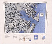
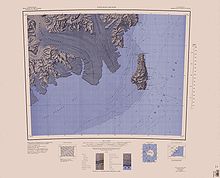
Coulman Island is an island 18 nautical miles long and 8 nautical miles wide, lying 9 nautical miles southeast of Cape Jones, Victoria Land, Antarctica, in the western Ross Sea. It was discovered in 1841 by Sir James Clark Ross who named it for his father-in-law, Thomas Coulman.

Borchgrevink Glacier is a large glacier in the Victory Mountains, Victoria Land, Antarctica. It drains south between Malta Plateau and Daniell Peninsula, and thence projects into Glacier Strait, Ross Sea, as a floating glacier tongue.

The Mariner Glacier is a major glacier over 60 nautical miles long, descending southeast from the plateau of Victoria Land, Antarctica, between Mountaineer Range and Malta Plateau, and terminating at Lady Newnes Bay, Ross Sea, where it forms the floating Mariner Glacier Tongue.

Lady Newnes Bay is a bay about 60 nautical miles long in the western Ross Sea, extending along the coast of Victoria Land from Cape Sibbald to Coulman Island.

Surveyors Range is a 30 miles (48 km) long mountain range in the Churchill Mountains of Antarctica.

<span class="mw-page-title-main">Adare Peninsula</span> Mountain in Ross Dependency, Antarctica

The Adare Peninsula, is a high ice-covered peninsula, 40 nautical miles long, in the northeast part of Victoria Land, extending south from Cape Adare to Cape Roget. The peninsula was named by the New Zealand Antarctic Place-Names Committee (NZ-APC) for Cape Adare. The peninsula is considered the southernmost point of the Borchgrevink Coast, named for Carsten Borchgrevink (1864-1934).

Wood Bay is a large bay which is bounded by Cape Johnson and Aviator Glacier Tongue on the north, and Cape Washington on the south, along the coast of Victoria Land, Antarctica. It was discovered in 1841 by Captain James Clark Ross, Royal Navy, and named by him for Lieutenant James F.L. Wood of the ship HMS Erebus.

<span class="mw-page-title-main">Robertson Bay</span>

Robertson Bay is a large, roughly triangular bay that indents the north coast of Victoria Land between Cape Barrow and Cape Adare. Discovered in 1841 by Captain James Clark Ross, Royal Navy, who named it for Dr. John Robertson, surgeon on HMS Terror.

The Nash Range is a mainly ice-covered coastal range in the Churchill Mountains of Antarctica.

Moubray Bay is a bay in the western Ross Sea, indenting the coast of Victoria Land, Antarctica, between Cape Roget and Cape Hallett. It was discovered in 1841 by Sir James Clark Ross and named by him for George H. Moubray, clerk in charge of the expedition ship Terror.

<span class="mw-page-title-main">Hallett Peninsula</span>

Hallett Peninsula is a triangular, dome-shaped peninsula, 20 nautical miles long, with 1,500 metres (4,900 ft) cliffs on its eastern seaboard side and 300 metres (980 ft) on its west side. The peninsula extends from Cape Hallett to Cape Wheatstone and is joined to the mainland by a narrow ridge between Tucker Glacier and Edisto Inlet. It was so named by the New Zealand Geological Survey Antarctic Expedition (NZGSAE), 1957–58, because Hallett Station on Seabee Hook was established at the north end of the peninsula.

<span class="mw-page-title-main">Mandible Cirque</span> Cirque of Antarctica

Mandible Cirque is a cirque indenting the coast of Daniell Peninsula 8 km (5.0 mi) west-south-west of Cape Phillips, in Victoria Land, Antarctica. It was named in 1966 by the New Zealand Antarctic Place-Names Committee for its appearance in plan and oblique views suggestive of a mandible.

The Holland Range is a rugged coastal mountain range in the Ross Dependency, Antarctica, on the west coast of the Ross Ice Shelf. It is about 60 nautical miles (110 km) long.

The Lillie Range in Antarctica extends northward from the Prince Olav Mountains to the Ross Ice Shelf. Mounts Hall, Daniel, Krebs and Mason are in the range.

Quetin Head is a rock headland 3.5 nautical miles (6.5 km) southwest of Cape Phillips, Daniell Peninsula, Borchgrevink Coast. The headland rises to 900 m and marks the eastern extent of Mandible Cirque. Named by the Advisory Committee on Antarctic Names in 2005 after Langdon B. Quetin and Robin Macurda Ross-Quetin, Marine Science Institute, University of California, Santa Barbara, collaborators in United States Antarctic Program ecological research in the Southern Ocean for 14 field seasons, from 1991 to 2004.

References

  1. 1 2 Alberts 1995, p. 172.
  2. Riffenburgh, Beau (2007). Encyclopedia of the Antarctic. Vol. 1. Taylor & Francis. p. 639. ISBN   0-415-97024-5.
  3. 1 2 3 4 Smellie, J. L.; Rocchi, S.; Armienti, P. (2011). "Late Miocene volcanic sequences in northern Victoria Land, Antarctica: products of glaciovolcanic eruptions under different thermal regimes". Bulletin of Volcanology . Springer: 4, 5. ISSN   0258-8900.
  4. 1 2 3 "K/Ar and Rb/Sr dating of McMurdo Volcanic Group (north of Campbell Glacier)" (PDF). Geological Society of America. p. 1.
  5. 1 2 Coulman Island USGS.
  6. 1 2 Cape Hallet USGS.
  7. Alberts 1995, p. 592.
  8. Alberts 1995, pp. 92–93.
  9. Alberts 1995, p. 376.
  10. Alberts 1995, p. 446.
  11. Alberts 1995, p. 755.
  12. Alberts 1995, p. 517.
  13. Alberts 1995, p. 458.
  14. Alberts 1995, p. 573.

Sources

PD-icon.svg This article incorporates public domain material from websites or documents of the United States Geological Survey .