Danville, Missouri

Last updated

Danville, Missouri
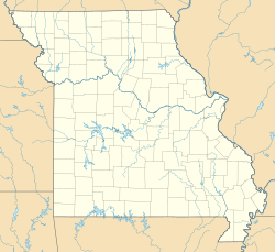
USA Missouri location map.svg
Red pog.svg
Danville
Usa edcp location map.svg
Red pog.svg
Danville
Coordinates: 38°54′45″N91°31′57″W / 38.91250°N 91.53250°W / 38.91250; -91.53250
Country United States
State Missouri
County Montgomery
Area
[1]
 • Total
0.38 sq mi (0.99 km2)
 • Land0.38 sq mi (0.98 km2)
 • Water0.0039 sq mi (0.01 km2)
Elevation
[2]
804 ft (245 m)
Population
 (2020) [3]
 • Total
28
 • Density74.2/sq mi (28.65/km2)
ZIP Code
63361
FIPS code 29-18190
GNIS feature ID2587062 [2]

Danville is an unincorporated community and census-designated place in Montgomery County, in the U.S. state of Missouri. [2] As of the 2020 census, it had a population of 28. [3]

Contents

History

Danville was laid out in 1834 and named after Danville, Virginia, the native home of an early settler. [4] A post office at Danville was established in 1834, and remained in operation until 1942. [5]

Geography

According to the U.S. Census Bureau, the Danville CDP has a total area of 0.38 square miles (0.98 km2), of which 0.006 square miles (0.016 km2), or 1.57%, are water. [1] The community sits on a ridge which drains north to Rumbo Branch and south to Sallee Branch, both west-flowing tributaries of the Loutre River, part of the Missouri River watershed.

Demographics

Historical population
CensusPop.Note%±
2010 34—
2020 28−17.6%
U.S. Decennial Census [6]

Education

It is in the Montgomery County R-II School District. [7]

References

  1. 1 2 "2023 U.S. Gazetteer Files: Missouri". United States Census Bureau. Retrieved May 9, 2024.
  2. 1 2 3 U.S. Geological Survey Geographic Names Information System: Danville, Missouri
  3. 1 2 "P1. Race – Danville CDP, Missouri: 2020 DEC Redistricting Data (PL 94-171)". U.S. Census Bureau. Retrieved May 9, 2024.
  4. ↑ "Montgomery County Place Names, 1928–1945". The State Historical Society of Missouri. Archived from the original on June 24, 2016. Retrieved November 11, 2016.
  5. ↑ "Post Offices". Jim Forte Postal History. Retrieved November 11, 2016.
  6. ↑ "Census of Population and Housing". Census.gov. Retrieved June 4, 2016.
  7. ↑ Geography Division (January 12, 2021). 2020 CENSUS - SCHOOL DISTRICT REFERENCE MAP: Montgomery County, MO (PDF) (Map). U.S. Census Bureau . Retrieved June 10, 2025. - Text list