Dashtak, Marvdasht

Last updated
Dashtak
دشتك
village
Iran location map.svg
Red pog.svg
Dashtak
Coordinates: 30°17′24″N52°28′11″E / 30.29000°N 52.46972°E / 30.29000; 52.46972 Coordinates: 30°17′24″N52°28′11″E / 30.29000°N 52.46972°E / 30.29000; 52.46972
Country Flag of Iran.svg  Iran
Province Fars
County Marvdasht
Bakhsh Dorudzan
Rural District Dorudzan
Population (2006)
  Total 2,109
Time zone IRST (UTC+3:30)
  Summer (DST) IRDT (UTC+4:30)

Dashtak (Persian : دشتك) [1] is a village in Dorudzan Rural District, Dorudzan District, Marvdasht County, Fars Province, Iran. At the 2006 census, its population was 2,109, in 542 families. [2]

Persian language Western Iranian language

Persian, also known by its endonym Farsi, is one of the Western Iranian languages within the Indo-Iranian branch of the Indo-European language family. It is primarily spoken in Iran, Afghanistan, and Tajikistan, Uzbekistan and some other regions which historically were Persianate societies and considered part of Greater Iran. It is written right to left in the Persian alphabet, a modified variant of the Arabic script.

Dorudzan Rural District is a rural district (dehestan) in Dorudzan District, Marvdasht County, Fars Province, Iran. At the 2006 census, its population was 11,470, in 2,683 families. The rural district has 15 villages.

Dorudzan District is a district (bakhsh) in Marvdasht County, Fars Province, Iran. At the 2006 census, its population was 38,801, in 8,867 families. The District has one city: Ramjerd. The District has three rural districts (dehestan): Abarj Rural District, Dorudzan Rural District, and Ramjerd-e Do Rural District.

Contents

History

DASHTAK in mountain gorge in the north plains DASHTAK been Doroodzan. The village is 2040 meters height above sea level and the climate is temperate in the spring and summer and in the fall and cold winter. Remnants of the Achaemenid period DASHTAK left in the village and on the formation of the village on the old cemetery inscription DASHTAK, to the seventh century AH is concerned. [3]

Plain Extensive flat region that generally does not vary much in elevation

In geography, a plain is a flat, sweeping landmass that generally does not change much in elevation. Plains occur as lowlands along the bottoms of valleys or on the doorsteps of mountains, as coastal plains, and as plateaus or uplands.

Climate Statistics of weather conditions in a given region over long periods

Climate is the statistics of weather over long periods of time. It is measured by assessing the patterns of variation in temperature, humidity, atmospheric pressure, wind, precipitation, atmospheric particle count and other meteorological variables in a given region over long periods of time. Climate differs from weather, in that weather only describes the short-term conditions of these variables in a given region.

Village Small clustered human settlement smaller than a town

A village is a clustered human settlement or community, larger than a hamlet but smaller than a town, with a population ranging from a few hundred to a few thousand. Though villages are often located in rural areas, the term urban village is also applied to certain urban neighborhoods. Villages are normally permanent, with fixed dwellings; however, transient villages can occur. Further, the dwellings of a village are fairly close to one another, not scattered broadly over the landscape, as a dispersed settlement.

People

DASHTAK village Dashtaki speak in Farsi accent, Muslims and followers of the Shia Jafari. Activity majority DASHTAK village, horticulture and animal husbandry. The group's service activities and handicraft production, including Shoemaker embroidery, carpet weaving and carpet weaving process. Village garden products include walnuts, grapes, pomegranate, almond and meat, dairy products and wool from the village livestock products. Beekeeping and honey production to new and traditional methods are common.

Garden planned space set aside for the display, cultivation, and enjoyment of plants

A garden is a planned space, usually outdoors, set aside for the display, cultivation, or enjoyment of plants and other forms of nature. The garden can incorporate both natural and man-made materials. The most common form today is known as a residential garden, but the term garden has traditionally been a more general one. Zoos, which display wild animals in simulated natural habitats, were formerly called zoological gardens. Western gardens are almost universally based on plants, with garden often signifying a shortened form of botanical garden. Some traditional types of eastern gardens, such as Zen gardens, use plants sparsely or not at all.

Topography

DASHTAK village located in the mountain range and its physical context, following the slope of the seating, the stepped shaped. Rural road network as a communication artery irregular pattern based on people's needs and limitations of topography, shape and most of the roads are winding, narrow is irregular. Old house village of stone and mud brick built and has stair arrangement itself has a beautiful village. DASHTAK mountain village, with a temperate climate, forest cover, extensive gardens, abundant spring Saran, beautiful waterfalls and landscapes hospitable heart, especially in spring and summer, provide awesome space for the viewer. DASHTAK village looks very impressive staircase architecture as it has. [4]

Topography The study of the shape and features of the surface of the Earth and other observable astronomical objects

Topography is the study of the shape and features of land surfaces. The topography of an area could refer to the surface shapes and features themselves, or a description.

Tourist areas

According to the Public Relations Department of the Cultural Heritage, Handicrafts and Tourism Organization of Fars, old plane trees village, one of the oldest trees in Iran and the world in general. The tree height is raised at the core of the village, according to some paleontologists natural, dating back four thousand years. Fakhruddin shrine, the shrine revered buildings in the village. One of the interesting works, DASHTAK village, the staircase is named Cattell. 1,200 stairs and through it to the rest of the movement were in the past. The old mill village, consisting of 6 old mill that has been used in the past the old mill village DASHTAK is a sign of cultural and historical monuments. Spas Khnar, Nhrvm, Morshedi, Bgry, ten times, the valley and the spa waters are healing. Natural attractions are DASHTAK village and also grabbed Willow Springs Water Chghvr, garden Jamal (Babajmal), three wells, the Bidi, narrow tail, Bidak, Abdv, Grdvk, Tdk, Baghak, Swivel and spring flowers Jshmh beautiful Saran is located in the mountains around the village are DASHTAK. [5]

A ministry is a governmental organisation, headed by a minister, that is meant to manage a specific sector of public administration. Governments may have differing numbers and types of ministries, but the Brockhaus and Efron Encyclopedic Dictionary notes that all states have a Ministry of Interior, a Ministry of Foreign Affairs, a Ministry of Defense, a Ministry of Justice and a Ministry of Finance. A Ministry of Education or similar is also commonly present.

Fars Province Province in Region 2, Iran

Fars Province also known as Pars or Persia in the Greek sources in historical context, is one of the thirty-one provinces of Iran and known as the cultural capital of the country. It is in the south of the country, in Iran's Region 2, and its administrative center is Shiraz. It has an area of 122,400 km². In 2011, this province had a population of 4.6 million people, of which 67.6% were registered as urban dwellers (urban/suburbs), 32.1% villagers, and 0.3% nomad tribes. The etymology of the word Persian, found in many ancient names associated with Iran, is derived from the historical importance of this region. Fars Province is the original homeland of the Persian people.

Stairs construction designed to bridge a large vertical distance by dividing it into smaller vertical distances

A stairway, staircase, stairwell, flight of stairs, or simply stairs, is a construction designed to bridge a large vertical distance by dividing it into smaller vertical distances, called steps. Stairs may be straight, round, or may consist of two or more straight pieces connected at angles.

Customs

Shoemaker weaving, rug and carpet weaving craft village is Dashtak. Nine local game play and kicking game is common among people Dashtak village. Folk music Dashtak people also often played with reeds and local melodies as sung and played Shoshtari. Local clothing DASHTAK beautiful designs and happiness of the people of the village. [6]

A people is a plurality of persons considered as a whole, as is the case with an ethnic group or nation, but that is distinct from a nation which is more abstract, and more overtly political. Collectively, for example, the contemporary Frisians and Danes are two related Germanic peoples, while various Middle Eastern ethnic groups are often linguistically categorized as Semitic peoples.

Related Research Articles

Shiraz City in Fars, Iran

Shiraz is the fifth-most-populous city of Iran and the capital of Fars Province. At the 2016 census, the population of the city was 1,869,001 and its built-up area with "Shahr-e Jadid-e Sadra" was home to 1,565,572 inhabitants. Shiraz is located in the southwest of Iran on the "Rudkhaneye Khoshk" seasonal river. It has a moderate climate and has been a regional trade center for over a thousand years. Shiraz is one of the oldest cities of ancient Persia.
Nishapur City in Razavi Khorasan Province, Iran

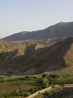
Nishapur or Nishabur is a city in Razavi Khorasan Province, capital of the Nishapur County and former capital of Province Khorasan, in northeastern Iran, situated in a fertile plain at the foot of the Binalud Mountains. It had an estimated population of 239,185 as of 2011 and its county 433,105. Nearby are the turquoise mines that have supplied the world with turquoise for at least two millennia. The city was founded in the 3rd century by Shapur I as a Sasanian satrapy capital. Nishapur later became the capital of Tahirid dynasty and was reformed by Abdullah Tahir in 830, and was later selected as the capital of Seljuq dynasty by Tughril in 1037. From the Abbasid era to the Mongol invasion of Khwarezmia and Eastern Iran, the city evolved into a significant cultural, commercial, and intellectual center within the Islamic world. Nishapur, along with Merv, Herat and Balkh were one of the four great cities of Greater Khorasan and one of the greatest cities in the middle ages, a seat of governmental power in eastern of caliphate, a dwelling place for diverse ethnic and religious groups, a trading stop on commercial routes from Transoxiana and China, Iraq and Egypt.

Kerman City in Iran

Kerman is the capital city of Kerman Province, Iran. At the 2011 census, its population was 821,374, in 221,389 households, making it the 10th most populous city of Iran.

Persian carpet type of handmade carpet

A Persian carpet or Persian rug, also known as Iranian carpet, is a heavy textile made for a wide variety of utilitarian and symbolic purposes and produced in Iran, for home use, local sale, and export. Carpet weaving is an essential part of Persian culture and Iranian art. Within the group of Oriental rugs produced by the countries of the so-called "rug belt", the Persian carpet stands out by the variety and elaborateness of its manifold designs.

Khachmaz District City in Azerbaijan

Khachmaz is one of administrative divisions of Azerbaijan. It is located about 10 km from the Caspian Sea, below Khudat, and to the east of Quba. Khachmaz is 170 kilometres north of the capital Baku. The Khachmaz rayon borders the Republic of Dagestan of the Russian Federation.

Bandar Torkaman City in Golestan, Iran

Bandar Torkaman, formerly known as Bandar Shah بَندَرِ شاه), is a city and capital of Torkaman County, Golestan Province, Iran. At the 2006 census its population was 45,045, in 9,755 families.

Zanjan, Iran City in Iran

Zanjan is the capital of Zanjan Province in Iranian Azerbaijan. It lies 298 km (185 mi) north-west of Tehran on the main highway to Tabriz and Turkey and approximately 125 km (78 mi) from the Caspian Sea. The city is located about 20 kilometers south of the Qaflankuh Mountain Range. At the 2016 census, its population was 521,302 which is the 20th largest city in Iran. The population of Zanjan consists mostly of Iranian Azerbaijanis who speak the Azerbaijani language. Zanjan is 21733 square kilometers.

Tabriz rug

A Tabriz rug/carpet is a type in the general category of Persian carpets from the city of Tabriz, the capital city of East Azarbaijan Province in north west of Iran totally populated by Azerbaijanis. It is one of the oldest rug weaving centers and makes a huge diversity of types of carpets. The range starts at Bazaar quality of 24 raj and on up to the incredibly fine 110 raj. Raj are the units of knot density.
Nain, Iran City in Isfahan, Iran

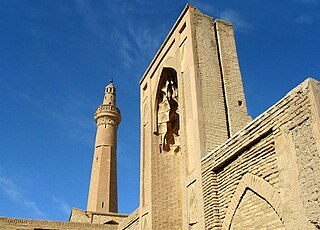
Nain is a city and capital of Nain County, Isfahan Province, Iran. At the 2011 census, its population was 25,379 in 7,730 families.

Kashan County County in Isfahan, Iran

Kashan County is a county in Isfahan Province in Iran. The capital of the county is Kashan. At the 2006 census, the county's population was 297,000, in 81,816 families. The county is subdivided into four districts: the Central District, Qamsar District, Neyasar District, and Barzok District. The county has eight cities: Kashan, Meshkat, Barzok, Jowshaqan va Kamu, Damaneh, Neyasar, Qamsar & Kamu va Chugan.

Golpayegan County County in Isfahan, Iran

Golpayegan County is a county in Isfahan Province in Iran. The capital of the county is Golpayegan. At the 2006 census, the county's population was 82,601, in 24,701 families. The county has one district: the Central District. The county has three cities: Golpayegan, Guged, and Golshahr.

Amol County County in Mazandaran, Iran

Amol County is a county in Mazandaran Province in Iran. The capital of the county is Amol. At the 2006 census, the county's population was 343,747, in 93,194 families. The county is subdivided into three districts: the Central District, Larijan District, and Dabudasht District. The county has five cities: Amol, Rineh, Gazanak, Dabudasht & Amamzadeh Abdallah.

Meshginshahr City in Ardabil, Iran

Meshgin Shahr is a city and capital of Meshgin Shahr County, in Ardabil Province, Iran. At the 2006 census, its population was 63,655, in 14,949 families.
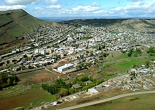
Germi City in Ardabil, Iran

Germi is a city in and the capital of Germi County, Ardabil Province, Iran.

Kivi, Iran City in Ardabil, Iran

Kivi is a city in and the capital of Kowsar County, Ardabil Province, Iran. At the 2006 census, its population was 6,467, in 1,721 families. Earlier, Kivi was divided into upper and lower Kivi: düz kıvı and aşaği kıvı.

Farashband City in Fars, Iran

Farashband is a city and capital of Farashband County, Fars Province, Iran. At the 2006 census, its population was 17,142, in 3,762 families. It is located at an altitude of 775 metres (2,543 ft).

Ardabil City in Iran

Ardabil is an ancient city in northwestern Iran, and the capital of Ardabil Province. Located in the northeastern part of Iran's historic Azerbaijan region, at the 2011 census, Ardabil's population was 564,365, in 156,324 families. The dominant majority in the city are ethnic Iranian Azerbaijanis and the primary language of the people is Azerbaijani.

Noqol village in Isfahan, Iran

Noqol is a village in Padena-ye Olya Rural District, Padena District, Semirom County, Isfahan Province, Iran. At the 2006 census, its population was 315, in 73 families.

Barak, South Khorasan village in South Khorasan, Iran

Barak is a village in Arabkhaneh Rural District, Shusef District, Nehbandan County, South Khorasan Province, Iran. At the 2006 census, its population was 305, in 102 families.
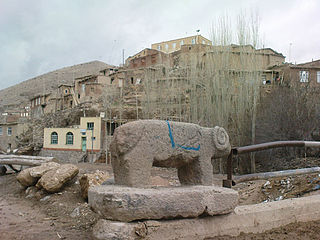
Majarshin village in East Azerbaijan, Iran

Majarshin is a village in Gonbar Rural District, in the Central District of Osku County, East Azerbaijan Province, Iran. At the 2011 census, its population was 1,112, in 304 families.

References

  1. Dashtak can be found at GEOnet Names Server , at this link , by opening the Advanced Search box, entering "-3059967" in the "Unique Feature Id" form, and clicking on "Search Database".
  2. "Census of the Islamic Republic of Iran, 1385 (2006)". Islamic Republic of Iran. Archived from the original (Excel) on 2011-11-11.
  3. روستای دشتک
  4. ارزان
  5. دشتک – از توابع مرودشت در استان فارس
  6. fa:دشتک (مرودشت)