Kootenai County is located in the U.S. state of Idaho. In 2020, the United States Census Bureau estimated the county's population at 171,362, making it the third-most populous county in Idaho and by far the largest in North Idaho, the county accounting for 45.4% of the region's total population. The county seat and largest city is Coeur d'Alene. The county was established in 1864 and named after the Kootenai tribe.

Benewah County is a county located in the northwest part of the U.S. state of Idaho. As of the 2020 United States Census the county had a population of 9,530. The county seat and largest city is St. Maries, which has some area inside the Coeur d'Alene Reservation.

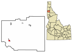
Tensed is a city in Benewah County, Idaho, United States. The population was 123 at the 2010 census, down from 126 in 2000. The city is within the Coeur d'Alene Reservation, and is accessed by U.S. Route 95, the state's primary north-south highway. The city is located about 1 mile (0.6 km) from the north entrance of McCroskey State Park.
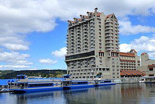
Coeur d'Alene is a city and the county seat of Kootenai County, Idaho, United States. It is the largest city in North Idaho and the principal city of the Coeur d'Alene Metropolitan Statistical Area. At the 2020 census the city's population was 54,628. Coeur d'Alene is a satellite city of Spokane, which is located about thirty miles (50 km) to the west in the state of Washington. The two cities are the key components of the Spokane–Coeur d'Alene Combined Statistical Area, of which Coeur d'Alene is the third-largest city. The city is situated on the north shore of the 25-mile (40 km) long Lake Coeur d'Alene and to the west of the Coeur d'Alene Mountains. Locally, Coeur d'Alene is known as the "Lake City," or simply called by its initials, "CDA."

The Coeur d'Alene are a Native American nation and one of five federally recognized tribes in the state of Idaho.

The Coeur d'Alene Reservation is a Native American reservation in northwestern Idaho, United States. It is home to the federally recognized Coeur d'Alene, one of the five federally recognized tribes in the state.

Clarkia is a small unincorporated community in the southwestern corner of Shoshone County, Idaho. It is surrounded by publicly and privately managed forest lands of Douglas-fir, Ponderosa Pine, and Western Larch. Located just to the east of State Highway 3, the town is in the drainage area of the West Fork of the St. Maries River.

Four Lakes is an unincorporated community and census-designated place in Spokane County, Washington, United States, just southwest of the city of Spokane, and north of Cheney. As of the 2010 census, its population was 512. Both Interstate 90 and SR 904 run through Four Lakes and the junction of the two is located near the center of town. Four Lakes was founded in 1879 by G.H. Morgan. The community was so named on account of there being four lakes near the original town site. It is speculated the fourth lake, is now a marsh south of Meadow Lake, which was drained by the ditch, blasted through basalt, which Minnie Creek flows through, under SR 904, south of the rodeo grounds.
Cataldo is an unincorporated community in Kootenai and Shoshone counties in northern Idaho. It is located at an altitude of 2,139 feet (652 m). Cataldo lies on the southeast banks of the Coeur d'Alene River and Interstate 90 passes the south side of the community. The community of Kingston lies along I-90 to the east. The ZIP Code for Cataldo is 83810.
Corral is an unincorporated community in southwestern Camas County, Idaho, United States. It lies along U.S. Route 20 west of the city of Fairfield, the county seat of Camas County. Its elevation is 5,098 feet (1,554 m). Although Corral is unincorporated, it has a post office, with the ZIP code of 83322.
Geneva is an unincorporated community in on the eastern edge of Bear Lake County, Idaho, United States, near the Wyoming border.
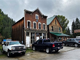
Murray is an unincorporated community in Shoshone County, Idaho, United States. It is twenty miles from Wallace along Dobson Pass Road. Prichard Creek flows through the community, forming a thin and deep valley in the surrounding Coeur d'Alene Mountains.
Carmen is an unincorporated community in Lemhi County, Idaho, United States. Carmen is located on U.S. Route 93 4.5 miles (7.2 km) north of Salmon. Carmen has a post office with ZIP code 83462.
Gibbonsville is an unincorporated community in Lemhi County, Idaho, United States. Gibbonsville is 26 miles (42 km) north of Salmon. Gibbonsville has a post office with ZIP code 83463.
Arbon is an unincorporated community in Power County, Idaho, United States. Arbon is 25 miles (40 km) northwest of Malad City. Arbon has a post office with ZIP code 83212.
Bayview is an unincorporated community in the northwest United States, located in Kootenai County, Idaho, north of Coeur d'Alene. On the southwest shore of Lake Pend Oreille, Bayview is seven miles (11 km) east-northeast of Athol. The community is served by State Highway 54 and a post office with ZIP code 83803; its approximate elevation is 2,100 feet (640 m) above sea level. Nearby is Farragut State Park, formerly the Farragut Naval Training Station, a major training facility during World War II.
Medimont is an unincorporated community in Kootenai County, Idaho, United States. Medimont is located on the north shore of Cave Lake, 8.5 miles (13.7 km) east-northeast of Harrison. Medimont has a post office with ZIP code 83842.
Kingston is an unincorporated community in Shoshone County, Idaho, United States. Kingston is located on the south bank of the Coeur d'Alene River along Interstate 90 about 2 miles (3.2 km) northwest of Pinehurst.
Lane is an unincorporated community in Kootenai County, Idaho, United States. Lane is located along the Coeur d'Alene River and Idaho State Highway 3. It is 12 miles (19 km) northeast of Harrison. The community was founded as a lumber town in the 1880s and named after a logger.

Coeur d'Alene Mission of the Sacred Heart is a historic church mission school off U.S. 95 in Desmet, Idaho.