
Cilacap Regency is a regency in the southwestern part of Central Java province in Indonesia. Its capital is the town of Cilacap.

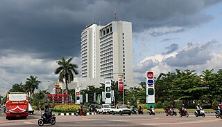
Purwokerto is a large but non-autonomous town on the island of Java, Indonesia. It is the coordinating centre of local government and the largest city in southwestern Central Java. Currently, Purwokerto is the capital of Banyumas Regency, Central Java province. The population of the four districts which comprise the town at the 2010 census was 233,951 and 229,271 at the 2020 census; the official estimate as of mid-2023 was 233,865. The City is considered to be the most comfortable city in Indonesia, as it is the favourite place for pensioners to live after they have finished working.

Sleman Regency is an Indonesian regency on the island of Java. It is located in the north of the Yogyakarta Special Administrative Region, Indonesia, and has an area of 574.82 square kilometres (221.94 sq mi), with a population of 1,093,110 at the 2010 Census and 1,125,804 at the 2020 Census; the official estimate as at mid 2023 was 1,157,292 - comprising 573,760 males and 583,540 females. Its capital is the town of Sleman. The current regent is Kustini Sri Purnomo.

Cibinong is a large town and an administrative district (kecamatan) in Bogor Regency, West Java Province, Indonesia which serves as the Regency's administrative seat - not to be confused with the district of the same name in Cianjur Regency. The town is located immediately due south of the city of Depok, which itself lies just south of Jakarta, with both Depok and Cibinong being part of the Jakarta Metropolitan Area. The town and district are named after the Binong River. Cibinong District covers a land area of 44.27 km2, and had 326,519 inhabitants at the 2010 Census and 363,424 inhabitants at the 2020 Census; the official estimate as at mid 2023 was 365,387 - comprising 183,718 males and 181,669 females. The administrative headquarters are in the town of Cirimekar.

Gianyar is a regency (kabupaten) in the Indonesian province and island of Bali, Indonesia. It has an area of 368.0 km2 and had a population of 469,777 at the 2010 Census, and 515,344 at the 2020 Census, making it the second most densely populated district in Bali ; the official estimate as of mid-2022 was 523,973 - comprising 262,708 males and 261,264 females. Its regency seat is the town of Gianyar. The civil registry survey of April 2011 listed 480,447 people, of which 469,929 were classified as Hindu.
Papua Indonesia Air System was a cargo airline based in Biak, Papua, Indonesia. It was established in 2003 and started operations on 1 February 2003 and operated a cargo service between Jayapura and Wamena.
Sukoharjo Regency is a regency in the Central Java province in Indonesia. It covers an area of 493.23 km2 and had a population of 824,238 at the 2010 Census and 907,587 at the 2020 Census; the official estimate as of mid-2023 was 932,680. Its administrative centre is in the town of Sukoharjo, about 10 km south of Surakarta. This regency is bordered by the city of Surakarta in the north, Karanganyar Regency in the east, Wonogiri Regency and Yogyakarta in the south as well as Klaten Regency in the west. The regency is part of the metropolitan zone of Surakarta, which is known as Subosukawonosraten.

Sorong Regency is a regency of the Southwest Papua province of Indonesia. It covers an area of 13,075.28 km2, and had a population of 70,619 at the 2010 Census, and 118,679 at the 2020 Census; the official estimate as of mid-2023 was 129,963. Its administrative centre is the town of Aimas. Sorong Regency surrounds Sorong City (Kota) on the landward side; the city is administratively independent of the Regency and is not included in the above statistics; Sorong City has an airport, Sorong Airport, which also serves the Regency.

Yahukimo Regency is one of the regencies (kabupaten) in the Indonesian province of Highland Papua. It covers an area of 17,152 km2, and had a population of 164,512 at the 2010 Census, but this figure more than doubled to reach 350,880 at the 2020 Census; the official estimate as at mid 2022 was 361,776. The official administrative centre of Yahukimo Regency is at Sumohai, which is located 25 kilometres north of the town of Dekai, but - due to the lack of infrastructure in Sumohai - the actual administrative centre of the regency is in Dekai. The regency was formerly part of the Jayawijaya Regency, but was split off to become a separate regency on 11 December 2002.

Pegunungan Bintang Regency or Bintang Mountains Regency is a regency in the Indonesian province of Highland Papua. It was created on 11 December 2002 from the north-eastern districts of Jayawijaya Regency. It covers an area of 15,683 km2, and had a population of 65,434 at the 2010 Census and 77,872 at the 2020 Census; the official estimate as at mid 2022 was 78,466 - comprising 42,362 males and 36,104 females. The administrative centre is the town of Oksibil.
Timika is a chartered city (kota), and the capital of Mimika Regency on the southern coast of Central Papua, Indonesia. At the 2020 Census, the district which includes the town had a population of 142,909.

South Barito Regency is a regency in Central Kalimantan province of Indonesia. On 10 April 2002 the eastern districts were split off to create a new East Barito Regency, while the residual South Barito District has an area of 7,020 km2. The regency seat is located in the town of Buntok, located in South Dusun district. The population of South Barito Regency was 124,128 at the 2010 Census and 131,140 at the 2020 Census; the official estimate as at mid 2023 was 134,698.
Sekadau Regency is a regency of West Kalimantan province of Indonesia. It was created on 18 December 2003 from the eastern part of Sanggau Regency. It covers an area of 6,275.39 km2, and had a population of 181,634 at the 2010 Census and 211,559 at the 2020 Census; the official estimate as at mid 2023 was 219,724. The regency seat lies at the town of Sekadau in Sekadau Hilir District.
Bolaang Mongondow Regency is a regency of North Sulawesi Province, Indonesia, situated on the island of Sulawesi. The principal town lies at Kotamobagu, which since 2007 has been administratively separated from the regency, the administrative centre of which is now at the town of Lolak. The regency covers a land area of 2,933.6 km2, and had a population of 213,484 at the 2010 Census and 248,751 at the 2020 Census; the official estimate as at mid 2023 was 254,945.

Southeast Maluku Regency is a regency of Maluku, Indonesia. It is coincident with the Kei Islands, except that the city of Tual, although within the Kei Islands geographically and the seat of the Regency's administration, is since 17 July 2007 technically independent of the Regency. The land area of the Regency is 1,031.01 km2, while the sea area administered by the Regency was 3,181 km2; it had a population of 96,442 at the 2010 Census; this increased to 121,511 at the 2020 Census, and the official estimate as at mid 2023 was 129,034.

Nop Goliat Dekai Airport is an airport serving the town of Dekai, the capital of Yahukimo Regency, Highland Papua, Indonesia. Nop Goliat Airport is one of the seven pioneer airports that connects 517 villages in Yahukimo. The airport was built on an area of 230 hectares between 2004–2010 by using a budget of Rp321 billion. The airport was built to be a logistics distribution center in the highland region of Papua, as well as supporting the mobility of people and goods. Construction of airports is intended as a logistics distribution center for central highland region of Papua Province, which previously concentrated through Wamena Airport.

Ranai Kota is the administrative capital of the Natuna Regency archipelago in the Riau Islands, Indonesia. It has one airport and can be reached by boat. It is located on Bunguran Island, in East Bunguran District, which had a population of 29,080 in mid 2023, of whom 8,735 lived in Ranai Kota.

The Brazza River is a river in Papua province, Indonesia. The Brazza River has its source at over 3000 meters of elevation in the Jayawijaya or Maoke Mountains of central Papua in Yahukimo Regency and flows south to the lowland rainforests of Asmat Regency before meeting the Pulau River, which flows southeast to the Arafura Sea.

Nabire, also known as the District of Nabire, is a town in the Indonesian province of Central Papua, at the western end of New Guinea. The town is the administrative seat of the Nabire Regency. It is served by Douw Aturure Airport.

Highland Papua is a province of Indonesia, which roughly follows the borders of Papuan customary region of Lano-Pago, shortened to La Pago. It covers an area of 51,213.33 km2 (19,773.58 sq mi) and had a population of 1,448,360 according to the official estimates as at mid 2023.

