The Gandhi Sagar Dam is one of the four major dams built on India's Chambal River. The dam is located in the Mandsaur, Neemuch districts of the state of Madhya Pradesh. It is a masonry gravity dam, standing 62.17 metres (204.0 ft) high, with a gross storage capacity of 7.322 billion cubic metres from a catchment area of 22,584 km2 (8,720 sq mi). The dam's foundation stone was laid by Prime Minister of India Pandit Jawaharlal Nehru on 7 March 1954, and construction of the main dam was done by leading contractor Dwarka Das Agrawal & Associates and was completed in 1960. Additional dam structures were completed downstream in the 1970s.

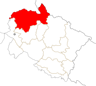
The Asan Barrage is a barrage in the Uttarakhand-Himachal Pradesh border region in Doon Valley,, northern India, situated at the confluence of the Eastern Yamuna Canal and the Asan River and about 11 km (7 mi) from Dakpathar, and 28 km. northwest of Dehradun.

The Ranapratap Sagar Dam is a gravity masonry dam of 53.8 metres (177 ft) height built on the Chambal River at Rawatbhata in Rajasthan in India. It is part of integrated scheme of a cascade development of the river involving four projects starting with the Gandhi Sagar Dam in the upstream reach in Madhya Pradesh and the Jawahar Sagar Dam on the downstream with a terminal structure of the Kota Barrage in Rajasthan for irrigation.
The Jawahar Sagar Dam is the third dam in the series of Chambal Valley Projects on the Chambal River, located 29 km upstream of Kota city and 26 km downstream of Rana Pratap Sagar dam. It is a concrete gravity dam, 45 meters high and 393 meters long, generating 60 MW of power with an installed capacity of 3 units of 33 MW. Its construction was completed in 1972. The total catchment area of the dam is 27,195 km2, of which only 1,496 km2 are in Rajasthan. The free catchment area below Rana Pratap Sagar dam is 2,331 km2. The dam is located after the Gandhi Sagar Dam and Rana Pratap Sagar Dam, but before the Kota Barrage.
Harduaganj Thermal Power Station is located at Qasimpur Power House Colony which is 1 km distance from Harduaganj railway station at Harduaganj in Aligarh district in the Indian state of Uttar Pradesh, about 18 km from Aligarh and 105 km from Agra. It is the new electric power station established in Aligarh district; the old one is Sumera Hydroelectric Power Plant located in Jawan Sikandarpur of Aligarh district.
Loharinag Pala Hydro Power Project is a run-of-the-river hydroelectricity generating project planned by the National Thermal Power Corporation (NTPC) Ltd to have an output capacity of 600 MW. The project is located on the river Bhagirathi, the headstream of the Ganges River at Loharinag Pala, below the confluence of the Songad River, next to NH 108 in Uttarkashi District of Uttarakhand state, India. This is about 100 kilometres (62 mi) upstream of the Tehri Dam.

Chinyalisaur is a small town and tehsil headquarters in the Uttarkashi district of the Indian state of Uttarakhand. It is a semi-urban settlement. It is named after a nearby village called Chinyali. 'Saur' is the Garhrwali word for "plain" area. Chinyalisaur is located along the pilgrimage route to Gangotri, surrounded by small mountains, on the banks of the river Bhagirathi. The Chinyali Saur was the native land of Bisht Thakurs And the Nagraja temple located in the village is the oldest temple here.Due to the land of Bisht Thakurs the patti here had been named as The Bishtpati.
The Ichari Dam is a concrete gravity dam on the Tons River 13 km (8 mi) north of Dakpathar in Uttarakhand, India. The primary purpose of the dam is hydroelectric power production and it is a run-of-the-river-type. It was completed in 1972. The dam diverts water to the Chibro Power Station which is then returned to the Tons River before being fed to the Khodri Power Station.

The Dakpathar Barrage is a concrete barrage across the Yamuna River adjacent to Dakpathar in Uttarakhand, India. In a run-of-the-river scheme, the barrage serves to divert water into the East Yamuna Canal for hydroelectric power production at the Dhakrani and Dhalipur Power Plants. The foundation stone for the dam was laid on 23 May 1949 by India's Prime Minister Jawaharlal Nehru. The project was delayed due to funding and both power stations were commissioned in 1965. The barrage is controlled by 25 floodgates and has a length of 516.5 m (1,695 ft).
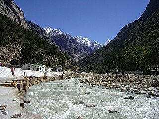
The Pashulok Barrage is a barrage located on the Ganges River just south of Rishikesh in Dehradun district, Uttarakhand, India.
The Ramganga Dam, also known as the Kalagarh Dam, is an embankment dam on the Ramganga River 3 km (2 mi) upstream of Kalagarh in Pauri Garhwal district, Uttarakhand, India. It is located within the Jim Corbett National Park.
The Bhimgoda Barrage, also referred to as the Bhimgoda Weir or Bhimgoda Head Works, is a barrage on the Ganges River at Har ki Pauri near Haridwar in Haridwar district, Uttarakhand, India. Built as the headworks of the Upper Ganges Canal, an initial barrage was completed by 1854 and replaced twice; the final one completed in 1983. The primary purpose for the barrage is irrigation but it also serves to provide water for hydroelectric power production and control floods. The area behind the barrage is known as the Neel Dhara Bird Sanctuary and is a popular destination for various waterbirds and tourists.
The Maneri Dam is a concrete gravity dam on the Bhagirathi River located at Maneri, 8.5 kilometres (5.3 mi) east of Uttarkashi in Uttarkashi district, Uttarakhand, India. The primary purpose of the dam is to divert water into a tunnel which feeds the 90 megawatts (120,000 hp) run-of-the-river Tiloth Power Plant.
The Maneri Bhali Hydroelectric Project in Uttarakhand, India refers to one of its two stages:
Lakhwar-Vyasi Dam project on Yamuna River, includes under-construction Lakhwar Dam and Power Station, Vyasi Dam, Hathiari Power Station and Katapathar Barrage, near the Lakhwar town in Kalsi block of Dehradun district of Uttarakhand in India, for the purpose of irrigation of 40,000 hectare land and total 927 MW hydroelectric power generation. "Lakhwar Dam" is a gravity dam near the Lohari village with 300MW power generation capacity. "Vyasi Dam" will be built 5 km downstream along with 120 MW "Hathiari Power Station" further 0.5 km downstream. "Katapathar Barrage", with the maximum ponding water level at 514.5m elevation, will be built further 2.75 km downstream of the Hathiari Power Station to supply the water to stakeholder states. Project will hold 580 million cubic metres water during monsoon and release into Yamuna during dry months.
Maneri, is a town in Uttarakhand, India. Situated on the banks of river Bhagirathi 8 km north of Uttarkashi, it is the home of Maneri Dam and the terminating railway station on Chota Char Dham Railway nearest to Gangotri.